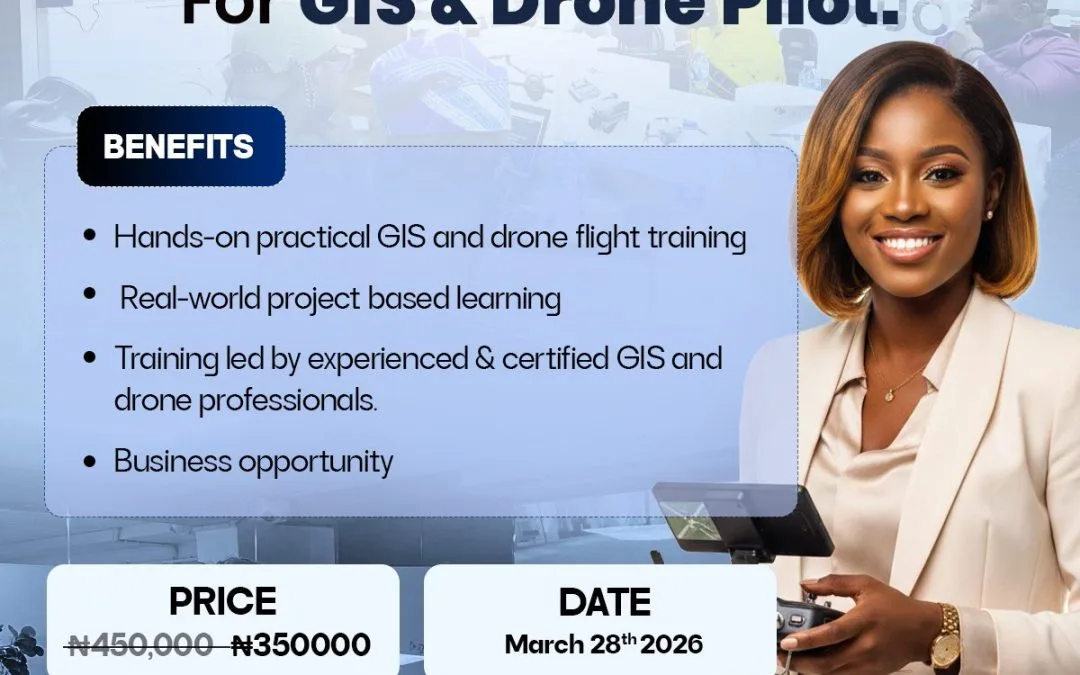
Drone Pilot for Professionals
Professional 3 Weekends ▪ Field Experience
5.0 ![]() (100% Practical) ▪ Exam & Certificate
(100% Practical) ▪ Exam & Certificate


What's Included in this Course
Free Software and Apps
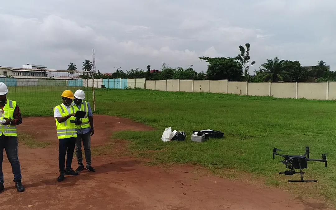
Hands on Practical and Field Experience
Manual, Jotter and Biro
Test, Assessment and Exam
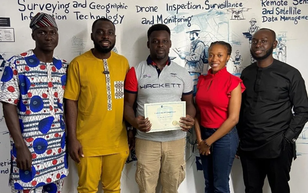
Certificate of Completion
Course Description:
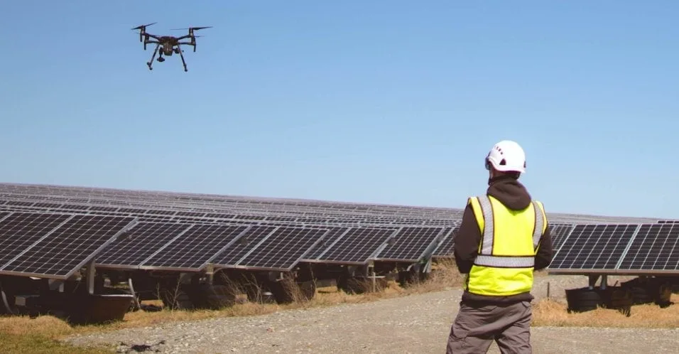
The Drone Professional Training course is a comprehensive program designed to equip participants with the necessary skills and knowledge to operate drones effectively and safely in a professional setting. Drones, also known as unmanned aerial vehicles (UAVs), have become increasingly prevalent across various industries, including photography and videography, agriculture, surveying and mapping, inspection and maintenance, and public safety. This course aims to bridge the gap between theoretical knowledge and practical expertise, enabling participants to excel in the rapidly expanding field of drone technology.
Course Highlights:
- Comprehensive theoretical knowledge of drone technology and operations.
- In-depth understanding of drone regulations and safety protocols.
- Hands-on training in drone piloting, aerial photography, and data collection.
- Exploration of advanced drone technologies and emerging industry trends.
- Real-world case studies and practical exercises to enhance learning.
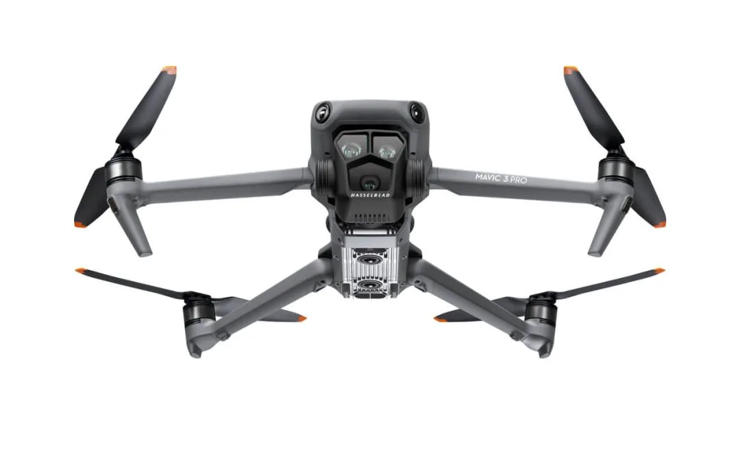
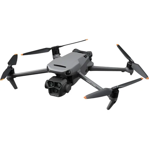
Drone used in this Course
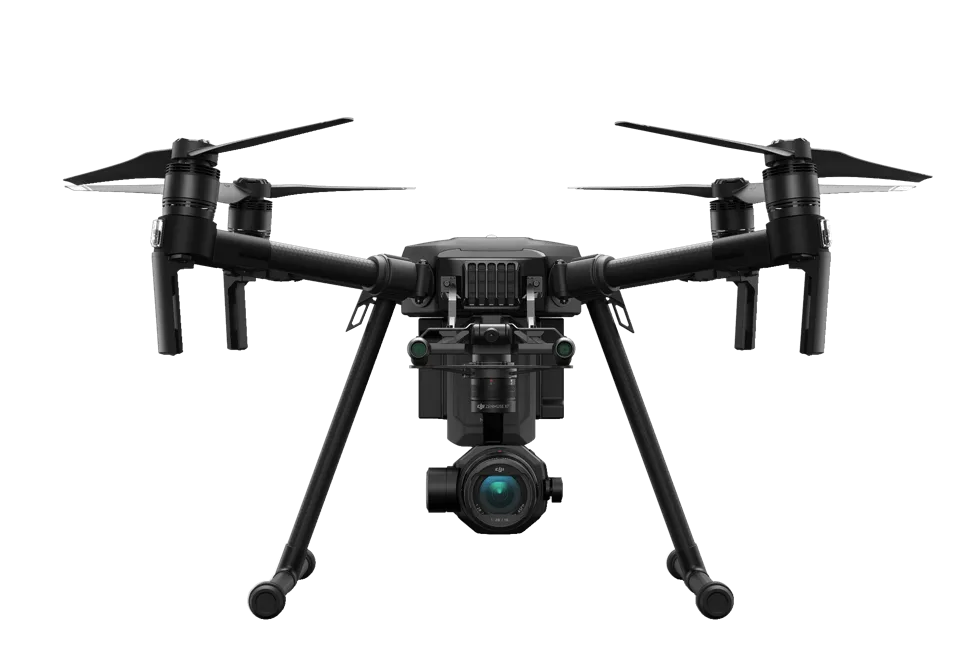
DJI Matrice
Our Certificate is Recognized by Top Industries

Certificate of completion
![]() Operate drones confidently in complex environments
Operate drones confidently in complex environments
![]() Increased job opportunities and career prospects
Increased job opportunities and career prospects
![]() Higher client confidence and trust
Higher client confidence and trust
Courses Modules
1. Introduction
A. Different Terminologies
B. Classification of Drones Based on Structure
C. Part of Drone System
D. Drone Types
2. Drone Regulations In Nigeria (NCAA Requirement and Registration)
A. No-Fly Zones 00
B. How to Unlock No-Fly Zones 00
3. Drone Application In Different Profession
A. Professional Drone Flying Techniques
4. Drone Manual Flight Control and Automatic Flight Operation (Take off and Return)
A. Drone Apps and Software Setup
B. Power Up and Getting Into Drone Apps
5. Professional Camera Settings and Functions
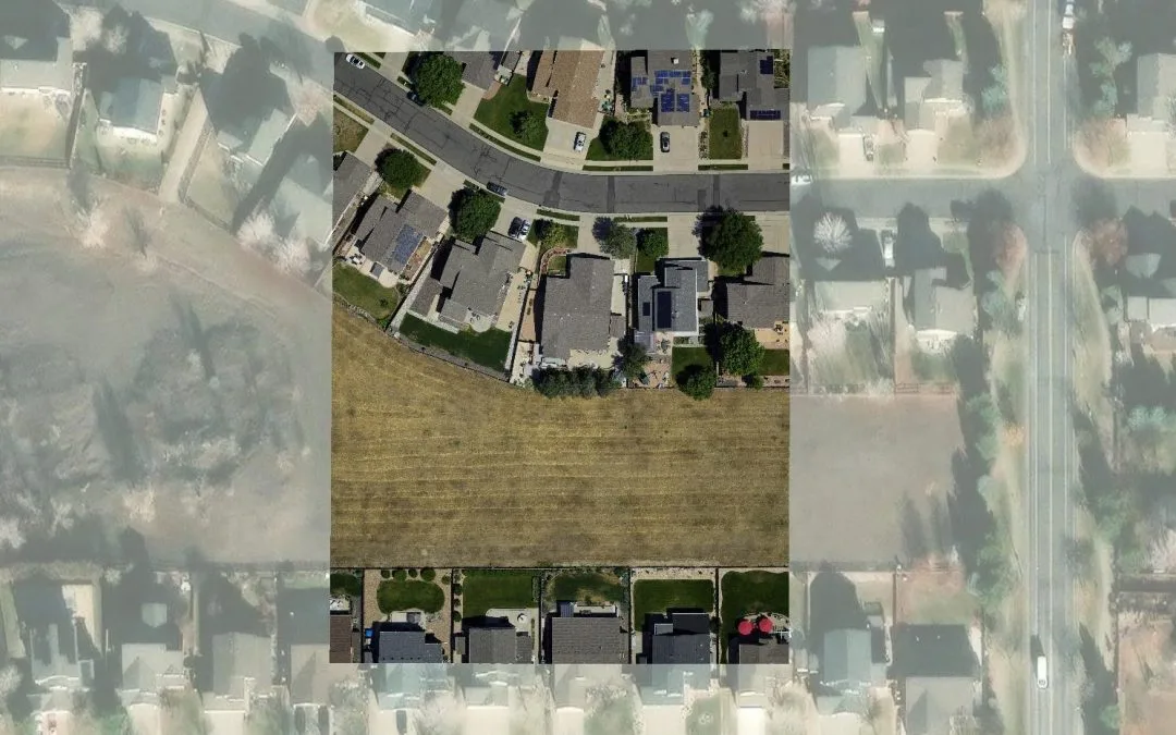
A. Aerial Inspection (Photography and Video)
B. Professional Photo and Video Capture
6. Drone Calibration Setting
A. Drone Calibration
B. Camera Calibration
C. Controller Calibration
7. Drone Safety and Pre-Fight Checklist
A. Reconnaissance Survey
B. Weather Forecast
8. Drone Mission Planning
A. Drone Data Extraction
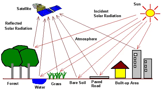
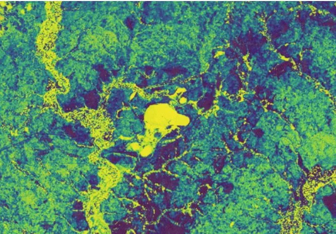
9. Overview of Drone Remote Sensing
A. Understanding Drone Remote Sensing Sensors
Upon completion of the Drone Professional Training course, participants will possess the expertise required to operate drones safely and effectively in a professional capacity. They will be well-versed in the legal and regulatory frameworks governing drone operations and will have the practical skills to undertake various drone-related tasks in their respective industries. This course opens up exciting career opportunities in fields such as aerial photography, agriculture, infrastructure inspection, surveying, and many more.
Share this course
Weekend Class Training
The flexible weekend class allows working professionals and students to upskill efficiently while gaining immediately applicable knowledge for careers in surveying, agriculture, real estate, construction, environmental management, and related fields. [ninja_form...

Drone Pilot for Beginners
Professional 3 Weekends ▪ Field Experience 5.0 (100% Practical) ▪ Exam & Certificate [dsm_blog_carousel include_categories="186,178,627,152,336,9,1" use_excerpt="off" use_date="off" use_author="off" slider_effect="coverflow" slider_effect_coverflow_depth="400"...
![[Beginners to Intermediate] Geographic Information System (ArcGIS Desktop and ArcGIS Pro)](https://geoinfotech.ng/wp-content/uploads/2024/08/today4-1-1080x675.jpg.webp)
[Beginners to Intermediate] Geographic Information System (ArcGIS Desktop and ArcGIS Pro)
[dsm_blog_carousel include_categories="336,186,1,179,178,627" use_excerpt="off" use_date="off" use_author="off" slider_effect="coverflow" slider_effect_coverflow_depth="400" columns="2" centered_slides="on" navi_size="21" use_prev_icon="on" navi_color="#0a0a0a"...
[Beginners to Advanced Class] Geographic Information System (ArcGIS Desktop and ArcGIS Pro)
Professional 6-7 Weekends ▪ Field Experience 5.0 (100% Practical) ▪ Exam & Certificate [dsm_blog_carousel include_categories="336,186,1,179,178,627" use_excerpt="off" use_date="off" use_author="off" slider_effect="coverflow" slider_effect_coverflow_depth="400"...
Drone Pilot for Beginners to Professional
Professional 3 Weekends ▪ Field Experience 5.0 (100% Practical) ▪ Exam & Certificate [dsm_blog_carousel include_categories="186,178,627,152,336,9,1" use_excerpt="off" use_date="off" use_author="off" slider_effect="coverflow" slider_effect_coverflow_depth="400"...
Online Courses
![[Beginners to Advanced] AutoCAD for Land Surveying](https://geoinfotech.ng/wp-content/uploads/2025/08/WhatsApp-Image-2025-08-19-at-09.22.28_2dc55c5c-1080x675.jpg.webp)
[Beginners to Advanced] AutoCAD for Land Surveying
The course AutoCAD for Land Surveying provides participants with practical skills for applying AutoCAD in survey analysis and plotting. Learners will gain hands-on experience in setting up and using AutoCAD software for survey data analysis, precise plotting, accurate...
Professional Drone Training Exam
2021 Workshop: Geospatial Analysis in GIS (ArcMap) for Fire Services in Lagos
2021 Workshop on Geospatial Analysis in GIS (ArcMap) for Fire Services in Lagos This analysis helps us on why, where and how many fire services needed to be deployed in Lagos Nigeria. Multicriterial Analysis AHP | Suitability Analysis in GIS Click Here to...
UAV Drone Foundation Exam
Take the drone skills to new heights and train with the Experts at Geoinfotech. Advance your career in Drone Surveying, Photography, 3D Mapping. The next-gen digital learning solution In your own time, learn at your own pace–without taking any time off work....
![[Beginners to Advanced] Geographic Information System (ArcGIS Desktop and ArcGIS Pro)](https://geoinfotech.ng/wp-content/uploads/2020/07/GIS-Online-Training-Geoinfotech-1-1080x675.jpeg.webp)
[Beginners to Advanced] Geographic Information System (ArcGIS Desktop and ArcGIS Pro)
Do you want to learn GIS as a professional with a proper guide online and procedures on executing GIS Projects/Tasks? This introductory course is for you. We have Introduced a step-by-step template, software installation, free data and manual to help you learn and...
[Beginners to Advanced] AutoCAD for Land Surveying
The course AutoCAD for Land Surveying provides participants with practical skills for applying AutoCAD in survey analysis and plotting. Learners will gain hands-on experience in setting up and using AutoCAD software for survey data analysis, precise plotting, accurate...
Professional Drone Training Exam
2021 Workshop: Geospatial Analysis in GIS (ArcMap) for Fire Services in Lagos
2021 Workshop on Geospatial Analysis in GIS (ArcMap) for Fire Services in Lagos This analysis helps us on why, where and how many fire services needed to be deployed in Lagos Nigeria. Multicriterial Analysis AHP | Suitability Analysis in GIS Click Here to...
UAV Drone Foundation Exam
Take the drone skills to new heights and train with the Experts at Geoinfotech. Advance your career in Drone Surveying, Photography, 3D Mapping. The next-gen digital learning solution In your own time, learn at your own pace–without taking any time off work....
[Beginners to Advanced] Geographic Information System (ArcGIS Desktop and ArcGIS Pro)
Do you want to learn GIS as a professional with a proper guide online and procedures on executing GIS Projects/Tasks? This introductory course is for you. We have Introduced a step-by-step template, software installation, free data and manual to help you learn and...