Document

Where to Buy the DJI Mavic 3 Battery in Lagos, Nigeria

Quick Summary

Looking for where to buy the DJI Mavic 3 Battery in Lagos, Nigeria? This guide explores trusted places to buy genuine DJI batteries, key features of the DJI Intelligent Flight Battery, pricing considerations, usage benefits, and how to get reliable drone accessories for professional and commercial operations in Nigeria.

Introduction

Search trends for:

  • Where to buy a DJI Mavic 3 Battery in Lagos
  • Where to buy a DJI Mavic 3 Battery in Nigeria
  • DJI Mavic 3 battery price in Lagos
  • original DJI drone battery in Nigeria
  • How to get a DJI Mavic 3 Battery near me

are rapidly increasing as drone usage continues to expand across industries such as surveying, filmmaking, agriculture, security, inspection, and aerial photography.

A reliable DJI Mavic 3 Battery is essential for maximizing flight performance, extending operational time, and ensuring safe drone missions. GeoStore provides access to genuine DJI drone batteries and accessories for professionals, businesses, and drone operators across Nigeria.

Overview of the DJI Mavic 3 Battery

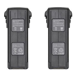
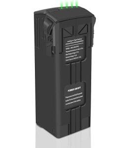
The DJI Mavic 3 Intelligent Flight Battery is designed specifically for the DJI Mavic 3 Series drones, delivering high-performance power management and extended flight capability.

Key highlights include:

  • Long flight endurance
  • Intelligent battery management system
  • Stable power output for professional operations
  • Fast charging support
  • Reliable performance in field operations

The battery is engineered to support demanding aerial missions while maintaining safety and operational efficiency.

Key Features of the DJI Mavic 3 Intelligent Flight Battery

A genuine DJI Mavic 3 Battery offers several advanced features, including:

  • High-capacity lithium battery technology
  • Intelligent power monitoring
  • Battery health protection system
  • Efficient energy consumption
  • Optimized performance for long-distance flights

These features are critical for drone operators handling commercial inspections, mapping, photography, and industrial projects.

Industries That Use DJI Mavic 3 Batteries

Aerial Photography & Videography

Professional content creators depend on extended battery life for:

  • Cinematic drone shots
  • Event coverage
  • Commercial productions
  • Real estate videography

Surveying & Mapping

Surveyors and GIS professionals use DJI drones for:

  • Land mapping
  • Orthomosaic generation
  • Topographic surveys
  • Construction monitoring

Agriculture

Drone batteries support agricultural operations such as:

  • Crop monitoring
  • Farm inspection
  • Precision agriculture analysis

Security & Inspection

Industries rely on stable drone power systems for:

  • Infrastructure inspections
  • Security surveillance
  • Powerline monitoring
  • Emergency response operations

Benefits of Buying an Original DJI Mavic 3 Battery

Using an original DJI battery provides:

  • Better flight safety
  • Longer battery lifespan
  • Improved drone performance
  • Reduced overheating risks
  • Accurate battery communication with the drone

Original batteries also help prevent operational failures often associated with counterfeit accessories.

Where to Buy a DJI Mavic 3 Battery in Lagos, Nigeria

If you are searching for:

  • Where to buy a DJI Mavic 3 Battery near me
  • DJI Mavic 3 Battery in Lagos
  • original DJI battery in Nigeria

GeoStore offers:

  • Genuine DJI drone accessories
  • Professional drone support
  • Nationwide delivery across Nigeria
  • Competitive pricing
  • Reliable customer assistance

Whether you are an individual drone pilot or an enterprise operator, getting authentic drone batteries is essential for operational reliability.

How to Get a DJI Mavic 3 Battery in Nigeria

GeoStore simplifies the process of purchasing genuine DJI drone accessories. Instead of risking counterfeit products from unreliable vendors, customers can access verified DJI batteries suitable for professional drone operations.

Buyers can request:

  • Single replacement batteries
  • Multiple batteries for field operations
  • Drone accessory packages
  • Charging solutions and related accessories

Factors to Consider Before Buying a DJI Mavic 3 Battery

Before purchasing, consider:

Battery Authenticity

Always verify that the battery is original DJI-certified.

Flight Requirements

Commercial drone operators may require multiple batteries for continuous operations.

Charging Compatibility

Ensure compatibility with DJI-approved charging hubs and chargers.

Warranty & Support

Buy from trusted suppliers that provide product support and guidance.

Related Drone Accessories

To maximize drone efficiency, you may also need:

  • DJI charging hubs
  • Drone landing pads
  • Remote controllers
  • Drone carrying cases
  • Memory cards and storage accessories

These accessories improve drone workflow, field efficiency, and equipment safety.

Conclusion

If you’re looking for where to buy the DJI Mavic 3 Battery in Lagos, Nigeria, GeoStore remains a trusted destination for genuine DJI drone accessories and professional support.

Whether for aerial photography, mapping, agriculture, inspections, or industrial operations, investing in an original DJI Mavic 3 Battery ensures reliable performance, longer flight time, and safer drone missions.

FAQs

What is the DJI Mavic 3 Battery used for?

The DJI Mavic 3 Intelligent Flight Battery powers DJI Mavic 3 Series drones for professional and recreational aerial operations.

Where can I buy an original DJI Mavic 3 Battery in Lagos?

You can purchase genuine DJI Mavic 3 batteries from trusted drone and geospatial equipment suppliers like GeoStore in Lagos, Nigeria.

Why should I buy an original DJI battery?

Original DJI batteries provide better safety, stable performance, longer lifespan, and full compatibility with DJI drones.

Can DJI Mavic 3 batteries be used for commercial drone operations?

Yes. They are widely used in industries such as surveying, filmmaking, agriculture, inspections, and security operations.

How long does the DJI Mavic 3 Battery last?

Battery performance depends on usage conditions, but DJI Mavic 3 batteries are designed for extended flight operations and efficient power management.


RECENT ACTIVITIES AND PROJECT...

URABN HEAT ISLAND EFFECT IN CALABAR MUNICIPAL

URABN HEAT ISLAND EFFECT IN CALABAR MUNICIPAL

ANALYZING URBANIZATION TRENDS IN KANO STATE, NIGERIA USING NIGHTTIME LIGHTS REMOTE SENSING DATA

ANALYZING URBANIZATION TRENDS IN KANO STATE, NIGERIA USING NIGHTTIME LIGHTS REMOTE SENSING DATA

COMPREHENSIVE OFFSHORE SURVEILLANCE AND MARITIME INFRASTRUCTURE MONITORING

COMPREHENSIVE OFFSHORE SURVEILLANCE AND MARITIME INFRASTRUCTURE MONITORING

Comprehensive Aerial Survey and Mapping for Golf Course Asset Management at Lakowe Golf Lake

Comprehensive Aerial Survey and Mapping for Golf Course Asset Management at Lakowe Golf Lake

Professional Drone Training Program for Enhanced Corporate Security Operations at Sahara Group

Professional Drone Training Program for Enhanced Corporate Security Operations at Sahara Group

Advanced Aerial Topographic Survey and Mapping for Land Development in Ogun State

Advanced Aerial Topographic Survey and Mapping for Land Development in Ogun State

Precision RGB and Thermal Imaging Revolutionizes Solar Infrastructure Inspection In Enugu

Precision RGB and Thermal Imaging Revolutionizes Solar Infrastructure Inspection In Enugu

Advanced Drone-Based Topographic Survey for Precision Land Development Planning

Advanced Drone-Based Topographic Survey for Precision Land Development Planning

Mapping the Future: Comprehensive Area Survey Transforms Land Development in Akure

Mapping the Future: Comprehensive Area Survey Transforms Land Development in Akure

Precision Topographical Survey and Mapping for Smarter Infrastructure Planning

Precision Topographical Survey and Mapping for Smarter Infrastructure Planning

Precision Drone Volumetric Surveys: How Purechem Industries Optimized Mineral Stockpile Management

Precision Drone Volumetric Surveys: How Purechem Industries Optimized Mineral Stockpile Management

Advanced Mapping & Environmental Survey for Ilubirin Property, Lagos Island

Advanced Mapping & Environmental Survey for Ilubirin Property, Lagos Island

Unveiling the Invisible: LiDAR Technology Transforms Terrain Analysis in Abeokuta North

Unveiling the Invisible: LiDAR Technology Transforms Terrain Analysis in Abeokuta North

 DETAILED AERIAL, LAND SURVEY AND GIS ANALYSIS FOR ADVANCED REAL ESTATE DEVELOPMENT

 DETAILED AERIAL, LAND SURVEY AND GIS ANALYSIS FOR ADVANCED REAL ESTATE DEVELOPMENT

Professional Drone Mapping and GIS Training For ETA-ZUMA Mining Company

Professional Drone Mapping and GIS Training For ETA-ZUMA Mining Company

Installation of Intelligent Traffic Lights

Installation of Intelligent Traffic Lights

Geological Report on a Mining/Exploration Survey

Geological Report on a Mining/Exploration Survey

Drone Survey and Mapping of Shaishen Foods Limited

Drone Survey and Mapping of Shaishen Foods Limited

Lidar Topographic Mapping Project

Lidar Topographic Mapping Project

Geophysical/hydrogeophysical Studies for Groundwater Development

Geophysical/hydrogeophysical Studies for Groundwater Development

Togo Digital Terrain Model Project

Togo Digital Terrain Model Project

Drone Mapping of Parts of Lome Rail Line for Graceland Energy Located at Lome Togo

Drone Mapping of Parts of Lome Rail Line for Graceland Energy Located at Lome Togo

Drone/land Survey of Pure-chem Industrial Limited, Ogun State.

Drone/land Survey of Pure-chem Industrial Limited, Ogun State.

Drone Inspection/survey of Southern Lake Estate, Chevron, Lekki, Lagos State

Drone Inspection/survey of Southern Lake Estate, Chevron, Lekki, Lagos State

Anniversary-Workshop on the Application of Remote Sensing and Drone Technology in GIS -Abuja

Anniversary-Workshop on the Application of Remote Sensing and Drone Technology in GIS -Abuja

Topographic Mapping of Oyo State

Topographic Mapping of Oyo State

Topographic Mapping of Part of the Local Government Areas in Oyo State

Topographic Mapping of Part of the Local Government Areas in Oyo State

Topographic Mapping of Part of Kwara, Ekiti and Kogi State Local Government Area

Topographic Mapping of Part of Kwara, Ekiti and Kogi State Local Government Area

Political Map of South West, Nigeria Located in Nigeria

Political Map of South West, Nigeria Located in Nigeria

Topographic Mapping of Parts of Niger State Located at Niger State, Nigeria

Topographic Mapping of Parts of Niger State Located at Niger State, Nigeria

Topographic Mapping of Part of Kwara, Ekiti, and Kogi State Local Government Area Located in Nigeria

Topographic Mapping of Part of Kwara, Ekiti, and Kogi State Local Government Area Located in Nigeria

Topographic Mapping of Part of Kwara State Local Government Area Located at Kwara State Nigeria

Topographic Mapping of Part of Kwara State Local Government Area Located at Kwara State Nigeria

Flood Analysis of Amuwo-odofin Orthophoto.

Flood Analysis of Amuwo-odofin Orthophoto.

Site Inspection Using Drone of Water Corporation Located at Oke-aro Agege

Site Inspection Using Drone of Water Corporation Located at Oke-aro Agege

24,000 meter Lome Rail Line for Drone Mapping, Graceland Energy Located at Lome, Togo

24,000 meter Lome Rail Line for Drone Mapping, Graceland Energy Located at Lome, Togo

10 Drone Inspection Traffic Signal in Lagos

10 Drone Inspection Traffic Signal in Lagos

Lagos October 1st Free GIS Training Workshop

Lagos October 1st Free GIS Training Workshop

Osun state parcel project

Osun state parcel project

Drone Mapping & Vectorization Of Abu-allied Farm

Drone Mapping & Vectorization Of Abu-allied Farm

Proposal for aerial deployment, tracking and monitoring of threats in victoria island phase 1 and ikoyi phase 2, nigeria

Proposal for aerial deployment, tracking and monitoring of threats in victoria island phase 1 and ikoyi phase 2, nigeria

Jabi Lake Mall Solar Inspection – Abuja

Jabi Lake Mall Solar Inspection – Abuja

Ground Control and Drone Survey for Mast 3D Modeling

Ground Control and Drone Survey for Mast 3D Modeling

Telecom Drone 3D and 2D Modeling of Cellsite

Telecom Drone 3D and 2D Modeling of Cellsite

Free GIS Spatial Analysis Training (Lagos Branch)

Free GIS Spatial Analysis Training (Lagos Branch)

800 Building Plots Aerial Capture and Delineation for Database. Greenfield Estate

800 Building Plots Aerial Capture and Delineation for Database. Greenfield Estate

100 Hectares Aerial Survey with Differential GPS of High Accuracy

100 Hectares Aerial Survey with Differential GPS of High Accuracy

Protected: Nigeria Crime Report and Dashboard

Protected: Nigeria Crime Report and Dashboard

Drone Survey and Mapping – Victoria Island  Copy

Drone Survey and Mapping – Victoria Island Copy

Akwa-Ibom 500 Hectares Drone Survey and Mapping in Nigeria

Akwa-Ibom 500 Hectares Drone Survey and Mapping in Nigeria

Ground Control Establishment – Republic of the Niger – Kano, Kastina, Jigawa, Kaduna

Ground Control Establishment – Republic of the Niger – Kano, Kastina, Jigawa, Kaduna

Drone Survey and Mapping – Victoria Island

Drone Survey and Mapping – Victoria Island

Control Point Establishment – DGPS

Control Point Establishment – DGPS

Land Survey – Northern Nigeria

Land Survey – Northern Nigeria

Biodiversity Mapping – Sweden

Biodiversity Mapping – Sweden

Flood Impact Mapping – United Kingdom

Flood Impact Mapping – United Kingdom

M and E GIS Dashboard for Control Establishment Project

M and E GIS Dashboard for Control Establishment Project

Geodatabase Management System Training For National Boundary Commission

Geodatabase Management System Training For National Boundary Commission

Nigeria Topographic Map – Project

Nigeria Topographic Map – Project

Abuja Training on Introduction to GIS

Abuja Training on Introduction to GIS

200 Hectares Land and Drone Survey – Lagos Nigeria

200 Hectares Land and Drone Survey – Lagos Nigeria

Inspection of 30 hectares drainage

Inspection of 30 hectares drainage

Drainage Drone Mapping and Surveying in Lagos Nigeria

Drainage Drone Mapping and Surveying in Lagos Nigeria

GIS Cadastral Mobile Application

GIS Cadastral Mobile Application

Abuja Topographical Map – HD GIS Mapping

Abuja Topographical Map – HD GIS Mapping

Ground Topography Survey (Lagos Island)

Ground Topography Survey (Lagos Island)

2.7km2 Topography Survey in Snake Island

2.7km2 Topography Survey in Snake Island

GIS Masterclass

GIS Masterclass

Sokoto Contour Map

Sokoto Contour Map

NDVI Vegetation Assessment in Lagos State

NDVI Vegetation Assessment in Lagos State

Lagos drone training master class

Lagos drone training master class

Ifako drone topographic survey and mapping

Ifako drone topographic survey and mapping

CMD Lagos 3D mapping aerial modeling

CMD Lagos 3D mapping aerial modeling

GIS and Drone Masterclass

GIS and Drone Masterclass

Drone aerial survey and mapping – Lagos Island _ Somolu

Drone aerial survey and mapping – Lagos Island _ Somolu

Covid-19 | Nigeria Data Visualisation

Covid-19 | Nigeria Data Visualisation

Benue Flood Analysis

Benue Flood Analysis

Aerial photography Ile-Ife Osun State

Aerial photography Ile-Ife Osun State

Kenya Forest Project

Kenya Forest Project

Tunsun Consultants Ltd

Tunsun Consultants Ltd

Introduction To Gis In Maritime at the National Boundary Commission

Introduction To Gis In Maritime at the National Boundary Commission

Training on GIS and Drone Mapping (batch-4 & 5)

Training on GIS and Drone Mapping (batch-4 & 5)

Osun Flood Mapping

Osun Flood Mapping

Lahass International Limited

Lahass International Limited

Linguistic Association of Nigeria

Linguistic Association of Nigeria

West African Indexing Services

West African Indexing Services

Lagos Ikeja Road Network Map

Lagos Ikeja Road Network Map

LASU Land Regularisation Portal

LASU Land Regularisation Portal

Lingua Plus International

Lingua Plus International

Lagferry Web Route

Lagferry Web Route

YOU MAY ALSO LIKE...

COURSES

Explore Geoinfotech courses and establish a strong foundation of knowledge and skills to be productive with the latest Technology.

NYSC Career Acceleration Program

The NYSC Career Acceleration Training Program is designed to equip corps members with industry-relevant geospatial and surveying skills that enhance…

Find out more

2-DAY DRONE PILOT TRAINING FOR YABATECH

This comprehensive 2-day drone pilot training program is designed to provide participants with essential theoretical knowledge and practical hands-on experience…

Find out more

Differential GPS (DGPS) Land Surveying Training

Professional 2 weekends ▪ Field Experience 5.0 (100% Practical) ▪ Exam & CertificateFree Software and AppsHands on Practical and Field…

Find out more

Training on AutoCAD for Surveying and Mapping

Duration: 4 Weekends (Every Friday 2pm and Saturday 10am)
Package: Field Experience, 100% Hands-on practical, jotter, Biro and Software Others, Test, Exam and Certificate.

Find out more
Training Venue Available in,Lagos and Abuja100253Nigeria
+ Google Map