Document

Where to Buy the DJI Flight Simulator in Lagos, Nigeria

Quick Summary

Looking for where to buy the DJI Flight Simulator in Lagos, Nigeria? This guide explains the benefits of DJI flight simulation software, industries that use it, compatible DJI drone models, and how to access professional drone training solutions in Nigeria.

Introduction

Search trends for:

  • Where to buy the DJI Flight Simulator in Lagos
  • Where to buy the DJI Flight Simulator in Nigeria
  • DJI Flight Simulator near me
  • How to get the DJI Flight Simulator in Nigeria

are rapidly increasing as drone adoption continues to grow across industries like surveying, inspection, agriculture, construction, security, and media production.

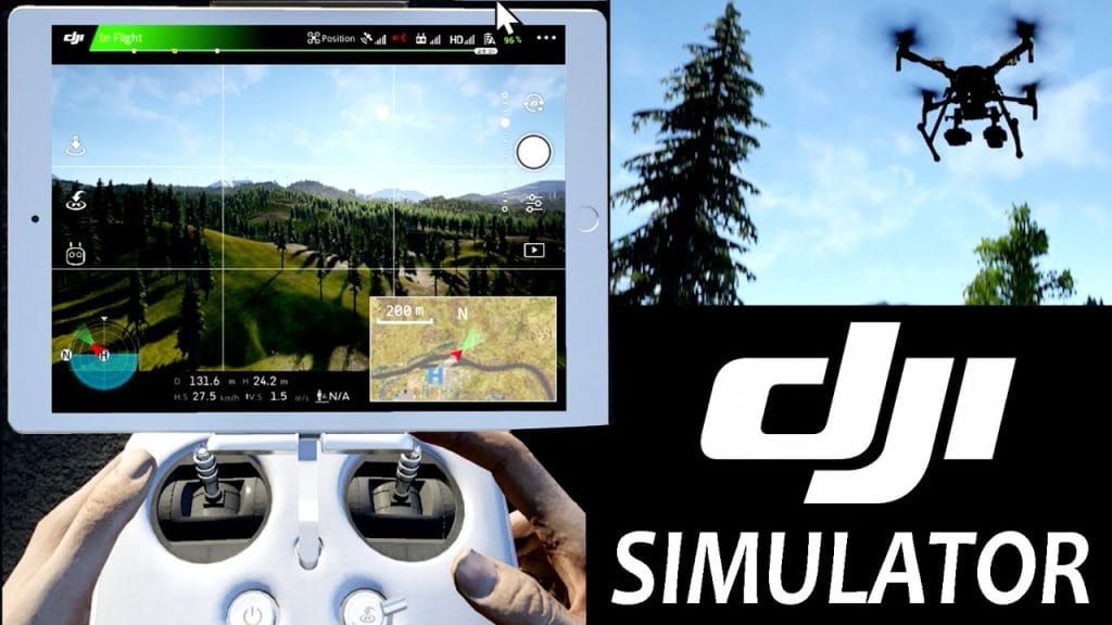
The DJI Flight Simulator is a professional pilot training software designed to help drone operators improve flying skills, reduce crash risks, and simulate real-world flight scenarios before actual drone deployment.

GeoStore provides access to professional drone solutions, DJI products, and geospatial technologies for individuals, organizations, and training institutions across Nigeria.

Overview of the DJI Flight Simulator

The DJI Flight Simulator is an advanced pilot training platform developed by DJI to replicate realistic drone flying experiences using DJI remote controllers and compatible aircraft models.

The simulator is designed for:

  • Drone pilot training
  • Flight safety practice
  • Enterprise mission simulation
  • Skill development for beginners and professionals

It helps users master drone operations without risking physical equipment damage.

Key Features of the DJI Flight Simulator

A professional DJI Flight Simulator setup includes:

  • Realistic flight physics and controls
  • Simulated weather and environmental conditions
  • Training modes for beginner and advanced pilots
  • Enterprise mission simulations
  • Support for multiple DJI drone models
  • Controller integration for real flight experience

These features help drone pilots improve operational confidence and efficiency.

Compatible DJI Drone Models

The DJI Flight Simulator supports several DJI drone series, including:

  • DJI Matrice Series
  • DJI Mavic Series
  • DJI Phantom Series
  • DJI Inspire Series
  • DJI Agras Series

This compatibility makes it valuable for enterprise operations, mapping projects, and industrial inspections.

Industries That Use DJI Flight Simulator

Drone Training Schools

Training institutions use the simulator to teach:

  • Basic flight control
  • Emergency response procedures
  • Safe drone operations

without exposing expensive drones to unnecessary risks.

Surveying & GIS Mapping

Surveyors and GIS professionals use the simulator to prepare pilots for:

  • Aerial mapping missions
  • Topographic surveys
  • Land data acquisition
  • Corridor mapping projects

This improves operational accuracy and mission planning.

Construction & Infrastructure Inspection

Construction companies and inspection teams use drone simulation training for:

  • Site monitoring
  • Structural inspections
  • Infrastructure analysis
  • Industrial facility operations

Agriculture & Environmental Monitoring

Agricultural drone operators use DJI simulation systems for:

  • Precision farming preparation
  • Crop spraying training
  • Environmental monitoring missions

Benefits of Using the DJI Flight Simulator

Improved Flight Safety

Pilots can practice emergency handling and operational techniques before live flights.

Reduced Equipment Damage

Simulation training minimizes crash risks and operational errors.

Cost-Effective Training

Organizations reduce maintenance and repair expenses associated with beginner pilot mistakes.

Faster Skill Development

The simulator helps pilots gain confidence and experience in controlled virtual environments.

Where to Buy DJI Flight Simulator in Lagos, Nigeria

If you’re searching for:

  • Where to buy the DJI Flight Simulator in Lagos
  • Where to buy the DJI Flight Simulator in Nigeria
  • DJI drone simulator near me

GeoStore offers:

  • Professional DJI drone solutions
  • Enterprise drone accessories
  • Drone pilot support solutions
  • GIS and geospatial technologies
  • Nationwide delivery across Nigeria

How to Get the DJI Flight Simulator in Nigeria

GeoStore simplifies the process of accessing professional drone simulation and geospatial solutions.

Instead of searching multiple platforms, users can access verified DJI-related solutions suitable for:

  • Drone training centers
  • Surveying companies
  • Engineering firms
  • Security agencies
  • Educational institutions

Related Drone & GIS Solutions

To maximize your drone operations, you may also need:

  • Where to buy a drone in Nigeria
  • Where to buy RTK GPS in Nigeria
  • Where to buy drone accessories in Lagos
  • Where to buy GIS software in Nigeria
  • Where to buy mapping equipment in Nigeria

These tools improve aerial data collection, positioning accuracy, and operational efficiency.

Why DJI Flight Simulator Matters for Modern Drone Operations

As drone regulations and enterprise applications continue to expand in Nigeria, pilot competence and operational safety are becoming increasingly important.

The DJI Flight Simulator helps organizations:

  • Build safer drone workflows
  • Train operators efficiently
  • Improve mission readiness
  • Reduce operational risks

This makes it an essential tool for professional drone programs and enterprise UAV operations.

Conclusion

If you’re looking for where to buy the DJI Flight Simulator in Lagos, Nigeria, GeoStore remains a trusted source for professional drone and geospatial solutions.

Whether you are a drone pilot, training institution, surveying company, or enterprise operator, the DJI Flight Simulator provides a safer and smarter way to develop drone flying expertise.

Investing in professional simulation technology improves operational efficiency, safety, and long-term drone performance.

FAQs

What is the DJI Flight Simulator?

The DJI Flight Simulator is a professional drone pilot training software designed to simulate real drone flight operations.

Who uses DJI Flight Simulator?

It is widely used by drone training schools, surveyors, engineers, construction firms, and enterprise drone operators.

Why is the DJI Flight Simulator important?

It helps improve pilot skills, reduce crash risks, and prepare operators for real-world drone missions.

Can beginners use the DJI Flight Simulator?

Yes. The simulator supports both beginner and advanced pilot training programs.

Where can I buy a DJI Flight Simulator in Nigeria?

GeoStore provides access to professional drone and geospatial solutions for users across Nigeria.

RECENT ACTIVITIES AND PROJECT...

URABN HEAT ISLAND EFFECT IN CALABAR MUNICIPAL

URABN HEAT ISLAND EFFECT IN CALABAR MUNICIPAL

ANALYZING URBANIZATION TRENDS IN KANO STATE, NIGERIA USING NIGHTTIME LIGHTS REMOTE SENSING DATA

ANALYZING URBANIZATION TRENDS IN KANO STATE, NIGERIA USING NIGHTTIME LIGHTS REMOTE SENSING DATA

COMPREHENSIVE OFFSHORE SURVEILLANCE AND MARITIME INFRASTRUCTURE MONITORING

COMPREHENSIVE OFFSHORE SURVEILLANCE AND MARITIME INFRASTRUCTURE MONITORING

Comprehensive Aerial Survey and Mapping for Golf Course Asset Management at Lakowe Golf Lake

Comprehensive Aerial Survey and Mapping for Golf Course Asset Management at Lakowe Golf Lake

Professional Drone Training Program for Enhanced Corporate Security Operations at Sahara Group

Professional Drone Training Program for Enhanced Corporate Security Operations at Sahara Group

Advanced Aerial Topographic Survey and Mapping for Land Development in Ogun State

Advanced Aerial Topographic Survey and Mapping for Land Development in Ogun State

Precision RGB and Thermal Imaging Revolutionizes Solar Infrastructure Inspection In Enugu

Precision RGB and Thermal Imaging Revolutionizes Solar Infrastructure Inspection In Enugu

Advanced Drone-Based Topographic Survey for Precision Land Development Planning

Advanced Drone-Based Topographic Survey for Precision Land Development Planning

Mapping the Future: Comprehensive Area Survey Transforms Land Development in Akure

Mapping the Future: Comprehensive Area Survey Transforms Land Development in Akure

Precision Topographical Survey and Mapping for Smarter Infrastructure Planning

Precision Topographical Survey and Mapping for Smarter Infrastructure Planning

Precision Drone Volumetric Surveys: How Purechem Industries Optimized Mineral Stockpile Management

Precision Drone Volumetric Surveys: How Purechem Industries Optimized Mineral Stockpile Management

Advanced Mapping & Environmental Survey for Ilubirin Property, Lagos Island

Advanced Mapping & Environmental Survey for Ilubirin Property, Lagos Island

Unveiling the Invisible: LiDAR Technology Transforms Terrain Analysis in Abeokuta North

Unveiling the Invisible: LiDAR Technology Transforms Terrain Analysis in Abeokuta North

 DETAILED AERIAL, LAND SURVEY AND GIS ANALYSIS FOR ADVANCED REAL ESTATE DEVELOPMENT

 DETAILED AERIAL, LAND SURVEY AND GIS ANALYSIS FOR ADVANCED REAL ESTATE DEVELOPMENT

Professional Drone Mapping and GIS Training For ETA-ZUMA Mining Company

Professional Drone Mapping and GIS Training For ETA-ZUMA Mining Company

Installation of Intelligent Traffic Lights

Installation of Intelligent Traffic Lights

Geological Report on a Mining/Exploration Survey

Geological Report on a Mining/Exploration Survey

Drone Survey and Mapping of Shaishen Foods Limited

Drone Survey and Mapping of Shaishen Foods Limited

Lidar Topographic Mapping Project

Lidar Topographic Mapping Project

Geophysical/hydrogeophysical Studies for Groundwater Development

Geophysical/hydrogeophysical Studies for Groundwater Development

Togo Digital Terrain Model Project

Togo Digital Terrain Model Project

Drone Mapping of Parts of Lome Rail Line for Graceland Energy Located at Lome Togo

Drone Mapping of Parts of Lome Rail Line for Graceland Energy Located at Lome Togo

Drone/land Survey of Pure-chem Industrial Limited, Ogun State.

Drone/land Survey of Pure-chem Industrial Limited, Ogun State.

Drone Inspection/survey of Southern Lake Estate, Chevron, Lekki, Lagos State

Drone Inspection/survey of Southern Lake Estate, Chevron, Lekki, Lagos State

Anniversary-Workshop on the Application of Remote Sensing and Drone Technology in GIS -Abuja

Anniversary-Workshop on the Application of Remote Sensing and Drone Technology in GIS -Abuja

Topographic Mapping of Oyo State

Topographic Mapping of Oyo State

Topographic Mapping of Part of the Local Government Areas in Oyo State

Topographic Mapping of Part of the Local Government Areas in Oyo State

Topographic Mapping of Part of Kwara, Ekiti and Kogi State Local Government Area

Topographic Mapping of Part of Kwara, Ekiti and Kogi State Local Government Area

Political Map of South West, Nigeria Located in Nigeria

Political Map of South West, Nigeria Located in Nigeria

Topographic Mapping of Parts of Niger State Located at Niger State, Nigeria

Topographic Mapping of Parts of Niger State Located at Niger State, Nigeria

Topographic Mapping of Part of Kwara, Ekiti, and Kogi State Local Government Area Located in Nigeria

Topographic Mapping of Part of Kwara, Ekiti, and Kogi State Local Government Area Located in Nigeria

Topographic Mapping of Part of Kwara State Local Government Area Located at Kwara State Nigeria

Topographic Mapping of Part of Kwara State Local Government Area Located at Kwara State Nigeria

Flood Analysis of Amuwo-odofin Orthophoto.

Flood Analysis of Amuwo-odofin Orthophoto.

Site Inspection Using Drone of Water Corporation Located at Oke-aro Agege

Site Inspection Using Drone of Water Corporation Located at Oke-aro Agege

24,000 meter Lome Rail Line for Drone Mapping, Graceland Energy Located at Lome, Togo

24,000 meter Lome Rail Line for Drone Mapping, Graceland Energy Located at Lome, Togo

10 Drone Inspection Traffic Signal in Lagos

10 Drone Inspection Traffic Signal in Lagos

Lagos October 1st Free GIS Training Workshop

Lagos October 1st Free GIS Training Workshop

Osun state parcel project

Osun state parcel project

Drone Mapping & Vectorization Of Abu-allied Farm

Drone Mapping & Vectorization Of Abu-allied Farm

Proposal for aerial deployment, tracking and monitoring of threats in victoria island phase 1 and ikoyi phase 2, nigeria

Proposal for aerial deployment, tracking and monitoring of threats in victoria island phase 1 and ikoyi phase 2, nigeria

Jabi Lake Mall Solar Inspection – Abuja

Jabi Lake Mall Solar Inspection – Abuja

Ground Control and Drone Survey for Mast 3D Modeling

Ground Control and Drone Survey for Mast 3D Modeling

Telecom Drone 3D and 2D Modeling of Cellsite

Telecom Drone 3D and 2D Modeling of Cellsite

Free GIS Spatial Analysis Training (Lagos Branch)

Free GIS Spatial Analysis Training (Lagos Branch)

800 Building Plots Aerial Capture and Delineation for Database. Greenfield Estate

800 Building Plots Aerial Capture and Delineation for Database. Greenfield Estate

100 Hectares Aerial Survey with Differential GPS of High Accuracy

100 Hectares Aerial Survey with Differential GPS of High Accuracy

Protected: Nigeria Crime Report and Dashboard

Protected: Nigeria Crime Report and Dashboard

Drone Survey and Mapping – Victoria Island  Copy

Drone Survey and Mapping – Victoria Island Copy

Akwa-Ibom 500 Hectares Drone Survey and Mapping in Nigeria

Akwa-Ibom 500 Hectares Drone Survey and Mapping in Nigeria

Ground Control Establishment – Republic of the Niger – Kano, Kastina, Jigawa, Kaduna

Ground Control Establishment – Republic of the Niger – Kano, Kastina, Jigawa, Kaduna

Drone Survey and Mapping – Victoria Island

Drone Survey and Mapping – Victoria Island

Control Point Establishment – DGPS

Control Point Establishment – DGPS

Land Survey – Northern Nigeria

Land Survey – Northern Nigeria

Biodiversity Mapping – Sweden

Biodiversity Mapping – Sweden

Flood Impact Mapping – United Kingdom

Flood Impact Mapping – United Kingdom

M and E GIS Dashboard for Control Establishment Project

M and E GIS Dashboard for Control Establishment Project

Geodatabase Management System Training For National Boundary Commission

Geodatabase Management System Training For National Boundary Commission

Nigeria Topographic Map – Project

Nigeria Topographic Map – Project

Abuja Training on Introduction to GIS

Abuja Training on Introduction to GIS

200 Hectares Land and Drone Survey – Lagos Nigeria

200 Hectares Land and Drone Survey – Lagos Nigeria

Inspection of 30 hectares drainage

Inspection of 30 hectares drainage

Drainage Drone Mapping and Surveying in Lagos Nigeria

Drainage Drone Mapping and Surveying in Lagos Nigeria

GIS Cadastral Mobile Application

GIS Cadastral Mobile Application

Abuja Topographical Map – HD GIS Mapping

Abuja Topographical Map – HD GIS Mapping

Ground Topography Survey (Lagos Island)

Ground Topography Survey (Lagos Island)

2.7km2 Topography Survey in Snake Island

2.7km2 Topography Survey in Snake Island

GIS Masterclass

GIS Masterclass

Sokoto Contour Map

Sokoto Contour Map

NDVI Vegetation Assessment in Lagos State

NDVI Vegetation Assessment in Lagos State

Lagos drone training master class

Lagos drone training master class

Ifako drone topographic survey and mapping

Ifako drone topographic survey and mapping

CMD Lagos 3D mapping aerial modeling

CMD Lagos 3D mapping aerial modeling

GIS and Drone Masterclass

GIS and Drone Masterclass

Drone aerial survey and mapping – Lagos Island _ Somolu

Drone aerial survey and mapping – Lagos Island _ Somolu

Covid-19 | Nigeria Data Visualisation

Covid-19 | Nigeria Data Visualisation

Benue Flood Analysis

Benue Flood Analysis

Aerial photography Ile-Ife Osun State

Aerial photography Ile-Ife Osun State

Kenya Forest Project

Kenya Forest Project

Tunsun Consultants Ltd

Tunsun Consultants Ltd

Introduction To Gis In Maritime at the National Boundary Commission

Introduction To Gis In Maritime at the National Boundary Commission

Training on GIS and Drone Mapping (batch-4 & 5)

Training on GIS and Drone Mapping (batch-4 & 5)

Osun Flood Mapping

Osun Flood Mapping

Lahass International Limited

Lahass International Limited

Linguistic Association of Nigeria

Linguistic Association of Nigeria

West African Indexing Services

West African Indexing Services

Lagos Ikeja Road Network Map

Lagos Ikeja Road Network Map

LASU Land Regularisation Portal

LASU Land Regularisation Portal

Lingua Plus International

Lingua Plus International

Lagferry Web Route

Lagferry Web Route

YOU MAY ALSO LIKE...

COURSES

Explore Geoinfotech courses and establish a strong foundation of knowledge and skills to be productive with the latest Technology.

NYSC Career Acceleration Program

The NYSC Career Acceleration Training Program is designed to equip corps members with industry-relevant geospatial and surveying skills that enhance…

Find out more

2-DAY DRONE PILOT TRAINING FOR YABATECH

This comprehensive 2-day drone pilot training program is designed to provide participants with essential theoretical knowledge and practical hands-on experience…

Find out more

Differential GPS (DGPS) Land Surveying Training

Professional 2 weekends ▪ Field Experience 5.0 (100% Practical) ▪ Exam & CertificateFree Software and AppsHands on Practical and Field…

Find out more

Training on AutoCAD for Surveying and Mapping

Duration: 4 Weekends (Every Friday 2pm and Saturday 10am)
Package: Field Experience, 100% Hands-on practical, jotter, Biro and Software Others, Test, Exam and Certificate.

Find out more
Training Venue Available in,Lagos and Abuja100253Nigeria
+ Google Map