Document

Quick Summary

Looking for where to buy the DJI Agras T50 Charging Station in Lagos, Nigeria? This guide explains the importance of the DJI Agras T50 charging system, its key features, applications in precision agriculture, and where to access reliable and genuine DJI agricultural drone accessories in Nigeria.

Introduction

Search trends for:

  • Where to buy the DJI Agras T50 Charging Station in Lagos
  • Where to buy the DJI Agras T50 charging hub in Nigeria
  • DJI Agras T50 battery charging station price in Lagos
  • How to get a DJI Agras T50 charger in Nigeria
  • DJI agriculture drone accessories Lagos

are increasing rapidly as precision agriculture continues to expand across Nigeria.

The DJI Agras T50 Charging Station is an essential power solution designed for fast, efficient, and reliable charging of DJI Agras drone batteries. For drone operators, agricultural service providers, and commercial farming businesses, having a dependable charging station ensures uninterrupted field operations and improved productivity.

GeoStore provides access to authentic DJI agricultural drone accessories and enterprise drone solutions tailored for Nigeria’s growing agritech industry.

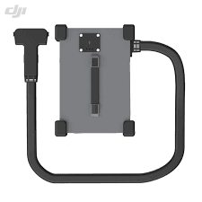
Overview of the DJI Agras T50 Charging Station

The DJI Agras T50 Charging Station is built specifically to support high-performance agricultural drone operations. It enables rapid battery charging, optimized power management, and efficient workflow during large-scale farming missions.

The charging system is designed to support:

  • Continuous drone field operations
  • Fast battery turnaround time
  • Stable and safe charging performance
  • Commercial agricultural workflows

This makes it a critical accessory for drone pilots handling spraying, seeding, mapping, and precision farming tasks.

Key Features of the DJI Agras T50 Charging Station

A professional DJI Agras T50 charging solution typically offers:

  • High-speed intelligent charging
  • Multiple battery charging support
  • Advanced cooling and safety systems
  • Smart battery monitoring technology
  • Optimized energy efficiency
  • Rugged design for field environments

These features help reduce downtime and improve operational efficiency during agricultural drone missions.

Industries That Use the DJI Agras T50 Charging Station

Precision Agriculture

Commercial farms rely on fast-charging systems to maintain uninterrupted drone spraying and crop-monitoring operations.

Agricultural Service Providers

Drone service companies require efficient battery management systems for large-scale client projects.

Environmental Monitoring

Agricultural and environmental agencies use DJI Agras systems for land assessment and vegetation analysis.

Research & Agricultural Development

Universities and agritech researchers use DJI agricultural equipment for data collection and field studies.

Benefits of Using the DJI Agras T50 Charging Station

Faster Field Operations

Rapid charging minimizes operational delays and maximizes drone deployment time.

Improved Productivity

Efficient battery cycling supports larger farm coverage within shorter timeframes.

Enhanced Battery Safety

Intelligent charging protection helps prevent overheating, overcharging, and battery damage.

Reliable Performance

Stable power management ensures dependable charging performance under demanding conditions.

Why the DJI Agras T50 Charging Station Matters in Nigeria

Nigeria’s agricultural sector is increasingly adopting drone technology for:

  • Crop spraying
  • Fertilizer application
  • Precision farming
  • Farm mapping
  • Yield optimization

Because agricultural operations often take place in remote locations, reliable charging infrastructure becomes essential for maintaining operational efficiency.

The DJI Agras T50 Charging Station helps Nigerian drone operators maintain productivity while reducing operational interruptions.

Where to Buy the DJI Agras T50 Charging Station in Lagos, Nigeria

If you are searching for:

  • Where to buy a DJI Agras T50 Charging Station near me
  • DJI Agras T50 charging station in Lagos
  • genuine DJI agriculture accessories in Nigeria

GeoStore offers:

  • Genuine DJI enterprise products
  • Professional agricultural drone accessories
  • Reliable customer support
  • Nationwide delivery across Nigeria
  • Expert guidance for drone operators and agribusinesses

Whether you are an individual drone pilot, an agritech startup, or a commercial farming company, GeoStore provides access to trusted DJI agricultural solutions.

How to Get the DJI Agras T50 Charging Station in Nigeria

GeoStore simplifies the process of purchasing authentic DJI agricultural drone equipment in Nigeria. Instead of dealing with unreliable suppliers or counterfeit products, customers can access verified DJI solutions tailored for professional agricultural use.

This ensures:

  • Product authenticity
  • Technical support
  • Reliable warranty guidance
  • Access to compatible DJI accessories

Related Drone & GIS Solutions

To maximize agricultural drone operations, you may also need:

  • Where to buy DJI Agras drones in Nigeria
  • Where to buy drone batteries in Lagos
  • Where to buy RTK GPS in Nigeria
  • Where to buy mapping drones in Nigeria
  • Where to buy surveying equipment in Lagos

These tools improve operational efficiency, mapping accuracy, and precision farming performance.

Conclusion

If you’re looking for where to buy the DJI Agras T50 Charging Station in Lagos, Nigeria, GeoStore remains a trusted source for genuine DJI agricultural drone solutions and accessories.

Whether for precision agriculture, commercial farming, environmental monitoring, or agritech operations, the DJI Agras T50 Charging Station provides the reliable power management needed to keep drone operations running efficiently.

Investing in authentic DJI charging infrastructure improves productivity, reduces downtime, and supports successful agricultural drone missions across Nigeria.

FAQs

What is the DJI Agras T50 Charging Station used for?

It is used for charging DJI Agras drone batteries efficiently during agricultural drone operations.

Where can I buy the DJI Agras T50 Charging Station in Lagos?

GeoStore provides access to genuine DJI agricultural drone accessories and enterprise drone solutions in Lagos and across Nigeria.

Why is the DJI Agras T50 Charging Station important?

It helps maintain continuous drone operations by providing fast, safe, and reliable battery charging.

Who uses the DJI Agras T50 Charging Station?

It is commonly used by commercial farmers, drone service providers, agritech companies, and agricultural researchers.

Can the DJI Agras T50 Charging Station support large-scale farming operations?

Yes. Its fast charging capability and efficient battery management make it suitable for commercial agricultural workflows.


RECENT ACTIVITIES AND PROJECT...

URABN HEAT ISLAND EFFECT IN CALABAR MUNICIPAL

URABN HEAT ISLAND EFFECT IN CALABAR MUNICIPAL

ANALYZING URBANIZATION TRENDS IN KANO STATE, NIGERIA USING NIGHTTIME LIGHTS REMOTE SENSING DATA

ANALYZING URBANIZATION TRENDS IN KANO STATE, NIGERIA USING NIGHTTIME LIGHTS REMOTE SENSING DATA

COMPREHENSIVE OFFSHORE SURVEILLANCE AND MARITIME INFRASTRUCTURE MONITORING

COMPREHENSIVE OFFSHORE SURVEILLANCE AND MARITIME INFRASTRUCTURE MONITORING

Comprehensive Aerial Survey and Mapping for Golf Course Asset Management at Lakowe Golf Lake

Comprehensive Aerial Survey and Mapping for Golf Course Asset Management at Lakowe Golf Lake

Professional Drone Training Program for Enhanced Corporate Security Operations at Sahara Group

Professional Drone Training Program for Enhanced Corporate Security Operations at Sahara Group

Advanced Aerial Topographic Survey and Mapping for Land Development in Ogun State

Advanced Aerial Topographic Survey and Mapping for Land Development in Ogun State

Precision RGB and Thermal Imaging Revolutionizes Solar Infrastructure Inspection In Enugu

Precision RGB and Thermal Imaging Revolutionizes Solar Infrastructure Inspection In Enugu

Advanced Drone-Based Topographic Survey for Precision Land Development Planning

Advanced Drone-Based Topographic Survey for Precision Land Development Planning

Mapping the Future: Comprehensive Area Survey Transforms Land Development in Akure

Mapping the Future: Comprehensive Area Survey Transforms Land Development in Akure

Precision Topographical Survey and Mapping for Smarter Infrastructure Planning

Precision Topographical Survey and Mapping for Smarter Infrastructure Planning

Precision Drone Volumetric Surveys: How Purechem Industries Optimized Mineral Stockpile Management

Precision Drone Volumetric Surveys: How Purechem Industries Optimized Mineral Stockpile Management

Advanced Mapping & Environmental Survey for Ilubirin Property, Lagos Island

Advanced Mapping & Environmental Survey for Ilubirin Property, Lagos Island

Unveiling the Invisible: LiDAR Technology Transforms Terrain Analysis in Abeokuta North

Unveiling the Invisible: LiDAR Technology Transforms Terrain Analysis in Abeokuta North

 DETAILED AERIAL, LAND SURVEY AND GIS ANALYSIS FOR ADVANCED REAL ESTATE DEVELOPMENT

 DETAILED AERIAL, LAND SURVEY AND GIS ANALYSIS FOR ADVANCED REAL ESTATE DEVELOPMENT

Professional Drone Mapping and GIS Training For ETA-ZUMA Mining Company

Professional Drone Mapping and GIS Training For ETA-ZUMA Mining Company

Installation of Intelligent Traffic Lights

Installation of Intelligent Traffic Lights

Geological Report on a Mining/Exploration Survey

Geological Report on a Mining/Exploration Survey

Drone Survey and Mapping of Shaishen Foods Limited

Drone Survey and Mapping of Shaishen Foods Limited

Lidar Topographic Mapping Project

Lidar Topographic Mapping Project

Geophysical/hydrogeophysical Studies for Groundwater Development

Geophysical/hydrogeophysical Studies for Groundwater Development

Togo Digital Terrain Model Project

Togo Digital Terrain Model Project

Drone Mapping of Parts of Lome Rail Line for Graceland Energy Located at Lome Togo

Drone Mapping of Parts of Lome Rail Line for Graceland Energy Located at Lome Togo

Drone/land Survey of Pure-chem Industrial Limited, Ogun State.

Drone/land Survey of Pure-chem Industrial Limited, Ogun State.

Drone Inspection/survey of Southern Lake Estate, Chevron, Lekki, Lagos State

Drone Inspection/survey of Southern Lake Estate, Chevron, Lekki, Lagos State

Anniversary-Workshop on the Application of Remote Sensing and Drone Technology in GIS -Abuja

Anniversary-Workshop on the Application of Remote Sensing and Drone Technology in GIS -Abuja

Topographic Mapping of Oyo State

Topographic Mapping of Oyo State

Topographic Mapping of Part of the Local Government Areas in Oyo State

Topographic Mapping of Part of the Local Government Areas in Oyo State

Topographic Mapping of Part of Kwara, Ekiti and Kogi State Local Government Area

Topographic Mapping of Part of Kwara, Ekiti and Kogi State Local Government Area

Political Map of South West, Nigeria Located in Nigeria

Political Map of South West, Nigeria Located in Nigeria

Topographic Mapping of Parts of Niger State Located at Niger State, Nigeria

Topographic Mapping of Parts of Niger State Located at Niger State, Nigeria

Topographic Mapping of Part of Kwara, Ekiti, and Kogi State Local Government Area Located in Nigeria

Topographic Mapping of Part of Kwara, Ekiti, and Kogi State Local Government Area Located in Nigeria

Topographic Mapping of Part of Kwara State Local Government Area Located at Kwara State Nigeria

Topographic Mapping of Part of Kwara State Local Government Area Located at Kwara State Nigeria

Flood Analysis of Amuwo-odofin Orthophoto.

Flood Analysis of Amuwo-odofin Orthophoto.

Site Inspection Using Drone of Water Corporation Located at Oke-aro Agege

Site Inspection Using Drone of Water Corporation Located at Oke-aro Agege

24,000 meter Lome Rail Line for Drone Mapping, Graceland Energy Located at Lome, Togo

24,000 meter Lome Rail Line for Drone Mapping, Graceland Energy Located at Lome, Togo

10 Drone Inspection Traffic Signal in Lagos

10 Drone Inspection Traffic Signal in Lagos

Lagos October 1st Free GIS Training Workshop

Lagos October 1st Free GIS Training Workshop

Osun state parcel project

Osun state parcel project

Drone Mapping & Vectorization Of Abu-allied Farm

Drone Mapping & Vectorization Of Abu-allied Farm

Proposal for aerial deployment, tracking and monitoring of threats in victoria island phase 1 and ikoyi phase 2, nigeria

Proposal for aerial deployment, tracking and monitoring of threats in victoria island phase 1 and ikoyi phase 2, nigeria

Jabi Lake Mall Solar Inspection – Abuja

Jabi Lake Mall Solar Inspection – Abuja

Ground Control and Drone Survey for Mast 3D Modeling

Ground Control and Drone Survey for Mast 3D Modeling

Telecom Drone 3D and 2D Modeling of Cellsite

Telecom Drone 3D and 2D Modeling of Cellsite

Free GIS Spatial Analysis Training (Lagos Branch)

Free GIS Spatial Analysis Training (Lagos Branch)

800 Building Plots Aerial Capture and Delineation for Database. Greenfield Estate

800 Building Plots Aerial Capture and Delineation for Database. Greenfield Estate

100 Hectares Aerial Survey with Differential GPS of High Accuracy

100 Hectares Aerial Survey with Differential GPS of High Accuracy

Protected: Nigeria Crime Report and Dashboard

Protected: Nigeria Crime Report and Dashboard

Drone Survey and Mapping – Victoria Island  Copy

Drone Survey and Mapping – Victoria Island Copy

Akwa-Ibom 500 Hectares Drone Survey and Mapping in Nigeria

Akwa-Ibom 500 Hectares Drone Survey and Mapping in Nigeria

Ground Control Establishment – Republic of the Niger – Kano, Kastina, Jigawa, Kaduna

Ground Control Establishment – Republic of the Niger – Kano, Kastina, Jigawa, Kaduna

Drone Survey and Mapping – Victoria Island

Drone Survey and Mapping – Victoria Island

Control Point Establishment – DGPS

Control Point Establishment – DGPS

Land Survey – Northern Nigeria

Land Survey – Northern Nigeria

Biodiversity Mapping – Sweden

Biodiversity Mapping – Sweden

Flood Impact Mapping – United Kingdom

Flood Impact Mapping – United Kingdom

M and E GIS Dashboard for Control Establishment Project

M and E GIS Dashboard for Control Establishment Project

Geodatabase Management System Training For National Boundary Commission

Geodatabase Management System Training For National Boundary Commission

Nigeria Topographic Map – Project

Nigeria Topographic Map – Project

Abuja Training on Introduction to GIS

Abuja Training on Introduction to GIS

200 Hectares Land and Drone Survey – Lagos Nigeria

200 Hectares Land and Drone Survey – Lagos Nigeria

Inspection of 30 hectares drainage

Inspection of 30 hectares drainage

Drainage Drone Mapping and Surveying in Lagos Nigeria

Drainage Drone Mapping and Surveying in Lagos Nigeria

GIS Cadastral Mobile Application

GIS Cadastral Mobile Application

Abuja Topographical Map – HD GIS Mapping

Abuja Topographical Map – HD GIS Mapping

Ground Topography Survey (Lagos Island)

Ground Topography Survey (Lagos Island)

2.7km2 Topography Survey in Snake Island

2.7km2 Topography Survey in Snake Island

GIS Masterclass

GIS Masterclass

Sokoto Contour Map

Sokoto Contour Map

NDVI Vegetation Assessment in Lagos State

NDVI Vegetation Assessment in Lagos State

Lagos drone training master class

Lagos drone training master class

Ifako drone topographic survey and mapping

Ifako drone topographic survey and mapping

CMD Lagos 3D mapping aerial modeling

CMD Lagos 3D mapping aerial modeling

GIS and Drone Masterclass

GIS and Drone Masterclass

Drone aerial survey and mapping – Lagos Island _ Somolu

Drone aerial survey and mapping – Lagos Island _ Somolu

Covid-19 | Nigeria Data Visualisation

Covid-19 | Nigeria Data Visualisation

Benue Flood Analysis

Benue Flood Analysis

Aerial photography Ile-Ife Osun State

Aerial photography Ile-Ife Osun State

Kenya Forest Project

Kenya Forest Project

Tunsun Consultants Ltd

Tunsun Consultants Ltd

Introduction To Gis In Maritime at the National Boundary Commission

Introduction To Gis In Maritime at the National Boundary Commission

Training on GIS and Drone Mapping (batch-4 & 5)

Training on GIS and Drone Mapping (batch-4 & 5)

Osun Flood Mapping

Osun Flood Mapping

Lahass International Limited

Lahass International Limited

Linguistic Association of Nigeria

Linguistic Association of Nigeria

West African Indexing Services

West African Indexing Services

Lagos Ikeja Road Network Map

Lagos Ikeja Road Network Map

LASU Land Regularisation Portal

LASU Land Regularisation Portal

Lingua Plus International

Lingua Plus International

Lagferry Web Route

Lagferry Web Route

YOU MAY ALSO LIKE...

COURSES

Explore Geoinfotech courses and establish a strong foundation of knowledge and skills to be productive with the latest Technology.

NYSC Career Acceleration Program

The NYSC Career Acceleration Training Program is designed to equip corps members with industry-relevant geospatial and surveying skills that enhance…

Find out more

2-DAY DRONE PILOT TRAINING FOR YABATECH

This comprehensive 2-day drone pilot training program is designed to provide participants with essential theoretical knowledge and practical hands-on experience…

Find out more

Differential GPS (DGPS) Land Surveying Training

Professional 2 weekends ▪ Field Experience 5.0 (100% Practical) ▪ Exam & CertificateFree Software and AppsHands on Practical and Field…

Find out more

Training on AutoCAD for Surveying and Mapping

Duration: 4 Weekends (Every Friday 2pm and Saturday 10am)
Package: Field Experience, 100% Hands-on practical, jotter, Biro and Software Others, Test, Exam and Certificate.

Find out more
Training Venue Available in,Lagos and Abuja100253Nigeria
+ Google Map