
Geophysical Exploration Services In Nigeria
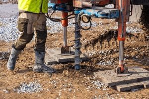
Close-up of soil sampling during pile drilling process. Extraction of subsurface material for geotechnical analysis and foundation assessment. High quality photo
Nigeria is one of Africa’s most geologically diverse countries, with vast subsurface resources ranging from the oil-rich Niger Delta to the mineral belts of the Middle Belt and Northern regions. For construction, infrastructure, and resource development projects, understanding what lies beneath the surface is critical.
Choosing the right provider for geological survey services in Nigeria can determine whether your project succeeds or faces costly delays. At Geoinfotech, we deliver advanced geophysical exploration solutions that help clients make accurate, data-driven decisions.
Why Geological Surveys Matter for Construction Projects in Nigeria
Before any construction begins, a proper geological and geophysical survey ensures that the ground conditions are suitable for development.
Key benefits include:
- Identifying soil and rock properties for foundation design
- Detecting underground water, voids, or weak zones
- Preventing structural failure and costly redesigns
- Supporting compliance with engineering and environmental standards
Working with experienced geology companies in Nigeria ensures that your project is built on reliable scientific data not assumptions.
Why Choose Geoinfotech for Geological Survey Services in Nigeria
Geoinfotech stands out among the top geological survey services in Nigeria by combining modern technology with deep local expertise.
What makes us different:
- Certified geophysical exploration specialists with nationwide experience
- A multidisciplinary team of geologists, geophysicists, and data analysts
- Advanced tools including seismic, Electrical Resistivity Tomography (ERT), Ground Penetrating Radar (GPR), magnetic, gravity, and borehole logging systems
- High-quality deliverables such as subsurface maps, geotechnical reports, and 3D geological models
- Proven experience across oil & gas, mining, construction, water resources, and environmental projects
- Coverage across key geological zones including the Niger Delta, Benue Trough, Chad Basin, and Southwest basement complex
Our goal is simple: reduce uncertainty, minimise risk, and improve project outcomes.
Our Geophysical Exploration Workflow
We follow a structured approach to ensure accurate and reliable results for every project.
- Project Scoping and Survey Design
We begin by understanding your project goals, site conditions, and budget. This helps us select the most suitable geophysical methods and design a tailored survey plan. - Field Data Acquisition
Our team mobilises to your site with calibrated equipment to collect high-quality data, following international best practices to ensure accuracy and consistency. - Data Processing and Interpretation
Using industry-standard software, we analyse and interpret the data to produce actionable insights, including subsurface models and engineering-ready reports.
Cost of Geophysical Survey in Nigeria
The cost of geophysical survey in Nigeria varies depending on several factors:
- Type of survey method (ERT, seismic, GPR, etc.)
- Project size and scope
- Terrain and accessibility
- Data processing and reporting requirements
Smaller surveys like resistivity tests are generally more affordable, while large-scale seismic or integrated surveys require higher investment.
However, investing in professional geological surveys helps prevent expensive drilling errors, structural failures, and project delays—saving significant costs in the long run.
Final Takeaway
Selecting the right partner for geological survey services in Nigeria is one of the most important decisions for any construction or development project.
Accurate geophysical exploration eliminates guesswork, reduces risk, and ensures every engineering decision is backed by reliable data.
Whether you’re comparing the cost of geophysical survey in Nigeria or evaluating different geology companies in Nigeria, Geoinfotech provides the expertise, technology, and reliability you need to start your project on a solid foundation.
Frequently Asked Questions
What industries use geological survey services in Nigeria?
Geoinfotech serves oil and gas, mining, construction, water resources, environmental management, and government infrastructure projects.
How accurate are geophysical surveys?
With proper equipment and methodology, surveys provide highly reliable subsurface data. Accuracy improves further when multiple geophysical techniques are combined.
Is geophysical exploration only for oil and gas?
No. It is widely used in groundwater exploration, construction, mining, and environmental studies.
How long does a geophysical survey take?
Small surveys may take 1–3 days, while large-scale projects can take several weeks depending on complexity.
What deliverables will I receive?
Deliverables include subsurface maps, geological cross-sections, borehole recommendations, geotechnical reports, and 3D models compatible with GIS and engineering software.


