
Upcoming GIS Conferences in Africa in 2026: Discover Geoinnovation Summit 3.0 in Lagos
Are you looking for upcoming GIS conferences in Africa in 2026? As geospatial technology continues to influence national development, infrastructure, security, agriculture and environmental management, conferences and industry gatherings provide valuable opportunities to learn, connect and discover new applications.
For GIS professionals, remote sensing specialists, drone operators, researchers, students and technology enthusiasts, attending a relevant geospatial event can offer more than technical knowledge. It can create opportunities to meet industry experts, explore emerging technologies, exchange ideas and build professional relationships.
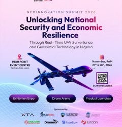
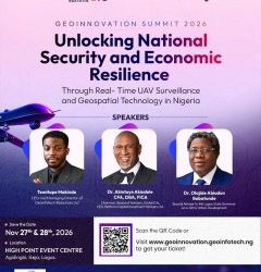
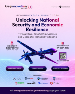
One event to look out for before the end of 2026 is Geoinnovation Summit 3.0, scheduled for November 27th–28th, 2026, in Lagos, Nigeria.
Organised by Geoinfotech, the summit will bring together industry leaders, technology experts, innovators, researchers and decision-makers to explore the role of real-time UAV surveillance and geospatial technology in strengthening national security and economic resilience.
Why Attend GIS and Geospatial Conferences in Africa?
Geographic Information Systems (GIS) have become important tools for understanding locations, analyzing spatial information and supporting better decisions.
Across Africa, geospatial technology has applications in areas such as urban planning, transportation, agriculture, environmental monitoring, disaster management, infrastructure development and security.
Attending conferences and professional gatherings can help participants keep up with these developments.
Some important benefits include:
- Learning about emerging technologies
Geospatial conferences provide opportunities to learn about developments in GIS, remote sensing, satellite imagery, drone technology, GeoAI and spatial data analytics.
- Connecting with industry professionals
Meeting other GIS practitioners, researchers, government representatives and technology developers can create opportunities for collaboration and professional growth.
- Discovering practical applications
Conferences help participants understand how geospatial tools are being applied to real-world challenges across different industries.
- Exploring career and business opportunities
Students and young professionals can gain exposure to industry developments, while businesses can discover technologies, partnerships and potential clients.
- Sharing knowledge and innovation
Presentations, discussions, demonstrations and networking sessions provide opportunities to exchange ideas and learn from different experiences.
For professionals who want to remain relevant in the evolving geospatial industry, participating in these gatherings can be a valuable investment.
Geoinnovation Summit 3.0: A Geospatial Event to Watch in 2026
Among the events to consider adding to your November calendar is Geoinnovation Summit 3.0.
Taking place on November 27th–28th, 2026, at High Point Event Centre, Agidingbi, Ikeja, Lagos, the summit will focus on the relationship between geospatial intelligence, UAV surveillance, national security and economic development.
Its official theme is:
“Unlocking National Security and Economic Resilience Through Real-Time UAV Surveillance and Geospatial Technology in Nigeria.”
The theme reflects the growing importance of location-based intelligence and aerial data collection in addressing challenges that affect organisations, communities and national development.
The summit is designed to bring together people working in different areas of the technology ecosystem, creating opportunities for conversations around innovation, practical solutions and collaboration.
For anyone searching for a GIS conference in Nigeria or a geospatial technology event in Africa, Geoinnovation Summit 3.0 offers an opportunity to engage with these conversations in Lagos.
What Makes Geoinnovation Summit 3.0 Relevant to GIS Professionals?
GIS is no longer limited to producing maps. It is increasingly used to collect, manage, analyze and communicate information that supports operational and strategic decisions.
Geoinnovation Summit 3.0 places attention on several technologies and applications connected to this development.
Geographic Information Systems and Spatial Intelligence
GIS helps organisations understand the relationship between people, infrastructure, resources and their surrounding environments.
It supports applications such as infrastructure planning, asset management, site analysis, environmental monitoring and security operations.
UAV and Drone Technology
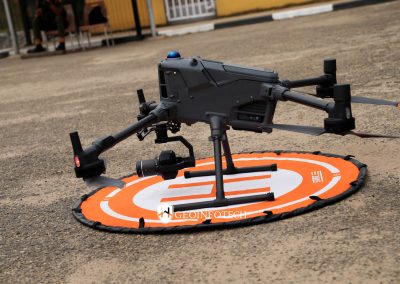
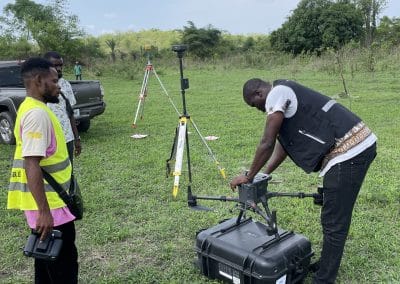
Unmanned aerial vehicles (UAVs), commonly known as drones, provide new ways to collect aerial information.
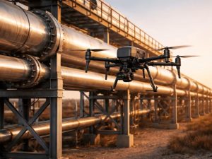
They can support land surveying, construction monitoring, agricultural assessment, infrastructure inspection and surveillance activities.
Remote Sensing and Earth Observation
Satellite imagery and other remote sensing technologies help users monitor changes across large geographical areas.
Applications include land-use monitoring, environmental assessment, vegetation analysis, flood mapping and agricultural monitoring.
Geospatial Intelligence and Real-Time Surveillance
Geospatial intelligence combines location-based information with analysis to help decision-makers understand situations and identify patterns.
When supported by UAV data and other sources, it can contribute to improved monitoring, situational awareness and the protection of critical infrastructure.
These areas connect directly with the summit’s central theme and make the event relevant to professionals working across the wider geospatial industry.
Who Should Attend Geoinnovation Summit 3.0?
The summit is relevant to people at different stages of their professional and academic journeys.
GIS and geospatial professionals: Analysts, cartographers, surveyors, geographers and spatial data specialists can engage with discussions about the future of geospatial technology.
Remote sensing specialists: Professionals working with satellite imagery, Earth observation and spatial analysis can explore related applications and industry developments.
Drone pilots and UAV enthusiasts: The event provides an opportunity to engage with conversations around drone technology, surveillance and aerial data collection.
Students and recent graduates: Those studying geography, surveying, computer science, environmental science and related disciplines can gain exposure to the industry.
Government agencies and policymakers: Public-sector stakeholders can explore how geospatial intelligence can support planning, security and infrastructure management.
Business owners and technology companies: Organisations interested in GIS, UAV services, surveillance solutions and digital innovation can connect with professionals and explore potential opportunities.
Competitions and Innovation Opportunities
Geoinnovation Summit 3.0 also features competitions designed to encourage practical skills and innovation.
The Geoinnovation GIS Challenge 2026 focuses on geospatial solutions that address challenges relevant to Nigeria. Its areas of interest include national and border security, critical infrastructure protection, disaster response, agriculture, environmental security and public safety.
The challenge has a total prize pool of ₦600,000, with opportunities for top-performing participants to showcase their projects at the summit.
The Drone Race Competition will test participants’ drone speed, precision and control through a gated race course. The competition offers a total prize pool of ₦1.6 million.
These activities demonstrate the importance of practical application, creativity and technical skills within the geospatial and UAV communities.
Competition registration deadlines and participation requirements differ. Visit the official summit website for current information.
Why Lagos Is an Important Destination for the Summit
Lagos provides a meeting point for professionals, businesses, government stakeholders and technology communities from different parts of Nigeria.
Hosting Geoinnovation Summit 3.0 in Ikeja creates an opportunity for participants to connect with people working across the geospatial and technology sectors.
The event also provides a platform for discussions that extend beyond GIS software and mapping techniques.
Topics connected to national security, infrastructure, business operations, environmental management and economic resilience demonstrate how geospatial technology can contribute to several sectors of the Nigerian economy.
For participants travelling from other parts of Nigeria or outside the country, the summit offers an opportunity to engage with the Nigerian geospatial community in person.
Geoinnovation Summit 3.0: Event Date, Venue and Registration
If you are planning to attend, here are the key event details:
- Event: Geoinnovation Summit 3.0
- Date: November 27th–28th, 2026
- Venue: High Point Event Centre, Agidingbi, Ikeja, Lagos, Nigeria
- Organizer: Geoinfotech
- Theme: Unlocking National Security and Economic Resilience Through Real-Time UAV Surveillance and Geospatial Technology in Nigeria.
For registration, ticket information and event updates, visit:
https://geoinnovation.geoinfotech.ng
Be Part of the Geospatial Technology Conversation in Africa
The future of GIS and geospatial technology will depend not only on new tools but also on the people, organisations and ideas driving their application.
Conferences and industry gatherings provide opportunities to bring these groups together, encourage collaboration and explore solutions to challenges affecting different sectors.
Geoinnovation Summit 3.0 is an opportunity for geospatial professionals, technology enthusiasts, researchers, businesses and decision-makers to participate in this conversation.
If you are looking for a geospatial event to attend in Nigeria this November, consider joining the summit in Lagos.
Be part of Geoinnovation Summit 3.0 on November 27th–28th, 2026.
Visit https://geoinnovation.geoinfotech.ng to learn more and secure your participation.