Buying, developing or managing land in Port Harcourt requires accurate information about the property. A land survey helps establish where a parcel is located, its boundaries, dimensions and other important spatial details.
Whether you are buying land, planning a building project or resolving a boundary issue, a professional land survey in Port Harcourt can help you make decisions based on accurate measurements rather than assumptions.
What Is a Land Survey?
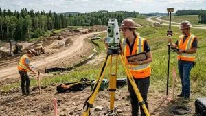
A land survey is the process of measuring and documenting a parcel of land and its relevant features. Surveyors use instruments such as GNSS receivers, total stations and other geospatial technologies to determine positions, distances, directions and elevations.
The resulting information can be used to produce a survey plan, establish boundaries and support property, engineering or development decisions.
In Nigeria, surveying is regulated by the Surveyors Council of Nigeria (SURCON), which regulates and controls the practice of surveying.
Types of Land Survey in Port Harcourt
The type of survey you need depends on your property or project.
- Cadastral or Boundary Survey
This establishes the location and boundaries of a parcel. It is particularly important when buying property, subdividing land or resolving boundary questions.
- Topographic Survey
A topographic survey captures elevations, contours and natural and man-made features. It is useful for architects, engineers and developers who need accurate site information before designing or constructing a project.
- Setting-Out Survey
This transfers positions from design drawings to the actual site. It helps construction teams correctly locate buildings, roads, foundations and other proposed structures.
- As-Built Survey
An as-built survey records the location and dimensions of features after construction. This can support project documentation and future maintenance.
- Route and Engineering Surveys
These are commonly used for roads, pipelines, drainage systems, utilities and other infrastructure projects where accurate positioning along a corridor is required.
How Much Does Land Survey Cost in Port Harcourt?
There is no single fixed price for a land survey. The cost depends on the property size, terrain, survey type, location, accessibility, required deliverables and project complexity.
Recent 2026 market estimates place standard residential land surveys in Rivers State at roughly ₦120,000 to ₦400,000, although Port Harcourt locations and more complex projects can cost more.
Topographic surveys can also cost considerably more than a basic boundary survey because they require additional measurements, processing and mapping.
Therefore, it is better to request a project-specific quotation rather than choosing a surveyor based only on the lowest price.
Why You Need a Professional Surveyor
A survey is more than simply measuring the four corners of a property.
Accurate coordinates and proper documentation can affect property transactions, development approvals, construction and land administration. Rivers State’s land administration process also incorporates survey information during applications and land documentation.
SURCON states that a surveyor is a person registered by the Council to practice surveying. It also publishes information on eligible surveyors and enlisted survey companies.
Consequently, property owners should verify that the professional or firm handling their survey is properly qualified and authorised to provide the required service.
What to Provide Before a Land Survey
To make the process easier, provide the surveyor with as much information about the property as possible.
This may include the location or address, existing documents, approximate plot size, previous survey plans and the purpose of the survey.
For example, someone preparing to build a house may need a topographic survey, while someone purchasing an undeveloped plot may primarily require a boundary or cadastral survey.
Choosing a Land Surveyor in Port Harcourt
When comparing surveyors, consider more than price. Check their professional registration, relevant experience, equipment, expected deliverables and ability to explain the results clearly.
Port Harcourt has several surveying practices offering land, topographic, engineering and mapping services. For example, local providers such as Aga Group, OBA SURVEYS DEVELOPMENT LTD. and BigG Geo-Survey Services appear in current local business listings.
For larger engineering and mapping projects, local firms also offer services that combine conventional surveying with digital mapping and other geospatial technologies.
Get the Right Land Survey for Your Port Harcourt Property
A reliable survey provides the spatial information needed to understand, develop and manage land properly. Whether you need a boundary survey for a property transaction, a topographic survey for design or setting-out for construction, the right survey depends on the purpose of the project.
For organisations that need professional surveying combined with GIS, mapping and other geospatial services, Geoinfotech can provide surveying and geospatial solutions tailored to different project requirements.
If you are planning land survey in Port Harcourt, start by defining exactly what you need the survey to achieve. This makes it easier to select the appropriate survey type, understand the expected deliverables and obtain an accurate quotation.