
- Introduction
Quarry operations are integral to Nigeria’s construction and mining sectors, supplying materials such as granite, limestone, sand, and gravel for infrastructure and urban development. Efficient quarry management requires precise spatial data to guide excavation, monitor progress, optimize resources, and ensure safety. Traditionally, quarry mapping relied on manual surveying and total stations, which are labor-intensive, time-consuming, and sometimes hazardous. The emergence of drone technology (Unmanned Aerial Vehicles, UAVs) has revolutionized quarry mapping by providing rapid, accurate, and high-resolution spatial data. Drones facilitate the creation of 3D terrain models, orthomosaic maps, volumetric analyses, and slope stability assessments, supporting operational efficiency, safety, and environmental compliance.
- Objectives of Drone-Based Quarry Mapping
The primary objectives of employing drones in quarry mapping include:
- Accurate Topographic Mapping: Generate high-resolution 3D models of quarry terrain to understand elevation, slope, and spatial extent,
- Volume Estimation: Calculate extracted materials, remaining reserves, and stockpile quantities,
- Safety Assessment: Monitor slopes, cliffs, and unstable areas to prevent accidents,
- Environmental Monitoring: Track erosion, sedimentation, vegetation impact, and water accumulation,
- Operational Planning: Optimize haul routes, machinery placement, and extraction sequencing, and
- Regulatory Compliance: Provide data for mining permits, environmental audits, and reporting.
- Drone Technologies for Quarry Mapping
There are drones suitable for quarry mapping that show better results or outputs useful in project execution and sustainable development.
3.1 Types of Drones
The following are some specific drones that are good for quarry mapping:
- Multirotor Drones: Ideal for small and medium quarries; offer vertical takeoff and landing (VTOL), precise hovering, and maneuverability around confined areas,
- Fixed-Wing Drones: Suitable for large quarries with extensive coverage; provide longer flight durations and greater endurance but require open takeoff space, and
- Hybrid VTOL Drones: Combine multirotor precision with fixed-wing efficiency; suitable for quarries of varying size and terrain complexity.
3.2 Sensors and Equipment
Using drone for quarry mapping requires certain sensors and equipment as listed below:
- RGB Cameras: Capture high-resolution imagery for photogrammetry and orthomosaic maps.
- LiDAR Sensors: Produce detailed 3D point clouds, penetrate vegetation, and generate precise elevation models.
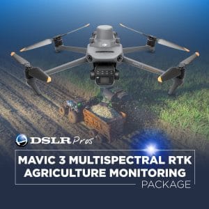
- Multispectral and Thermal Cameras: Useful for environmental monitoring, detecting vegetation health, and identifying water or erosion zones.
- GNSS/RTK Systems: Enable centimeter-level positioning for high-accuracy survey results.
- Data Acquisition Workflow
A structured workflow ensures that drone surveys produce reliable and actionable data. Therefor, the following are suitable workflow data acquisition using drone:
- Pre-Survey Planning:
- Define survey objectives and deliverables.
- Identify hazards, airspace restrictions, and survey boundaries.
- Select drone type and sensors appropriate for site conditions.
- Flight Planning:
- Set flight altitude, overlap, and flight paths using mission planning software.
- Ensure sufficient image overlap for accurate photogrammetry.
- Data Capture:
- Conduct flights according to the flight plan.
- Capture aerial images, LiDAR point clouds, or multispectral data as required.
Data Processing: Process images using photogrammetry software (e.g., Pix4D, Agisoft Metashape) to generate:
- Orthomosaic Maps: High-resolution stitched images of the quarry surface.
- Digital Elevation Models (DEM): Represent terrain elevations.
- 3D Models: Detailed 3D representation of quarry topography.
- Analysis and Interpretation: The procedures for this are:
- Calculate volumetric data of stockpiles and extracted material.
- Perform slope stability analysis to identify hazards.
- Monitor changes in quarry morphology over time.
- Reporting:
- Generate maps, 3D models, and volumetric reports for operational decision-making, regulatory submission, and stakeholder communication.
Conclusion
Drone-based quarry mapping is transforming Nigeria’s mining and construction industries. By combining speed, accuracy, safety, and cost-effectiveness, drones provide critical data for operational planning, resource management, environmental compliance, and regulatory reporting.
Adoption of UAV technology in quarries represents a significant step toward modern, efficient, and sustainable mining operations. With proper training, regulatory compliance, and investment in data processing infrastructure, drones will continue to redefine quarry surveying and management in Nigeria.


