

1. Introduction
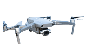
Drone-based quarry mapping refers to the use of Unmanned Aerial Vehicles (UAVs), commonly called drones, equipped with sensors like cameras and LiDAR to collect spatial data of quarry sites. These data are processed into high-resolution maps, orthophotos, digital elevation models (DEMs), and 3D models for analysis and decision-making. With the rapid evolution in drone technology and photogrammetric software, this method has become transformative for the mining, construction, and earthworks industries.
- Applications of Drone-Based Quarry Mapping
In quarry mapping there are different areas of application of drone and these include:
- Volume and Stockpile Measurement: Drones provide precise volume estimates of extracted material and stockpiles, improving resource tracking and operational planning. This eliminates errors associated with manual measurement and enables real-time inventory management.
- Slope and Safety Monitoring: Steep slopes in quarries are prone to collapse. Drone mapping enables frequent monitoring of slope conditions and early detection of instability, reducing risks to workers and equipment.
- Environmental and Regulatory Compliance: Drone data supports erosion control, vegetation assessment, sediment monitoring, and water management. Accurate mapping ensures compliance with environmental regulations and facilitates sustainable quarry operations.
- Operational Planning and Optimization: 3D models help design haul routes, machinery placement, and extraction sequencing. By understanding terrain features, operators can minimize fuel consumption, reduce wear on equipment, and improve workflow efficiency.
- Historical and Progress Monitoring: Periodic drone surveys allow comparison over time, tracking excavation progress, land reclamation efforts, and post-mining site restoration.
Different advantages of drone application of drone in quarry mapping are shown in Table 1.
Table 1: Advantages of Drone Quarry Mapping
| Parameter | Drone-Based Mapping | Traditional Surveying |
| Accuracy | Centimeter-level (with RTK/PPK) | Meter-level, depends on instrument and human skill |
| Safety | Minimal human exposure | Field personnel face hazards |
| Speed | Hours for large sites | Days/weeks |
| Cost | Reduced labor and equipment costs | Higher operational cost |
| Data Richness | 3D models, orthomosaics, volumetrics, slope analysis | Limited to points, lines, and manual calculations |
| Flexibility | Easily repeatable for frequent monitoring | Time-consuming, difficult for large or steep terrain |
- Challenges in Drone Quarry Mapping
Despite the advantages of drone in quarry mapping, there are some disadvantages that exist in the application of drone to quarry mapping which are presented as follows:
- Regulatory Compliance: UAV operations must comply with Nigeria Civil Aviation Authority (NCAA) regulations.
- Weather Dependency: Rain, wind, or poor visibility may delay or compromise flights.
- Data Processing Requirements: Large datasets require robust computing hardware and software.
- Operator Expertise: Skilled pilots and surveyors trained in photogrammetry and GIS are essential for accurate data collection.
- Terrain Complexity: Extremely rugged or confined quarries may require specialized drones and flight planning.
- Future Prospects
Drone technology is rapidly evolving, with applications in AI-powered analysis, autonomous flight, real-time monitoring, and integration with GIS and ERP systems. In Nigeria, integrating drones into standard quarry operations will enhance productivity, safety, and sustainability, aligning mining practices with international standards.
- Conclusion
Drone-based quarry mapping has revolutionized how quarries and mining operations capture spatial information. It provides high-resolution, accurate, and timely data to support planning, safety, compliance, and operational efficiency. However, organizations must navigate regulatory, technical, and skill-based challenges to fully leverage its benefits. As drone technology, sensors, and data analytics continue to evolve, drone mapping will become even more integral to modern quarry management.


