Document

Top Remote Sensing Training Centres in Lagos, Abuja, and Port Harcourt

How to Find the Right Remote Sensing Academy in Nigeria

Choosing a remote sensing training centre in Nigeria is not as straightforward as it should be. The demand for geospatial professionals is growing rapidly, training options are multiplying, and the quality gap between institutions is significant. Some centres promise hands-on training and deliver slide decks. Some claim industry relevance and offer outdated curricula. And some charge professional fees for beginner-level content.

So how do you choose?

The most reliable signals are consistent customer feedback, evidence of practical training, and clear career outcomes from graduates. Apply those filters to the Nigerian market and one institution rises to the top of every conversation.

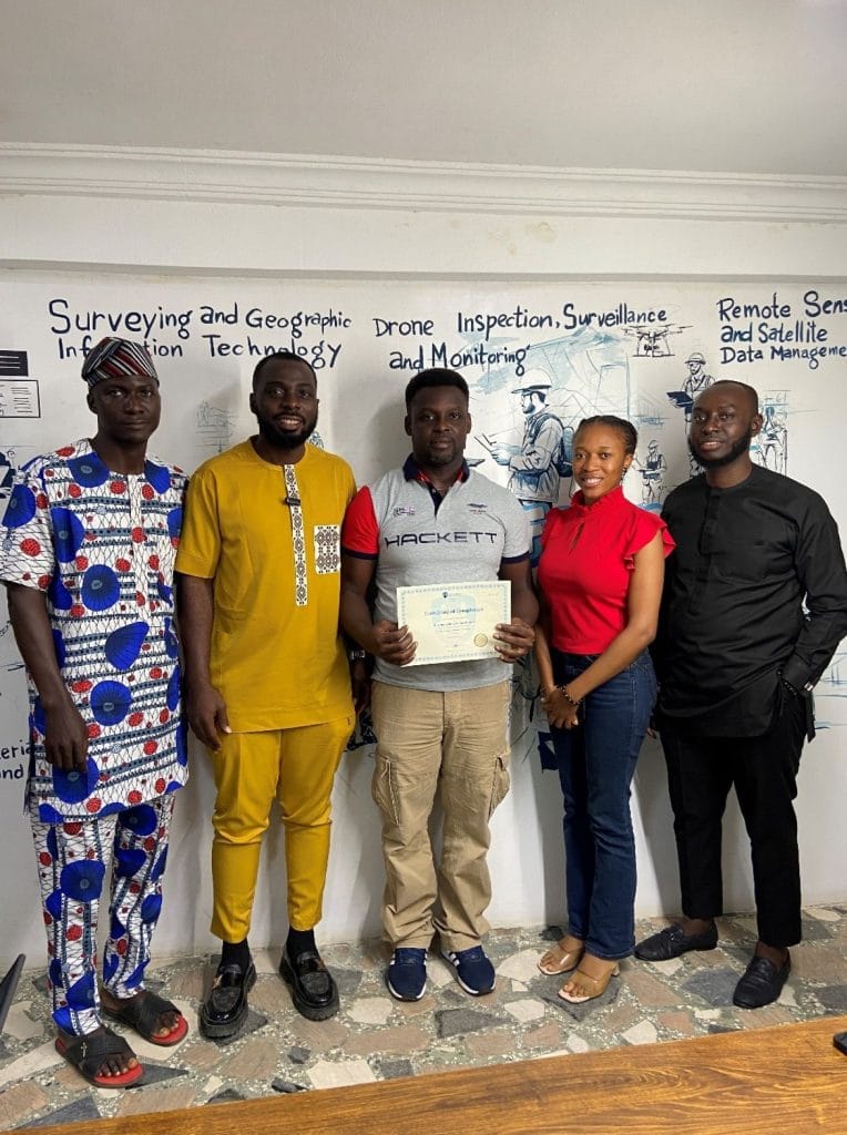
GeoInfo Academy — Geoinfotech’s Training Division

Lagos · Abuja · Port Harcourt

GeoInfo Academy is the training arm of Geoinfotech Resources Limited, one of Nigeria’s leading geospatial services companies. That origin matters. Unlike standalone training academies, GeoInfo Academy’s curriculum is built directly from the tools, workflows, and real-world challenges that Geoinfotech encounters on live client projects — in oil and gas, infrastructure, environmental monitoring, and urban development.

The result is training that is not theoretical by design. It is practical because it cannot be anything else.

What the Training Covers

GeoInfoAcademy offers structured, professional-grade training across the full geospatial skill stack:

Remote Sensing and Satellite Image Analysis — from the fundamentals of electromagnetic spectrum behaviour to advanced supervised and unsupervised image classification, spectral band analysis, and land use and land cover mapping using real Nigerian datasets.

ArcGIS Desktop and ArcGIS Pro — the industry standard platform, taught at a professional depth. Spatial analysis, geodatabase management, image analysis, cartographic output, and workflow automation.

Google Earth Engine — cloud-based geospatial analysis using one of the most powerful platforms available. Students learn to write JavaScript API queries, process multi-date satellite imagery, and build interactive analysis applications.

Drone Operations and Photogrammetry — hands-on drone flight training including NCAA regulatory compliance, ground control point placement, and the full pipeline from raw flight data to processed orthomosaic map and DEM deliverable.

Differential GPS and GNSS Surveying — field-based training using professional DGPS equipment for centimetre-level accuracy surveying.

Total Station and Levelling — for engineering and construction applications, taught with field practice.

What Students Say

Feedback from GeoInfo Academy graduates is consistent across cohorts. The phrases that appear most frequently in reviews and testimonials include:

“100 percent practical — I was in the field from week one.”

“The instructors don’t just teach — they transfer the skill.”

“I came in knowing nothing about GIS and left with a portfolio of real projects.”

“The best decision I made for my career.”

Five-star ratings dominate the Google Business Profile, and the comments reflect not just satisfaction with the content but genuine transformation in professional capability. That is the distinguishing signal. Satisfied trainees describe course content. Transformed trainees describe outcomes.

Why the Practical Approach Matters

The geospatial job market in Nigeria — and globally — does not reward knowledge of concepts. It rewards the ability to execute. A GIS analyst who can describe supervised classification but cannot execute it in ArcGIS Pro or Google Earth Engine is not competitive. A drone surveyor who understands photogrammetry theory but has never planned and executed a real flight mission is not hireable.

GeoInfoAcademy’s training structure addresses this directly. Every module is grounded in real tools, real datasets, and real workflows. Field sessions with drones and DGPS equipment are not optional add-ons — they are core components of the programme. Students produce deliverables — orthomosaic maps, classified land cover outputs, GEE analysis scripts — that they can include in a professional portfolio.

This is the gap that most training institutions in Nigeria have not closed. GeoInfo Academy has.

The Remote Sensing Training Landscape in Nigeria

Nigeria’s geospatial training market is growing, and that growth has produced a range of options at different quality levels.

University and academic programmes offer foundational geospatial education, but the curriculum typically lags industry standards by several years and prioritises theoretical rigour over practical application. Graduates often arrive at their first job knowing what GIS is but not how to use it professionally.

Government and research-affiliated centres provide structured programmes suited to public sector and academic career paths. The training is thorough within its scope but often narrowly focused, and the software tools taught may not reflect what the private sector actually uses.

Private consulting firms with training divisions vary enormously in quality. Some are strong. Many are not. The key differentiator is whether the training is built from genuine field and project experience or assembled as a secondary revenue stream from a consulting business that does not primarily identify as a training organisation.

Standalone online platforms offer accessibility and flexibility but typically lack the supervised practical component — field sessions, real equipment, instructor correction in real time — that separates competent from confident professionals.

GeoInfoAcademy sits in a distinct position: a private training institution directly backed by an active geospatial services company, offering both the curriculum depth of a professional academy and the practical grounding of an industry operator.

Choosing the Right Centre — What to Ask Before You Enrol

Regardless of which institution you are evaluating, these are the questions that will tell you more than any brochure:

What percentage of training time is field-based or software-hands-on? If the answer is less than 60 percent, the training is primarily theoretical.

What tools and software does the training use? The answer should include ArcGIS Pro, QGIS, Google Earth Engine, and drone hardware. If it does not, the curriculum is not current.

What does a graduate’s portfolio look like? Ask to see sample outputs from previous students — maps, classified imagery, project reports. If they cannot show you, the training is not producing professional-grade deliverables.

What do past students say, specifically? Not the testimonials selected for the website. The Google reviews. The LinkedIn recommendations. The WhatsApp group conversations. Find unprompted feedback and read it carefully.

What career support exists after training? Job placement assistance, alumni networks, LinkedIn endorsements, and referrals to industry contacts are signals of an institution that is invested in outcomes, not just enrolments.

Final Takeaway

Remote sensing is one of the highest-demand, lowest-supply skill sets in Nigeria’s job market right now. The oil and gas sector, construction industry, government agencies, NGOs, and technology companies are all actively seeking geospatial professionals — and consistently finding that the supply of genuinely competent practitioners does not meet the demand.

The training decision you make determines which side of that gap you end up on.

For anyone serious about building a career in remote sensing, GIS, or drone technology in Nigeria, the standard to measure against is not what a training centre claims about itself. It is what its graduates can do on their first day of work.

By that measure, GeoInfo Academy is the institution to beat.

Enrol in the next cohort. Call or WhatsApp: 07070708909.


RECENT ACTIVITIES AND PROJECT...

DRONE TOPOGRAPHIC SURVEY: HOW GEOINFOTECH SUPPORTED LAND DEVELOPMENT PLANNING IN IGABI, KADUNA STATE

DRONE TOPOGRAPHIC SURVEY: HOW GEOINFOTECH SUPPORTED LAND DEVELOPMENT PLANNING IN IGABI, KADUNA STATE

PRECISION TOPOGRAPHIC SURVEY AND MAPPING: HOW GEOINFOTECH SUPPORTED MINING SITE PLANNING IN JOS THROUGH DRONE TECHNOLOGY

PRECISION TOPOGRAPHIC SURVEY AND MAPPING: HOW GEOINFOTECH SUPPORTED MINING SITE PLANNING IN JOS THROUGH DRONE TECHNOLOGY

ROUTE TOPO SURVEY AND MAPPING: HOW GEOINFOTECH SUPPORTED THE ENUGU CABLE CAR PROJECT THROUGH ADVANCED GEOSPATIAL SOLUTIONS

ROUTE TOPO SURVEY AND MAPPING: HOW GEOINFOTECH SUPPORTED THE ENUGU CABLE CAR PROJECT THROUGH ADVANCED GEOSPATIAL SOLUTIONS

BOUNDARY SURVEY AND ENCROACHMENT ANALYSIS: HOW EGBIN POWER PLANT IMPROVED LAND MANAGEMENT THROUGH GEOSPATIAL TECHNOLOGY

BOUNDARY SURVEY AND ENCROACHMENT ANALYSIS: HOW EGBIN POWER PLANT IMPROVED LAND MANAGEMENT THROUGH GEOSPATIAL TECHNOLOGY

DRONE APPLICATION IN AERIAL SURVEY AND MAPPING: HOW GEOINFOTECH ENHANCED AGRICULTURAL SITE PLANNING IN OSEFA THROUGH GEOSPATIAL TECHNOLOGY

DRONE APPLICATION IN AERIAL SURVEY AND MAPPING: HOW GEOINFOTECH ENHANCED AGRICULTURAL SITE PLANNING IN OSEFA THROUGH GEOSPATIAL TECHNOLOGY

AERIAL SURVEY AND MAPPING FOR AGRICULTURAL SITE PLANNING: HOW GEOINFOTECH IMPROVED AGRICULTURAL DEVELOPMENT IN ILORA THROUGH DRONE TECHNOLOGY

AERIAL SURVEY AND MAPPING FOR AGRICULTURAL SITE PLANNING: HOW GEOINFOTECH IMPROVED AGRICULTURAL DEVELOPMENT IN ILORA THROUGH DRONE TECHNOLOGY

URABN HEAT ISLAND EFFECT IN CALABAR MUNICIPAL

URABN HEAT ISLAND EFFECT IN CALABAR MUNICIPAL

ANALYZING URBANIZATION TRENDS IN KANO STATE, NIGERIA USING NIGHTTIME LIGHTS REMOTE SENSING DATA

ANALYZING URBANIZATION TRENDS IN KANO STATE, NIGERIA USING NIGHTTIME LIGHTS REMOTE SENSING DATA

COMPREHENSIVE OFFSHORE SURVEILLANCE AND MARITIME INFRASTRUCTURE MONITORING

COMPREHENSIVE OFFSHORE SURVEILLANCE AND MARITIME INFRASTRUCTURE MONITORING

Comprehensive Aerial Survey and Mapping for Golf Course Asset Management at Lakowe Golf Lake

Comprehensive Aerial Survey and Mapping for Golf Course Asset Management at Lakowe Golf Lake

Professional Drone Training Program for Enhanced Corporate Security Operations at Sahara Group

Professional Drone Training Program for Enhanced Corporate Security Operations at Sahara Group

Advanced Aerial Topographic Survey and Mapping for Land Development in Ogun State

Advanced Aerial Topographic Survey and Mapping for Land Development in Ogun State

Precision RGB and Thermal Imaging Revolutionizes Solar Infrastructure Inspection In Enugu

Precision RGB and Thermal Imaging Revolutionizes Solar Infrastructure Inspection In Enugu

Advanced Drone-Based Topographic Survey for Precision Land Development Planning

Advanced Drone-Based Topographic Survey for Precision Land Development Planning

Mapping the Future: Comprehensive Area Survey Transforms Land Development in Akure

Mapping the Future: Comprehensive Area Survey Transforms Land Development in Akure

Precision Topographical Survey and Mapping for Smarter Infrastructure Planning

Precision Topographical Survey and Mapping for Smarter Infrastructure Planning

Precision Drone Volumetric Surveys: How Purechem Industries Optimized Mineral Stockpile Management

Precision Drone Volumetric Surveys: How Purechem Industries Optimized Mineral Stockpile Management

Advanced Mapping & Environmental Survey for Ilubirin Property, Lagos Island

Advanced Mapping & Environmental Survey for Ilubirin Property, Lagos Island

Unveiling the Invisible: LiDAR Technology Transforms Terrain Analysis in Abeokuta North

Unveiling the Invisible: LiDAR Technology Transforms Terrain Analysis in Abeokuta North

 DETAILED AERIAL, LAND SURVEY AND GIS ANALYSIS FOR ADVANCED REAL ESTATE DEVELOPMENT

 DETAILED AERIAL, LAND SURVEY AND GIS ANALYSIS FOR ADVANCED REAL ESTATE DEVELOPMENT

Professional Drone Mapping and GIS Training For ETA-ZUMA Mining Company

Professional Drone Mapping and GIS Training For ETA-ZUMA Mining Company

Installation of Intelligent Traffic Lights

Installation of Intelligent Traffic Lights

Geological Report on a Mining/Exploration Survey

Geological Report on a Mining/Exploration Survey

Drone Survey and Mapping of Shaishen Foods Limited

Drone Survey and Mapping of Shaishen Foods Limited

Lidar Topographic Mapping Project

Lidar Topographic Mapping Project

Geophysical/hydrogeophysical Studies for Groundwater Development

Geophysical/hydrogeophysical Studies for Groundwater Development

Togo Digital Terrain Model Project

Togo Digital Terrain Model Project

Drone Mapping of Parts of Lome Rail Line for Graceland Energy Located at Lome Togo

Drone Mapping of Parts of Lome Rail Line for Graceland Energy Located at Lome Togo

Drone/land Survey of Pure-chem Industrial Limited, Ogun State.

Drone/land Survey of Pure-chem Industrial Limited, Ogun State.

Drone Inspection/survey of Southern Lake Estate, Chevron, Lekki, Lagos State

Drone Inspection/survey of Southern Lake Estate, Chevron, Lekki, Lagos State

Anniversary-Workshop on the Application of Remote Sensing and Drone Technology in GIS -Abuja

Anniversary-Workshop on the Application of Remote Sensing and Drone Technology in GIS -Abuja

Topographic Mapping of Oyo State

Topographic Mapping of Oyo State

Topographic Mapping of Part of the Local Government Areas in Oyo State

Topographic Mapping of Part of the Local Government Areas in Oyo State

Topographic Mapping of Part of Kwara, Ekiti and Kogi State Local Government Area

Topographic Mapping of Part of Kwara, Ekiti and Kogi State Local Government Area

Political Map of South West, Nigeria Located in Nigeria

Political Map of South West, Nigeria Located in Nigeria

Topographic Mapping of Parts of Niger State Located at Niger State, Nigeria

Topographic Mapping of Parts of Niger State Located at Niger State, Nigeria

Topographic Mapping of Part of Kwara, Ekiti, and Kogi State Local Government Area Located in Nigeria

Topographic Mapping of Part of Kwara, Ekiti, and Kogi State Local Government Area Located in Nigeria

Topographic Mapping of Part of Kwara State Local Government Area Located at Kwara State Nigeria

Topographic Mapping of Part of Kwara State Local Government Area Located at Kwara State Nigeria

Flood Analysis of Amuwo-odofin Orthophoto.

Flood Analysis of Amuwo-odofin Orthophoto.

Site Inspection Using Drone of Water Corporation Located at Oke-aro Agege

Site Inspection Using Drone of Water Corporation Located at Oke-aro Agege

24,000 meter Lome Rail Line for Drone Mapping, Graceland Energy Located at Lome, Togo

24,000 meter Lome Rail Line for Drone Mapping, Graceland Energy Located at Lome, Togo

10 Drone Inspection Traffic Signal in Lagos

10 Drone Inspection Traffic Signal in Lagos

Lagos October 1st Free GIS Training Workshop

Lagos October 1st Free GIS Training Workshop

Osun state parcel project

Osun state parcel project

Drone Mapping & Vectorization Of Abu-allied Farm

Drone Mapping & Vectorization Of Abu-allied Farm

Proposal for aerial deployment, tracking and monitoring of threats in victoria island phase 1 and ikoyi phase 2, nigeria

Proposal for aerial deployment, tracking and monitoring of threats in victoria island phase 1 and ikoyi phase 2, nigeria

Jabi Lake Mall Solar Inspection – Abuja

Jabi Lake Mall Solar Inspection – Abuja

Ground Control and Drone Survey for Mast 3D Modeling

Ground Control and Drone Survey for Mast 3D Modeling

Telecom Drone 3D and 2D Modeling of Cellsite

Telecom Drone 3D and 2D Modeling of Cellsite

Free GIS Spatial Analysis Training (Lagos Branch)

Free GIS Spatial Analysis Training (Lagos Branch)

800 Building Plots Aerial Capture and Delineation for Database. Greenfield Estate

800 Building Plots Aerial Capture and Delineation for Database. Greenfield Estate

100 Hectares Aerial Survey with Differential GPS of High Accuracy

100 Hectares Aerial Survey with Differential GPS of High Accuracy

Protected: Nigeria Crime Report and Dashboard

Protected: Nigeria Crime Report and Dashboard

Drone Survey and Mapping – Victoria Island  Copy

Drone Survey and Mapping – Victoria Island Copy

Akwa-Ibom 500 Hectares Drone Survey and Mapping in Nigeria

Akwa-Ibom 500 Hectares Drone Survey and Mapping in Nigeria

Ground Control Establishment – Republic of the Niger – Kano, Kastina, Jigawa, Kaduna

Ground Control Establishment – Republic of the Niger – Kano, Kastina, Jigawa, Kaduna

Drone Survey and Mapping – Victoria Island

Drone Survey and Mapping – Victoria Island

Control Point Establishment – DGPS

Control Point Establishment – DGPS

Land Survey – Northern Nigeria

Land Survey – Northern Nigeria

Biodiversity Mapping – Sweden

Biodiversity Mapping – Sweden

Flood Impact Mapping – United Kingdom

Flood Impact Mapping – United Kingdom

M and E GIS Dashboard for Control Establishment Project

M and E GIS Dashboard for Control Establishment Project

Geodatabase Management System Training For National Boundary Commission

Geodatabase Management System Training For National Boundary Commission

Nigeria Topographic Map – Project

Nigeria Topographic Map – Project

Abuja Training on Introduction to GIS

Abuja Training on Introduction to GIS

200 Hectares Land and Drone Survey – Lagos Nigeria

200 Hectares Land and Drone Survey – Lagos Nigeria

Inspection of 30 hectares drainage

Inspection of 30 hectares drainage

Drainage Drone Mapping and Surveying in Lagos Nigeria

Drainage Drone Mapping and Surveying in Lagos Nigeria

GIS Cadastral Mobile Application

GIS Cadastral Mobile Application

Abuja Topographical Map – HD GIS Mapping

Abuja Topographical Map – HD GIS Mapping

Ground Topography Survey (Lagos Island)

Ground Topography Survey (Lagos Island)

2.7km2 Topography Survey in Snake Island

2.7km2 Topography Survey in Snake Island

GIS Masterclass

GIS Masterclass

Sokoto Contour Map

Sokoto Contour Map

NDVI Vegetation Assessment in Lagos State

NDVI Vegetation Assessment in Lagos State

Lagos drone training master class

Lagos drone training master class

Ifako drone topographic survey and mapping

Ifako drone topographic survey and mapping

CMD Lagos 3D mapping aerial modeling

CMD Lagos 3D mapping aerial modeling

GIS and Drone Masterclass

GIS and Drone Masterclass

Drone aerial survey and mapping – Lagos Island _ Somolu

Drone aerial survey and mapping – Lagos Island _ Somolu

Covid-19 | Nigeria Data Visualisation

Covid-19 | Nigeria Data Visualisation

Benue Flood Analysis

Benue Flood Analysis

Aerial photography Ile-Ife Osun State

Aerial photography Ile-Ife Osun State

Kenya Forest Project

Kenya Forest Project

Tunsun Consultants Ltd

Tunsun Consultants Ltd

Introduction To Gis In Maritime at the National Boundary Commission

Introduction To Gis In Maritime at the National Boundary Commission

Training on GIS and Drone Mapping (batch-4 & 5)

Training on GIS and Drone Mapping (batch-4 & 5)

Osun Flood Mapping

Osun Flood Mapping

Lahass International Limited

Lahass International Limited

Linguistic Association of Nigeria

Linguistic Association of Nigeria

West African Indexing Services

West African Indexing Services

Lagos Ikeja Road Network Map

Lagos Ikeja Road Network Map

LASU Land Regularisation Portal

LASU Land Regularisation Portal

Lingua Plus International

Lingua Plus International

Lagferry Web Route

Lagferry Web Route

YOU MAY ALSO LIKE...

COURSES

Explore Geoinfotech courses and establish a strong foundation of knowledge and skills to be productive with the latest Technology.

NYSC Career Acceleration Program

The NYSC Career Acceleration Training Program is designed to equip corps members with industry-relevant geospatial and surveying skills that enhance…

Find out more

Beyond Mapping; How GIS & UAV Technology Are Transforming Oil & Gas Surveillance and Assest Management

Join us for an insightful and industry-focused webinar as we explore how Geographic Information Systems (GIS) and Unmanned Aerial Vehicle…

Find out more

Differential GPS (DGPS) Land Surveying Training

Professional 2 weekends ▪ Field Experience 5.0 (100% Practical) ▪ Exam & CertificateFree Software and AppsHands on Practical and Field…

Find out more

Training on AutoCAD for Surveying and Mapping

Duration: 4 Weekends (Every Friday 2pm and Saturday 10am)
Package: Field Experience, 100% Hands-on practical, jotter, Biro and Software Others, Test, Exam and Certificate.

Find out more
Training Venue Available in,Lagos and Abuja100253Nigeria
+ Google Map