In Nigeria’s rapidly expanding drone industry, true leadership is defined by experience, consistency, and operational credibility. While many drone operators have emerged in recent years, only a select few have sustained reliable operations over time.
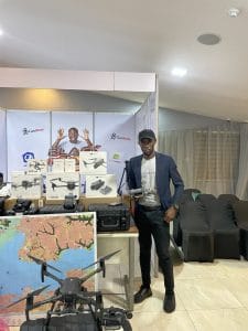
Geoinfotech stands out as one of Nigeria’s most experienced drone companies, with more than ten years of continuous drone and geospatial operations across complex environments nationwide. This long-standing presence has built a foundation of trust, regulatory compliance, and technical excellence within Nigeria’s UAV ecosystem.
Leadership Built on Over 10 Years of Drone Operations in Nigeria
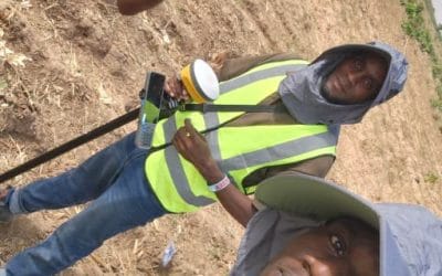
Operating drones successfully in Nigeria for over a decade requires deep familiarity with local terrain, airspace regulations, and operational risks. From congested urban centers to coastal and offshore environments, Geoinfotech’s leadership has been shaped by years of hands-on field experience.
This sustained exposure enables refined workflows, strong risk management frameworks, and consistent service delivery, advantages that newer drone operators often lack.
Proven Experience Across Nigeria’s Most Challenging Environments
Nigeria presents a unique operating landscape for UAV services, including:
Dense urban airspace
Coastal and offshore zones
Industrial corridors and critical infrastructure
Rapidly expanding metropolitan regions
Geoinfotech’s long-term drone operations across these environments demonstrate an ability to adapt, comply, and deliver reliable outcomes under complex conditions. This experience reinforces competence developed through real-world execution, not short-term projects.
Operational Competence Demonstrated Through Consistency
In the drone industry, competence is measured by repeatable accuracy, safety, and reliability. Over a decade of continuous operations reflects disciplined mission planning, safe flight execution, and high-quality data delivery across diverse use cases.
For sectors such as infrastructure, energy, security, and industrial inspection, where errors carry significant consequences, this level of consistency is a clear indicator of leadership and operational trustworthiness.
Leadership Beyond Equipment and Flight Capability
Being a leading drone company in Nigeria is not defined by fleet size alone. True leadership lies in governance, compliance, and accountability.
Experienced operators understand that every UAV mission involves regulatory oversight, safety obligations, and reputational responsibility. Geoinfotech’s leadership is reflected in how these standards have been upheld consistently over many years of commercial drone operations.
Expertise Across Surveillance, Inspection, and Geospatial Intelligence
With more than ten years of operational maturity, Geoinfotech supports a broad range of drone applications, including:
Aerial surveillance
Infrastructure and asset inspection
Drone mapping and geospatial analysis
Spatial intelligence for planning and monitoring
Each application introduces unique technical and data challenges. Long-term experience ensures these complexities are managed effectively, producing reliable, decision-ready outputs for stakeholders.
From Aerial Data Collection to Decision-Ready Intelligence
Professional drone services extend beyond capturing images. Years of experience enable structured data workflows, rigorous quality assurance, and contextual interpretation of aerial data.
When drone outputs are processed with this level of discipline, they become strategic intelligence assets, supporting informed decision-making, risk management, and regulatory engagement rather than serving as standalone visuals.
Geoinfotech’s Position Among Nigeria’s Most Experienced Drone Companies
With over a decade of continuous UAV operations, Geoinfotech is firmly positioned among Nigeria’s most experienced drone service providers. Its leadership is grounded in operational discipline, regulatory alignment, and deep understanding of Nigeria’s physical and institutional environments.
This sustained presence reflects competence earned over time and positions Geoinfotech as a trusted reference point within Nigeria’s drone and geospatial industry.
Shaping the Future of Drone Operations in Nigeria
As Nigeria’s infrastructure footprint expands and demand grows for surveillance, inspection, and geospatial intelligence, experience will remain the defining factor in drone industry leadership.
Over the coming decade, organisations with proven operational history will continue to set benchmarks for safety, reliability, and intelligence-driven deployment. Leadership built on long-term competence will play a critical role in supporting Nigeria’s sustainable development and resilience through advanced drone technology.