SURVEYING AND
GEO-INFORMATION
TECHNOLOGY
Committed to on-time product delivery, accurate and precise data.
CLIENTS


Why Choose us
We are Professional Surveyors & GIS Specialist
We offer High-Level Drone and Land Surveying Services, for high and precise measurement.

Geotechnical Survey
Data Processing and Analysis
GIS & Mapping

Aerial and Satellite Data Collection
SERVICE LIST
We take your industry to the next level. Support Service Geoinfotech

Drone (Survey, Inspection, Surveillance, and Mapping)

Geographic Information System

Land Surveying

Remote Sensing and Satellite Mapping

Hydrographic Survey (Bathymetry)

Geophysical Survey

Training (Beginners to Advance / Professional)

GeoStore (Buy Products) Hardware / Software
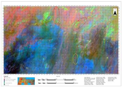
Our Portfolio
Check out our previous projects on GIS, Drone, Land Surveyor and Mapping Services in Nigeria


Deliver accurate and quality results
We work with Latest Equipment and Software
DRONE SERVICES
DRONE SURVEY
- Topographic Survey
- Cadastral Survey
- Engineering Survey
- Mining Survey
- Bathymetry (Hydrography) Survey
- Reconnaissance Survey
- RGB, Thermal, and LIDAR Survey
DRONE INSPECTION
- Power Line Inspection
- Cell site
- Drainage
- Areas difficult to access
- Construction (Road, Building, Bridges, Mast, etc)
- Preventive maintenance planning and optimised production
- Access to areas that pose health, safety and environmental risk to humans
- Quick on-site deployment of the drone inspection system
DRONE DATA PROCESSING & MAPPING
- Orthophoto (Mapping)
- Contour / Elevation
- Digital Surface Model (DSM) and Digital Terrain Model (DTM)
- Point Cloud
- Slope,
- Hydrology (Flood, Catchment Area, Cut and Fill, Flow Direction, Flow Accumulation, Basin, Watershed)
- Data Delineation (Digitizing) Buildings, Road, Riverine area (Swamp, lake, sea, etc)
- Detailed 2D and 3D Models
- Drone Training
- Corporate Drone Consulting
- More…
Surveying and Geoinformatics
- Land Survey
- Bathymetry Survey
- Drone Survey
Data accuracy in surveying, analysis and mapping
We deliver better understanding of the earth surface
Download free and paid datasets, software, and maps. Get the best quality UAV (Drone) Products, GPS, Manuals, and other GeoTech Equipment.
Training
- Geographic Information System
- Remote Sensing
- Drone
- Surveying
100% Practical and Advance Training
Explore our courses and establish a strong foundation of knowledge and skills
For any inquires call now
Contact us
Do you have any query?
WHAT OUR CLIENTS SAY

Aisha Abubakar
Building Construction
Very interactive and insightful, Top notch

Amarachi christiana .N.
Research and Development
Wonderful service delivery, pls keep it up.

Abubakar Lawal
Civil Engineer
Well presented and coordinated

Victor Chima
Researcher
Service was awesome

Maxwell Bawa
GEOGRAPHIC INFORMATION SYSTEM GIS,
I'm really impressed by the professional service and quality of work I got from Geoinfotech. I won't hesitate to seek your services again when the need arises. Keep up the good work!!

Anietie Etuk
Surveyor
Quality Service rendered

Ekele John
Everything about Geoinfotech s unique

Saleh Alhassan
Rice Farmers Association of Nigeria (RIFAN), Engineer, Excellent, The level of interaction is commendable

Mr Oyetunde Folajin
Urban Planner, Drone Mapping, Federal College Of Education, Osiele Abeokuta
Good office location,
Good staff and well packaged

Augustine Michael
Electrician
Service was good and well structured

Ibrahim Sanusi
National boundary commission, Computer Analyst, The service is top notch

Quadree Akanni
The Polytechnic Ibadan, GEOGRAPHIC INFORMATION SYSTEM GIS
Satisfactory, The service rendered is up to standard

Yusuf Ibrahim
Surveyor, National Boundary Commission
Job well done

Genesis Ikaye
Corrosion Inspector
DRONE Survey and Mapping
Concise and direct, with flexible scheduling.

Vyvian Ugwudinso
Development Control
I love what I got with respect to the service paid for.
Ekele John
Everything about Geoinfotech s unique
Victor Chima
Researcher
Service was awesome
Quadree Akanni
The Polytechnic Ibadan, GEOGRAPHIC INFORMATION SYSTEM GIS
Satisfactory, The service rendered is up to standard
Vyvian Ugwudinso
Development Control
I love what I got with respect to the service paid for.
Saleh Alhassan
Rice Farmers Association of Nigeria (RIFAN), Engineer, Excellent, The level of interaction is commendable
Ibrahim Sanusi
National boundary commission, Computer Analyst, The service is top notch
Maxwell Bawa
GEOGRAPHIC INFORMATION SYSTEM GIS,
I'm really impressed by the professional service and quality of work I got from Geoinfotech. I won't hesitate to seek your services again when the need arises. Keep up the good work!!
Mr Oyetunde Folajin
Urban Planner, Drone Mapping, Federal College Of Education, Osiele Abeokuta
Good office location,
Good staff and well packaged
Yusuf Ibrahim
Surveyor, National Boundary Commission
Job well done
Augustine Michael
Electrician
Service was good and well structured
Amarachi christiana .N.
Research and Development
Wonderful service delivery, pls keep it up.
Anietie Etuk
Surveyor
Quality Service rendered
Genesis Ikaye
Corrosion Inspector
DRONE Survey and Mapping
Concise and direct, with flexible scheduling.
Aisha Abubakar
Building Construction
Very interactive and insightful, Top notch
Abubakar Lawal
Civil Engineer
Well presented and coordinated