Document
What is Emergency Response?

Emergency response refers to the actions taken by individuals, organizations, and authorities to address and mitigate the impacts of emergencies, disasters, or crises. This can include natural disasters such as hurricanes, earthquakes, floods, or wildfires, as well as human-made emergencies like industrial accidents, terrorist attacks, or public health crises.

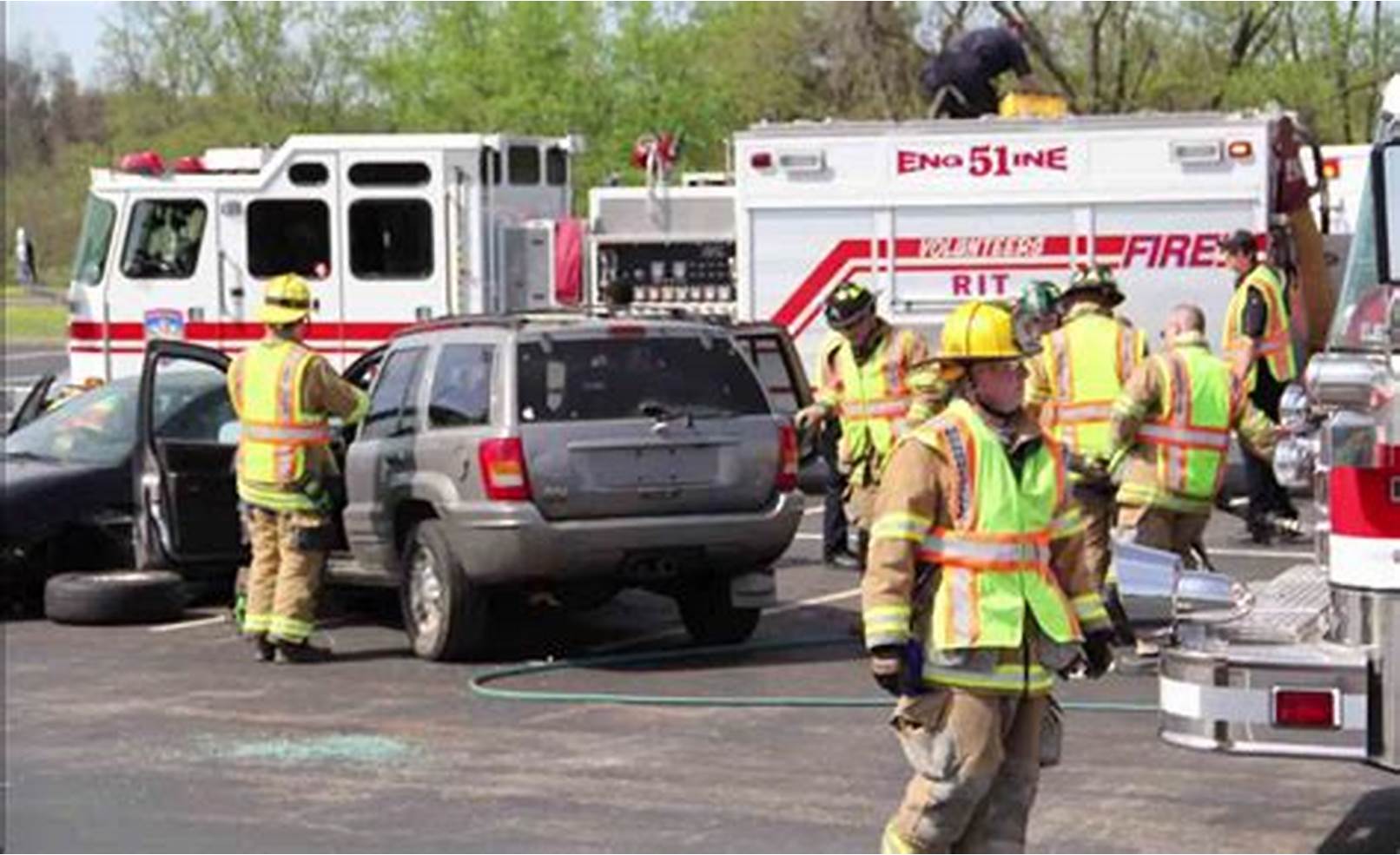
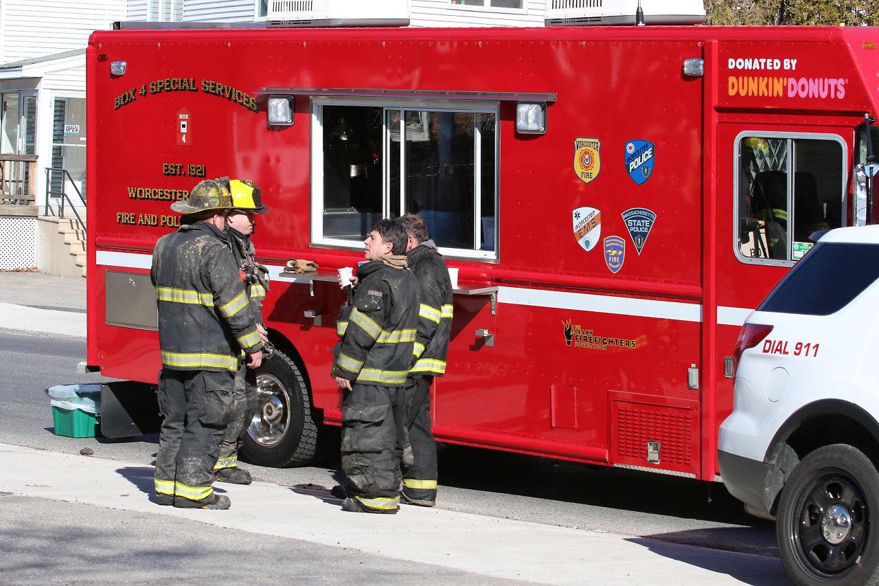
Emergency response typically involves a coordinated effort among various stakeholders, including emergency services such as police, fire departments, medical personnel, and government agencies responsible for disaster management. The primary goals of emergency response are to save lives, protect property, and ensure the safety and well-being of affected individuals and communities.

emergencyKey components of emergency response may include:

  1. Preparedness: Planning, training, and resource allocation before an emergency occurs to ensure readiness to respond effectively.
  2. Detection and notification: Early detection of emergencies and timely notification to relevant authorities and the public.
  3. Mobilization of resources: Activation of emergency response teams, deployment of personnel, equipment, and supplies to the affected areas.
  4. Search and rescue: Identifying and rescuing individuals who may be trapped or injured as a result of the emergency.
  5. Medical assistance: Providing emergency medical care, triage, and transportation of injured individuals to medical facilities.
  6. Shelter and support: Establishing temporary shelters, providing food, water, and other essential supplies to displaced persons.
  7. Coordination and communication: Facilitating communication and coordination among response agencies, government bodies, and other stakeholders to ensure an effective and cohesive response effort.
  8. Damage assessment: Evaluating the extent of damage and determining the needs for recovery and reconstruction efforts.
  9. Public information and education: Providing timely and accurate information to the public about the emergency situation, safety measures, and available assistance resources.
  10. Recovery and rehabilitation: Initiating long-term recovery and rehabilitation efforts to restore affected communities to their pre-disaster state or better.
How to Manage Emergency

The five basic ways to manage emergency, they are often summarized using the acronym “S.T.O.P.P.”:

Emergency Response

  • Stay calm: Maintaining composure and a clear mind is crucial in any emergency situation. Panic can hinder decision-making and exacerbate the situation.
  • Think: Assess the situation carefully before taking any action. Consider the potential risks and hazards, as well as the available resources and options for response.
  • Observe: Gather information about the emergency, including the nature and extent of the problem, any immediate dangers, and the needs of individuals involved.
  • Plan: Develop a plan of action based on your assessment of the situation. Determine the most effective and safest course of action to address the emergency and protect yourself and others.
  • Proceed: Implement your plan and take appropriate actions to respond to the emergency. This may involve providing assistance to those in need, alerting authorities, evacuating the area, or following established emergency procedures.
Basic Responses to Emergency

The four basic responses to emergencies are commonly known as the “Four Rs”:

  1. Readiness: This involves being prepared for emergencies before they occur. It includes creating emergency plans, assembling emergency kits with essential supplies, and staying informed about potential hazards and response procedures.
  2. Response: This refers to the immediate actions taken during an emergency to address the situation and protect lives and property. It involves implementing emergency plans, activating response teams, and providing assistance to those in need.
  3. Recovery: After the immediate threat has passed, recovery efforts focus on restoring affected areas to normalcy. This includes assessing damage, rebuilding infrastructure, providing support to affected individuals and communities, and implementing measures to prevent similar emergencies in the future.
  4. Mitigation: Mitigation involves taking proactive measures to reduce the likelihood and severity of future emergencies. This includes implementing safety measures, conducting risk assessments, improving infrastructure resilience, and promoting community preparedness and awareness.

These four responses provide a framework for comprehensive emergency management, encompassing preparedness, response, recovery, and mitigation efforts to effectively address emergencies and build resilience in communities.


Our Portfolio

Check out our previous projects on GIS, Drone, Land Surveyor and Mapping Services in Nigeria

Advanced Drone-Based Topographic Survey for Precision Land Development Planning

Mapping the Future: Comprehensive Area Survey Transforms Land Development in Akure

Mapping the Future: Comprehensive Area Survey Transforms Land Development in Akure

Precision Topographical Survey and Mapping for Smarter Infrastructure Planning

Precision Topographical Survey and Mapping for Smarter Infrastructure Planning

Precision Drone Volumetric Surveys: How Purechem Industries Optimized Mineral Stockpile Management

Precision Drone Volumetric Surveys: How Purechem Industries Optimized Mineral Stockpile Management

Advanced Mapping & Environmental Survey for Ilubirin Property, Lagos Island

Advanced Mapping & Environmental Survey for Ilubirin Property, Lagos Island

Unveiling the Invisible: LiDAR Technology Transforms Terrain Analysis in Abeokuta North

Unveiling the Invisible: LiDAR Technology Transforms Terrain Analysis in Abeokuta North

LAND USE/LAND COVER MAPPING AND ANALYSIS OF AKURE, NIGERIA

LAND USE/LAND COVER MAPPING AND ANALYSIS OF AKURE, NIGERIA

 DETAILED AERIAL, LAND SURVEY AND GIS ANALYSIS FOR ADVANCED REAL ESTATE DEVELOPMENT

 DETAILED AERIAL, LAND SURVEY AND GIS ANALYSIS FOR ADVANCED REAL ESTATE DEVELOPMENT

Professional Drone Mapping and GIS Training For ETA-ZUMA Mining Company

Professional Drone Mapping and GIS Training For ETA-ZUMA Mining Company

Installation of Intelligent Traffic Lights

Installation of Intelligent Traffic Lights

Geological Report on a Mining/Exploration Survey

Geological Report on a Mining/Exploration Survey

Drone Survey and Mapping of Shaishen Foods Limited

Drone Survey and Mapping of Shaishen Foods Limited

Gold Site Suitability Analysis in North Africa

Gold Site Suitability Analysis in North Africa

Lidar Topographic Mapping Project

Lidar Topographic Mapping Project

Geophysical/hydrogeophysical Studies for Groundwater Development

Geophysical/hydrogeophysical Studies for Groundwater Development

Togo Digital Terrain Model Project

Togo Digital Terrain Model Project

Drone Mapping of Parts of Lome Rail Line for Graceland Energy Located at Lome Togo

Drone Mapping of Parts of Lome Rail Line for Graceland Energy Located at Lome Togo

Drone/land Survey of Pure-chem Industrial Limited, Ogun State.

Drone/land Survey of Pure-chem Industrial Limited, Ogun State.

Drone Inspection/survey of Southern Lake Estate, Chevron, Lekki, Lagos State

Drone Inspection/survey of Southern Lake Estate, Chevron, Lekki, Lagos State

Anniversary-Workshop on the Application of Remote Sensing and Drone Technology in GIS -Abuja

Anniversary-Workshop on the Application of Remote Sensing and Drone Technology in GIS -Abuja

Topographic Mapping of Oyo State

Topographic Mapping of Oyo State

Topographic Mapping of Part of the Local Government Areas in Oyo State

Topographic Mapping of Part of the Local Government Areas in Oyo State

Topographic Mapping of Part of Kwara, Ekiti and Kogi State Local Government Area

Topographic Mapping of Part of Kwara, Ekiti and Kogi State Local Government Area

Political Map of South West, Nigeria Located in Nigeria

Political Map of South West, Nigeria Located in Nigeria

Topographic Mapping of Parts of Niger State Located at Niger State, Nigeria

Topographic Mapping of Parts of Niger State Located at Niger State, Nigeria

Topographic Mapping of Part of Kwara, Ekiti, and Kogi State Local Government Area Located in Nigeria

Topographic Mapping of Part of Kwara, Ekiti, and Kogi State Local Government Area Located in Nigeria

Topographic Mapping of Part of Kwara State Local Government Area Located at Kwara State Nigeria

Topographic Mapping of Part of Kwara State Local Government Area Located at Kwara State Nigeria

Guide Map of Oshodi Transport Interchange Located in Lagos

Guide Map of Oshodi Transport Interchange Located in Lagos

Flood Analysis of Amuwo-odofin Orthophoto.

Flood Analysis of Amuwo-odofin Orthophoto.

Site Inspection Using Drone of Water Corporation Located at Oke-aro Agege

Site Inspection Using Drone of Water Corporation Located at Oke-aro Agege

24,000 meter Lome Rail Line for Drone Mapping, Graceland Energy Located at Lome, Togo

24,000 meter Lome Rail Line for Drone Mapping, Graceland Energy Located at Lome, Togo

10 Drone Inspection Traffic Signal in Lagos

10 Drone Inspection Traffic Signal in Lagos

Lagos October 1st Free GIS Training Workshop

Lagos October 1st Free GIS Training Workshop

Abuja GIS Training 12th of August 2022

Abuja GIS Training 12th of August 2022

Osun state parcel project

Osun state parcel project

Drone Mapping & Vectorization Of Abu-allied Farm

Drone Mapping & Vectorization Of Abu-allied Farm

Proposal for aerial deployment, tracking and monitoring of threats in victoria island phase 1 and ikoyi phase 2, nigeria

Proposal for aerial deployment, tracking and monitoring of threats in victoria island phase 1 and ikoyi phase 2, nigeria

Jabi Lake Mall Solar Inspection – Abuja

Jabi Lake Mall Solar Inspection – Abuja

Ground Control and Drone Survey for Mast 3D Modeling

Ground Control and Drone Survey for Mast 3D Modeling

Telecom Drone 3D and 2D Modeling of Cellsite

Telecom Drone 3D and 2D Modeling of Cellsite

Free GIS Spatial Analysis Training (Lagos Branch)

Free GIS Spatial Analysis Training (Lagos Branch)

800 Building Plots Aerial Capture and Delineation for Database. Greenfield Estate

800 Building Plots Aerial Capture and Delineation for Database. Greenfield Estate

100 Hectares Aerial Survey with Differential GPS of High Accuracy

100 Hectares Aerial Survey with Differential GPS of High Accuracy

Protected: Nigeria Crime Report and Dashboard

Protected: Nigeria Crime Report and Dashboard

Drone Survey and Mapping – Victoria Island  Copy

Drone Survey and Mapping – Victoria Island Copy

Akwa-Ibom 500 Hectares Drone Survey and Mapping in Nigeria

Akwa-Ibom 500 Hectares Drone Survey and Mapping in Nigeria

Ground Control Establishment – Republic of the Niger – Kano, Kastina, Jigawa, Kaduna

Ground Control Establishment – Republic of the Niger – Kano, Kastina, Jigawa, Kaduna

Drone Survey and Mapping – Victoria Island

Drone Survey and Mapping – Victoria Island

Control Point Establishment – DGPS

Control Point Establishment – DGPS

Land Survey – Northern Nigeria

Land Survey – Northern Nigeria

Biodiversity Mapping – Sweden

Biodiversity Mapping – Sweden

Flood Impact Mapping – United Kingdom

Flood Impact Mapping – United Kingdom

M and E GIS Dashboard for Control Establishment Project

M and E GIS Dashboard for Control Establishment Project

Geodatabase Management System Training For National Boundary Commission

Geodatabase Management System Training For National Boundary Commission

Nigeria Topographic Map – Project

Nigeria Topographic Map – Project

Abuja Training on Introduction to GIS

Abuja Training on Introduction to GIS

200 Hectares Land and Drone Survey – Lagos Nigeria

200 Hectares Land and Drone Survey – Lagos Nigeria

Inspection of 30 hectares drainage

Inspection of 30 hectares drainage

Drainage Drone Mapping and Surveying in Lagos Nigeria

Drainage Drone Mapping and Surveying in Lagos Nigeria

GIS Cadastral Mobile Application

GIS Cadastral Mobile Application

Abuja Topographical Map – HD GIS Mapping

Abuja Topographical Map – HD GIS Mapping

Ground Topography Survey (Lagos Island)

Ground Topography Survey (Lagos Island)

2.7km2 Topography Survey in Snake Island

2.7km2 Topography Survey in Snake Island

GIS Masterclass

GIS Masterclass

Sokoto Contour Map

Sokoto Contour Map

NDVI Vegetation Assessment in Lagos State

NDVI Vegetation Assessment in Lagos State

Lagos drone training master class

Lagos drone training master class

Ifako drone topographic survey and mapping

Ifako drone topographic survey and mapping

CMD Lagos 3D mapping aerial modeling

CMD Lagos 3D mapping aerial modeling

GIS and Drone Masterclass

GIS and Drone Masterclass

Drone aerial survey and mapping – Lagos Island _ Somolu

Drone aerial survey and mapping – Lagos Island _ Somolu

Drone Pilot Mapping and Aerial Photography

Drone Pilot Mapping and Aerial Photography

AutoCAD Mapping and Surveying

AutoCAD Mapping and Surveying

Mapping with GIS for Maritime Boundary

Mapping with GIS for Maritime Boundary

GIS for Maritime using ArcGIS and QGIS

GIS for Maritime using ArcGIS and QGIS

Migrating from ArcMap to ArcGIS Pro

Migrating from ArcMap to ArcGIS Pro

Getting started with Web Mapping using ArcGIS

Getting started with Web Mapping using ArcGIS

Geographic Information System – Python, SQL, DBMS

Geographic Information System – Python, SQL, DBMS

Introduction to GIS [NYSC Special]

Introduction to GIS [NYSC Special]

Drone Photography and Videography

Drone Photography and Videography

Introduction to GIS

Introduction to GIS

Drone Training for Beginners

Drone Training for Beginners

Covid-19 | Nigeria Data Visualisation

Covid-19 | Nigeria Data Visualisation

Benue Flood Analysis

Benue Flood Analysis

Aerial photography Ile-Ife Osun State

Aerial photography Ile-Ife Osun State

Kenya Forest Project

Kenya Forest Project

Tunsun Consultants Ltd

Tunsun Consultants Ltd

Introduction To Gis In Maritime at the National Boundary Commission

Introduction To Gis In Maritime at the National Boundary Commission

Training on GIS and Drone Mapping (batch-4 & 5)

Training on GIS and Drone Mapping (batch-4 & 5)

Osun Flood Mapping

Osun Flood Mapping

Lahass International Limited

Lahass International Limited

Linguistic Association of Nigeria

Linguistic Association of Nigeria

West African Indexing Services

West African Indexing Services

Lagos Ikeja Road Network Map

Lagos Ikeja Road Network Map

LASU Land Regularisation Portal

LASU Land Regularisation Portal

Lingua Plus International

Lingua Plus International

Lagferry Web Route

Lagferry Web Route

COURSES

Explore Geoinfotech courses and establish a strong foundation of knowledge and skills to be productive with the latest Technology.

Drone Pilot for Beginners

The Drone Beginners Training course is a comprehensive program designed to equip participants with the necessary skills and knowledge to operate drones effectively and safely in a professional setting.
Duration: 3 Weekends (Every Friday 2pm and Saturday 10am)
Package: Field Experience, 100% Hands-on practical, jotter, Biro and Software Others, Test, Exam and Certificate.

Find out more
Training Venue Available in,Lagos and Abuja100253Nigeria
+ Google Map

[Beginners to Advanced Class] Geographic Information System (ArcGIS Desktop and ArcGIS Pro)

This course will develop your skills in spatial data analysis, making maps application of Python, apply SQL as a standard language for accessing and manipulating databases.
Duration: 3 Weekends (Every Friday 2pm and Saturday 10am)
Package: Field Experience, 100% Hands-on practical, jotter, Biro and Software Others, Test, Exam and Certificate.

Find out more

Drone Pilot for Beginners to Professional

The Drone Professional Training course is a comprehensive program designed to equip participants with the necessary skills and knowledge to operate drones effectively and safely in a professional setting.
Duration: 3 Weekends (Every Friday 2pm and Saturday 10am)
Package: Field Experience, 100% Hands-on practical, jotter, Biro and Software Others, Test, Exam and Certificate.

Find out more
Training Venue Available in,Lagos and Abuja100253Nigeria
+ Google Map

[Beginners to Intermediate] Geographic Information System (ArcGIS Desktop and ArcGIS Pro)

GIS principles and ArcGIS techniques are implemented in this course to simulate real-world features, explore patterns, and make better decisions.
Duration: 4 Weekends (Every Friday 2pm and Saturday 10am)
Package: Field Experience, 100% Hands-on practical, jotter, Biro and Software Others, Test, Exam and Certificate.

Find out more

YOU MAY ALSO LIKE...