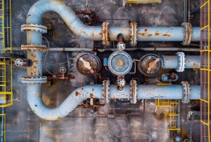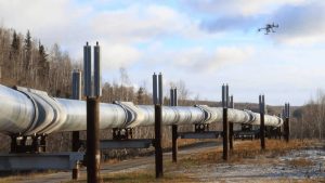
Oil and gas pipelines extend across large areas. They pass through creeks, farmland, settlements, wetlands, and industrial zones. These environments can change over time, making pipeline monitoring a continuous challenge.
Sometimes, the first visible sign of a problem is a change near the pipeline right-of-way. It could be disturbed ground, new construction, vegetation loss, or an access track that was not present during an earlier inspection.
Identifying these changes early can help operators decide where further investigation is needed.
Pipeline surveillance in Port Harcourt combines aerial imagery, satellite remote sensing, and Geographic Information Systems (GIS) to support infrastructure monitoring. These technologies can help operators document pipeline conditions, identify changes, and organize information about their assets.
Geoinfotech provides drone, GIS, and remote sensing services that can support pipeline surveillance and asset protection across Port Harcourt and the wider Niger Delta.
This guide explains how these technologies work together, what a monitoring program can deliver, and how to get started.
What Needs Protection Along a Pipeline Corridor?
Pipeline protection involves more than monitoring the pipeline itself. Operators must also consider the infrastructure and environment surrounding each route.
A pipeline corridor may include valves, manifolds, access roads, flow stations, and storage facilities. Each asset has its own monitoring requirements.
Potential concerns include:
- Physical damage to exposed pipeline sections
- Unauthorized activities around the right-of-way
- New construction or encroachment
- Changes in surrounding land use
- Ground disturbance near the pipeline
- Environmental changes along the corridor
- Access restrictions and vegetation changes
These issues can occur in different locations at different times. As a result, monitoring every kilometre with the same level of effort may not be practical.
A structured surveillance program helps operators identify priority areas. It also helps them determine where aerial observation, satellite analysis, or ground inspection may be most useful.
Why One Monitoring Method Is Not Enough
Each monitoring method provides different information. Relying on only one method can leave gaps in the overall picture.
Ground Patrols
Ground patrols allow personnel to inspect accessible locations directly. They remain important for physical verification and incident assessment.
However, patrol teams may find it difficult to cover extensive pipeline networks frequently.
Drone Surveillance
Drones capture high-resolution imagery over selected sections of a pipeline corridor.
Survey teams can use this imagery to document visible conditions and compare observations from different dates. Drone flights can also help teams examine areas that require closer attention.
However, coverage depends on flight duration, site access, weather, and applicable operating requirements.
Satellite Remote Sensing
Satellite imagery can cover wider areas than a typical drone mission.
Comparing images from different dates can help analysts identify changes in land use, vegetation, construction, and ground disturbance. The ability to identify a specific feature depends on image resolution, conditions, and the type of change.
GIS Integration
GIS connects these observations to mapped pipeline routes, facilities, and surrounding features.
Geoinfotech can use drone imagery, remote sensing, and spatial data as complementary sources of information. This approach helps organize observations in one geographic environment rather than leaving them in separate reports.
How Geoinfotech Builds a Pipeline Surveillance Program
A structured pipeline surveillance program starts with clear objectives. Geoinfotech can scope the work around the operator’s assets, monitoring priorities, and reporting requirements.
1. Define the Project Scope
The first step is to identify which assets require monitoring.
These may include pipeline routes, rights-of-way, valves, flow stations, storage facilities, and associated infrastructure.
The project team should also establish the main monitoring concerns and the frequency of observations.
This keeps the program focused on the operator’s actual requirements.
2. Create a Digital Asset Baseline
Next, the team organizes available asset information within a GIS environment.
The database may include pipeline routes, facility locations, access roads, valves, and other relevant infrastructure.
Where suitable data is available, the team can also add terrain, settlements, waterways, and environmental features.
This digital baseline provides a spatial reference for future observations. It can also support maintenance planning, land management, and incident documentation.
3. Identify Priority Areas
Not every section of a pipeline corridor requires the same monitoring approach.
GIS can help combine pipeline locations with surrounding features and available historical information. Analysts can then identify areas that may need closer observation.
For example, a section near expanding development or a frequently disturbed access route may require additional assessment.
This process helps operators prioritize monitoring resources according to project-defined risks and available evidence.
4. Conduct Routine Monitoring
The next stage involves collecting imagery and other relevant observations.
Drone flights can capture detailed views of selected pipeline sections and facility boundaries. Satellite imagery can provide broader coverage across suitable areas.
When imagery from different dates is available, analysts can compare it to identify visible changes.
These changes may include new structures, ground disturbance, vegetation changes, or other features that require further investigation.
5. Review and Verify Observations
An apparent change in imagery does not automatically confirm a threat or incident.
The project team should review each finding and determine whether additional investigation is necessary.
Depending on the situation, this may involve another drone survey, a field inspection, or consultation with the operator’s technical team.
This verification stage helps distinguish useful observations from changes that have little operational significance.
6. Report Findings in GIS
Finally, the team organizes the findings into useful outputs.
These may include GIS maps, inspection records, imagery, change-detection results, and reports identifying locations that need further attention.
Where a suitable GIS dashboard is included in the project scope, authorized users can review asset locations, flagged observations, and previous records in one environment.
The result is a more organized view of the pipeline network and its changing surroundings.
Asset Protection Beyond the Pipeline
Pipeline protection also involves the facilities and infrastructure connected to the network.
Flow stations, storage facilities, access roads, and other assets may require their own monitoring plans.
Drone imagery can provide updated visual records of selected facilities and surrounding land. GIS can then connect these observations to the wider asset database.
This allows operators to examine changes along pipeline corridors alongside observations around connected facilities.
Over time, historical imagery and inspection records can help teams identify recurring patterns. These records may also support risk assessment and future inspection planning.
However, automated change alerts should be treated as prompts for review. They do not replace field verification, engineering assessment, or established security procedures.
Environmental Monitoring Along Pipeline Corridors
Pipeline surveillance can also support environmental monitoring.
In the Niger Delta, pipeline corridors may cross wetlands, waterways, farmland, mangrove vegetation, and populated areas. Monitoring these environments can help operators document changing site conditions.
Drone imagery and satellite remote sensing may support:
- Land-cover change monitoring
- Vegetation assessment
- Mapping of disturbed areas
- Environmental baseline documentation
- Waterway and surrounding land monitoring
- Visual assessment of areas affected by reported incidents
The suitability of each method depends on the monitoring objective and available imagery.
For example, satellite imagery can support broader-area change assessment. Drone surveys can provide more detailed views of selected locations.
GIS helps connect the resulting information to the relevant pipeline section or facility.
What Does a Client Receive?
The deliverables depend on the agreed scope, available data, and monitoring requirements.
A pipeline surveillance engagement may include:
- A digital inventory of selected assets
- Mapped pipeline routes and associated facilities
- Risk-priority maps based on agreed criteria
- Dated drone imagery
- Satellite imagery analysis, where included
- Change-detection findings
- GIS maps and spatial datasets
- Inspection records and reports
- Recommendations for further investigation
For ongoing monitoring, the program can also establish a schedule for repeated observations and comparisons.
Some operators may initially prefer a one-time baseline assessment. Others may need recurring monitoring to document changes over time.
The project scope should make the frequency, coverage, outputs, and responsibilities clear from the beginning.
Building an In-House Monitoring Capability
Some organizations prefer to manage parts of their monitoring operations internally.
Geoinfotech also offers drone-related equipment and training services through its wider business.
Depending on the client’s needs, an in-house capability may involve suitable drones, flight-planning procedures, imagery-processing tools, GIS software, and staff training.
Before adopting this approach, the operator should assess its equipment requirements, personnel, data-management needs, and applicable regulatory obligations.
An in-house team may handle routine data collection while using specialist support for complex processing, GIS analysis, or particular monitoring tasks.
The right arrangement depends on the organization’s resources and operational objectives.
Why Choose Geoinfotech for Pipeline Surveillance in Port Harcourt?
Geoinfotech provides drone surveying and mapping, GIS, remote sensing, and geospatial data services.
These capabilities can support different stages of a pipeline monitoring workflow, from asset mapping and imagery collection to spatial analysis and reporting.
For oil and gas operators in Port Harcourt and the wider Niger Delta, the monitoring approach can be designed around the actual pipeline network and its surrounding environment.
Depending on the project, the workflow may combine:
- Drone surveillance and aerial mapping
- Satellite remote sensing
- Pipeline corridor mapping
- GIS database development
- Spatial analysis
- Environmental monitoring
- Inspection documentation
- Change detection and reporting
The precise deliverables should be agreed before work begins. This ensures that the monitoring program matches the operator’s assets, data requirements, and available resources.
How to Start a Pipeline Surveillance Project
If your organization needs pipeline surveillance in Port Harcourt, begin by identifying the assets and monitoring objectives.
Before contacting a provider, consider the following questions:
- Which pipeline sections or facilities need monitoring?
- Do you have existing pipeline coordinates or GIS data?
- Do you need a one-time assessment or recurring monitoring?
- Which visible changes are most important to identify?
- Do you require drone imagery, satellite analysis, or both?
- Will the results need to integrate with an existing GIS?
- What maps, datasets, dashboards, or reports do you expect?
These details help the project team develop a suitable workflow and estimate the resources required.
Contact Geoinfotech or email mail@geoinfotech.ng to discuss your requirements.
You can also visit the Port Harcourt office at No. 21 Bekwere Street, opposite Living Faith Church, Fruit Garden Market, Emenike bus stop, Mile 1, Port Harcourt.
Final Thoughts
Effective pipeline surveillance in Port Harcourt starts with knowing where assets are located, understanding their surroundings, and documenting changes over time.
Ground patrols provide direct verification. Drones capture detailed imagery over selected areas. Satellite remote sensing supports wider-area monitoring, while GIS connects these observations to mapped infrastructure.
When combined appropriately, these methods can help operators prioritize inspections, maintain better asset records, and make informed decisions about pipeline protection.
Geoinfotech brings drone technology, GIS, remote sensing, and spatial analysis together to support pipeline surveillance and asset protection.
For operators managing infrastructure across the Niger Delta, a structured monitoring program can turn scattered observations into organized spatial information that supports timely investigation and better-informed asset management.