

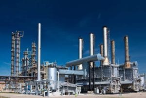
 Aerial surveillance for upstream and downstream operations in Port Harcourt.
Port Harcourt plays an important role in Nigeria’s oil and gas industry. From production facilities and wellheads to refineries, storage terminals and distribution infrastructure, the sector depends on assets that require regular inspection and monitoring.
Aerial surveillance for upstream and downstream operations in Port Harcourt provides oil and gas companies with another way to observe infrastructure, document site conditions and improve operational awareness. Geoinfotech combines drone technology, GIS and remote sensing to support these activities.
Understanding Upstream and Downstream Surveillance
Upstream operations focus on exploring for and producing oil and gas. They involve wellheads, flow stations, production facilities and associated infrastructure.
Downstream operations focus on refining, processing, storing and distributing petroleum products. These activities involve refineries, tank farms, terminals and other industrial facilities.
Each stage has different monitoring requirements. Aerial surveillance can complement conventional inspection methods by providing high-resolution imagery and a broader view of selected assets.
Drone Surveillance for Upstream Operations
Upstream facilities may span extensive areas or operate in environments where ground inspections require significant time and coordination. Drones can capture aerial imagery to support facility inspection, infrastructure mapping and environmental monitoring.
Geoinfotech provides specialized drone services for oil and gas operations in Nigeria. These services support pipeline monitoring, production facility inspections, thermal imaging, LiDAR mapping and geospatial data collection.
The resulting imagery can help operators document visible conditions, compare surveys and identify areas that need further inspection.
Aerial Monitoring for Downstream Facilities
Downstream facilities contain infrastructure such as storage tanks, processing plants, refineries and distribution terminals. Monitoring these assets requires accurate information and consistent documentation.
Drone surveys can provide an aerial overview of facility layouts and surrounding areas. Depending on the equipment and project requirements, specialized sensors can also support selected inspection activities.
Geoinfotech’s drone solutions can help organizations collect aerial data for infrastructure assessment, mapping and maintenance planning. These services can complement existing inspection programmed without replacing engineering assessments or required safety procedures.
GIS and Remote Sensing for Better Decisions
Aerial imagery becomes more useful when organizations can connect it to accurate geographic information.
Geographic Information Systems help teams map facilities, organize asset records and analyze spatial relationships. Remote sensing can provide additional information about land cover, environmental changes and the wider operating area.
Geoinfotech’s GIS and geospatial solutions support spatial analysis, mapping, data management and visualization. Combining these capabilities with drone imagery helps turn collected data into useful information for planning and asset management.
Real-Time Aerial Intelligence
Some operations benefit from viewing aerial footage while an inspection or monitoring activity is underway. Live video can help authorized stakeholders observe conditions remotely and decide whether further assessment is necessary.
Geoinfotech offers drone livestreaming services in Nigeria for suitable monitoring applications. Availability depends on operational conditions, equipment and project requirements.
Why Choose Geoinfotech?
Geoinfotech combines drone technology, GIS, remote sensing and aerial data processing to support oil and gas infrastructure monitoring across Nigeria.
For upstream and downstream operators in Port Harcourt, these services can support inspection, mapping, environmental assessment and infrastructure documentation.
Looking for aerial surveillance for upstream and downstream operations in Port Harcourt? Contact Geoinfotech to discuss drone and geospatial solutions tailored to your organization’s monitoring needs.















































































