Port Harcourt is home to critical oil and gas infrastructure, industrial facilities, transportation networks, pipelines and other important assets. Monitoring these environments requires more than periodic inspections. Organizations need timely information that helps them understand what is happening across their assets.
Real-time surveillance in Port Harcourt provides a technology-driven approach to this challenge. By combining drones, GIS, remote sensing and live aerial intelligence, organizations can improve visibility and make faster, better-informed decisions.
Why Real-Time Surveillance Matters
Traditional surveillance can create information gaps. A team may need to travel to a location before confirming what is happening. This can delay assessment and decision-making.
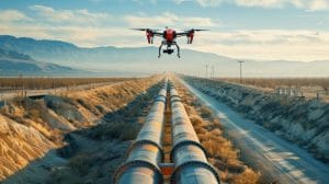
Drone technology changes this workflow by providing an aerial view of selected locations. High-resolution cameras can capture current visual information, while suitable systems can transmit live footage to authorized stakeholders.
For organizations managing large infrastructure networks, this can provide an additional layer of situational awareness.
Drone Surveillance in Port Harcourt
Drones are increasingly useful for monitoring infrastructure that covers large or difficult-to-access areas.
Geoinfotech provides drone services for oil and gas operations in Nigeria, supporting applications including infrastructure inspection, monitoring, mapping and aerial data collection. The company combines UAV technology with GIS, LiDAR, thermal imaging and photogrammetry.
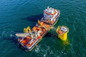
This makes drone surveillance useful for applications such as pipeline monitoring, facility observation, vessel protection and infrastructure inspection.
Live Aerial Intelligence
Real-time surveillance becomes even more valuable when aerial information can reach decisionmakers while an operation is underway.
Geoinfotech’s drone livestreaming service enables aerial video to be transmitted to authorized remote viewers. This can support remote monitoring of infrastructure, emergency situations and other operations where timely visual information is important.
Instead of waiting for a drone mission to end before reviewing its footage, stakeholders can gain visibility during the operation.
Connecting Surveillance With GIS
Aerial imagery becomes more useful when it has geographic context.
GIS can connect surveillance information to specific assets, locations and infrastructure. Organizations can use spatial data to understand where observations occur and compare current information with previous surveys.
This creates a workflow where:
Drone Capture → Live Monitoring → GIS Integration → Analysis → Decision-Making
The result is more than surveillance footage. It becomes structured geospatial intelligence.
Geoinfotech also provides GIS services in Port Harcourt, supporting mapping, spatial analysis and the management of geographic information.
Supporting Critical Infrastructure
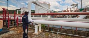
Real-time surveillance can support organizations responsible for pipelines, industrial facilities, energy infrastructure, vessels and other critical assets.
It can provide an updated view of selected locations, support inspection activities and help teams identify situations that require further assessment.
Geoinfotech’s existing work around drone monitoring in Port Harcourt demonstrates how UAVs, GIS, remote sensing and data analytics can work together to provide aerial intelligence for infrastructure management.
Choose Geoinfotech for Real-Time Surveillance
Effective surveillance depends on visibility, reliable technology and useful information.
Geoinfotech combines drone technology, GIS, remote sensing and real-time aerial intelligence to provide professional surveillance and monitoring solutions in Port Harcourt and across Nigeria.
Whether you need infrastructure monitoring, aerial surveillance, drone livestreaming or geospatial intelligence, Geoinfotech can help turn aerial observations into information that supports better decisions.
Looking for real-time surveillance in Port Harcourt? Contact Geoinfotech to explore professional drone and geospatial technology solutions for your organization.