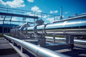
 Oil and gas pipelines are essential to energy production and distribution across Port Harcourt and the wider Niger Delta. These networks connect production sites, processing facilities and storage terminals. Protecting them requires regular monitoring, accurate asset records and timely information about changing conditions.
Pipeline surveillance and asset protection in Port Harcourt can combine drone technology, Geographic Information Systems (GIS) and remote sensing to improve infrastructure visibility and support informed operational decisions.
Why Pipeline Surveillance Matters
Pipeline networks extend across communities, wetlands, industrial areas and other challenging environments. Operators must monitor infrastructure conditions while remaining alert to environmental changes, physical damage and activities that may require investigation.
Ground inspections remain essential, but aerial data can provide an additional perspective. A combination of field inspections and geospatial monitoring helps organizations document conditions and prioritize maintenance or further assessment.
Drone Surveillance for Pipeline Protection
Drones can capture high-resolution aerial imagery of pipeline corridors and associated infrastructure. These observations can help inspection teams document visible changes, assess surrounding land use and identify areas that need closer examination.
Geoinfotech provides specialized drone services for oil and gas in Nigeria. Its UAV capabilities support infrastructure inspection, aerial mapping, monitoring and geospatial data collection.
Repeated surveys can also create a visual record of pipeline assets. Comparing imagery collected at different times can help teams identify changes and plan appropriate follow-up inspections.
GIS and Geospatial Intelligence
Protecting pipelines requires more than collecting aerial photographs. Organizations also need to understand where their assets are located and how they relate to surrounding infrastructure.
GIS provides a framework for mapping pipeline networks, organizing asset information and recording inspection findings. When integrated with drone imagery and satellite data, it can help operators compare observations and develop a clearer picture of their infrastructure.
Geoinfotech’s GIS services in Nigeria support mapping, spatial analysis and geographic data management. These capabilities can contribute to asset documentation, infrastructure planning and monitoring.
Real-Time Monitoring and Situational Awareness
Some monitoring operations require information while an inspection is underway. Live aerial video can provide authorized stakeholders with a current view of selected areas, subject to operational requirements and applicable regulations.
Geoinfotech’s drone livestreaming services can support remote viewing during suitable monitoring and infrastructure-related activities.
Combined with established reporting procedures, live aerial information can help decision-makers assess conditions and determine whether further investigation is necessary.
A Coordinated Approach to Asset Protection
Drone surveillance works best as part of a wider asset-management strategy. Operators should combine aerial observations with engineering inspections, preventive maintenance, field verification and established security procedures.
Remote sensing can provide broader information about environmental and land-use changes, while GIS helps organize observations into useful spatial records. Together, these technologies can support more consistent monitoring and better-informed planning.
Why Choose Geoinfotech?
Geoinfotech combines drone technology, GIS, remote sensing and geospatial expertise to support oil and gas infrastructure monitoring across Nigeria.
For organizations seeking pipeline surveillance and asset protection in Port Harcourt, these services can help improve asset visibility, document changing conditions and support inspection and maintenance decisions.
Protect your pipeline assets with better geospatial information. Contact Geoinfotech to discuss drone surveillance, GIS mapping and monitoring solutions tailored to your infrastructure requirements.