

Looking Beyond the Moon’s Familiar Surface
The Moon remains one of the most recognizable objects in the night sky. Its changing phases have fascinated people for centuries. However, billions of years of impact events, volcanic activity, and geological processes have shaped its rugged landscape. These processes created the craters, plains, and elevation differences visible today.
Understanding the Southeastern Lunar Surface
This project explores a southeastern region of the Moon using ArcGIS Pro and Blender. The workflow uses a Lunar Digital Elevation Model (DEM) to create a false-color topographic map. It transforms raw elevation data into a clear and visually engaging representation of the lunar surface.
Understanding False-Color Lunar Topography Map
The map applies a graduated false-color scheme to highlight elevation differences across the landscape. Darker tones represent deep basins and lower-lying maria, while lighter shades highlight elevated highlands and crater rims. As a result, readers can identify terrain variations more easily. The visualization also reveals the high density of impact craters across the region.
Building the Visualization
False color lunar topography focused on more than elevation mapping. It also emphasized terrain readability through careful color selection, contrast, and relief enhancement. In addition, continuous elevation rendering created smoother transitions between landforms. These techniques improve depth perception while preserving the Moon’s distinctive appearance.
Integrating ArcGIS Pro and Blender
ArcGIS Pro prepared and symbolized the elevation data. Blender enhanced the three-dimensional appearance of the terrain. Together, these tools demonstrate how GIS and 3D visualization support planetary cartography. They also present scientific data in a more engaging and accessible format.
GIS Beyond Earth
Planetary cartography continues to expand as an exciting field within geospatial science. Advances in GIS, remote sensing, and 3D visualization now enable researchers, educators, and enthusiasts to study planetary bodies beyond Earth. Furthermore, these technologies help communicate complex terrain features to both technical and non-technical audiences.
False-color lunar topography demonstrate how modern geospatial tools support scientific exploration and create visually compelling maps. Ultimately, they show that cartography extends beyond Earth and offers new ways to explore and understand landscapes across our solar system.
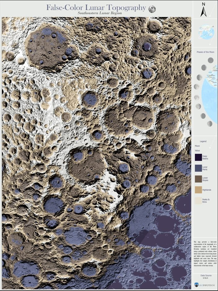
False color Lunar Topography















































































