drone-services-in-lagos.jpg
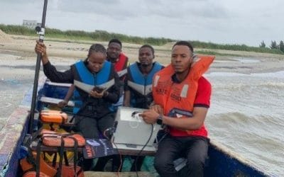
Drone services in Lagos have evolved significantly, moving far beyond aerial photography; they now support critical operations in surveying, mapping, agriculture, infrastructure inspection, and construction monitoring. By 2025, drone technology will have become an essential part of data acquisition and spatial analysis for both public and private sectors in Nigeria’s commercial capital.
This guide offers a verified overview of drone services in Lagos, including current applications, estimated costs, operational requirements, and strategies for businesses to effectively leverage drone technology.
The Growing Demand for Drone Services in Lagos
Lagos continues to experience rapid urbanization, with large-scale construction, transportation planning, and coastal management projects requiring precise spatial data. Traditional land surveys often take weeks, but drone-based mapping delivers centimeter-level accuracy in a fraction of the time.
According to recent trends in Nigeria’s tech and construction sectors, demand for aerial data collection has increased by more than 40% between 2022 and 2024, driven by developers, government agencies, and engineering firms seeking faster, safer, and more reliable methods of site assessment.
Major Types of Drone Services Available in Lagos

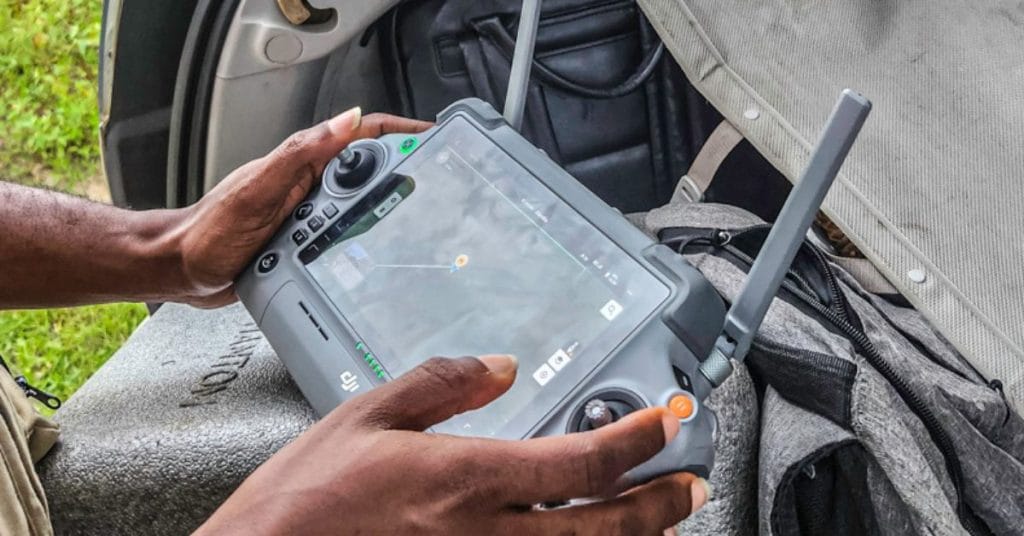
drone-survey-lagos.jpg
Aerial Mapping and Surveying
High-precision mapping is among the most requested drone services in Lagos. Using RTK and PPK-enabled UAVs, operators capture georeferenced images to produce orthomosaics, contour maps, and digital elevation models (DEMs). These datasets are crucial for civil engineering, urban planning, and environmental monitoring.
Topographic and Cadastral Surveys
Cadastral mapping defines property boundaries using aerial imagery and GNSS data integration. Licensed drone surveyors in Lagos provide survey-grade outputs that meet requirements set by the Office of the Surveyor-General of the Federation (OSGOF) and the Surveyors Council of Nigeria (SURCON).
Construction and Infrastructure Monitoring
Construction firms in Lagos increasingly depend on drones to document project progress and validate design accuracy. Drone-based volumetric analysis and as-built comparisons enhance decision-making and reduce rework costs.
Industrial and Utility Inspection
Energy and telecom industries deploy drones for pipeline, powerline, and tower inspections. Equipped with RGB and thermal sensors, drones detect heat leaks, corrosion, and structural defects, helping operators comply with safety standards while minimizing downtime.
Agricultural and Environmental Monitoring
Drones with multispectral sensors are now common in precision agriculture across Nigeria’s southwestern region. They assess crop vigor, irrigation patterns, and pest impact using vegetation indices such as NDVI. Lagos-based agritech firms use this data to support smarter farm management.
Aerial Photography and Cinematography
Beyond technical applications, drones play a key role in Lagos’s booming media, marketing, and real estate industries. Professional operators deliver stabilized 4K video and panoramic imagery for promotional campaigns, documentaries, and virtual property tours.
Legal and Regulatory Requirements for Drone Operations in Lagos
All drone operations in Nigeria are governed by the Nigerian Civil Aviation Authority (NCAA) under the Civil Aviation (Remotely Piloted Aircraft Systems) Regulations 2023.
Key requirements for commercial drone operations include:
- Registration: All drones used for business purposes must be registered with the NCAA.
- Operational Authorization: Commercial drone missions require prior approval, particularly in controlled airspace around Lagos.
- Remote Pilot Licensing: Operators must complete certified RPAS training approved by the NCAA.
- Insurance Coverage: Drone operators are required to maintain liability insurance.
- Data and Privacy Compliance: Flights must not infringe on individual privacy or restricted areas such as airports and government facilities.
GeoInfoTech NG operates fully under NCAA compliance, with certified pilots and RPAS operational authorization.
Drone Service Pricing in Lagos (2025 Estimates)
Drone service pricing depends on project scale, sensor type, and data-processing complexity. Based on current market trends in Lagos, 2025 rates generally fall within the following ranges:
- Aerial Photography / Videography: ₦100,000 – ₦300,000 per session
- Mapping and Topographic Surveys: ₦500,000 – ₦2,000,000 per site
- Construction Progress Monitoring: ₦200,000 – ₦1,000,000 per mission
- Industrial and Thermal Inspections: ₦800,000 – ₦3,000,000 per project
These costs vary with project location, airspace category, and required data resolution. GeoInfoTech NG provides transparent, project-specific quotations tailored to client objectives.
Why Businesses Trust Geoinfotech NG
Geoinfotech NG stands out as one of Nigeria’s most trusted geospatial and drone service providers. The company’s integration of UAV data with GIS and remote sensing analytics offers clients a full pipeline, from field data capture to processed insights.
Key strengths include:
- NCAA-certified drone operations and pilots
- RTK/PPK-capable UAV systems for centimeter-level accuracy
- End-to-end deliverables including DEMs, contour maps, 3D reconstructions, and analytics reports
- Proven experience across infrastructure, oil & gas, agriculture, and environmental projects
Leveraging Drone Technology for Business Growth
For Lagos-based organizations, drones are not just tools; they are strategic assets. Integrating drone data helps businesses to:
- Streamline surveying, inspection, and reporting workflows
- Reduce manual labor, site visits, and safety risks
- Enhance decision-making with real-time geospatial intelligence
- Improve stakeholder communication through accurate visual documentation
Industries that integrate UAV data with GIS and AI-based analytics are already seeing significant efficiency gains, particularly in infrastructure planning and environmental assessment.