
- This event has passed.
Spatial Analysis using ArcGIS

Spatial Analysis using ArcGIS
Professional 2 Weekends ▪ Field Experience
5.0 ![]() (100% Practical) ▪ Exam & Certificate
(100% Practical) ▪ Exam & Certificate


What's Included in this Course
Free Software and Apps
Hands on Practical and Field Experience
Manual, Jotter and Biro
Test, Assessment and Exam
Certificate of Completion
Course Description:
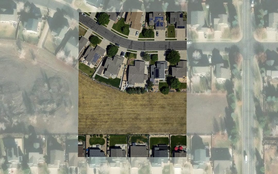
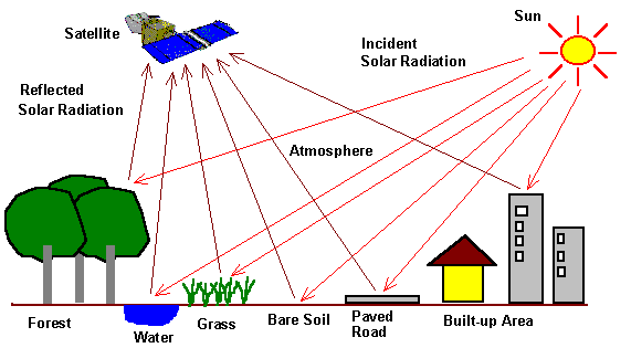
Learn essential concepts and a standard workflow you can apply to any spatial analysis project. You will work with a variety of ArcGIS tools to explore, analyze, and produce reliable information from data.
Course Highlights:
- Essential concepts: Learn fundamental principles for spatial analysis projects.
- Standard workflow: Develop a reliable workflow for any spatial analysis project.
- ArcGIS tool proficiency: Gain hands-on experience with diverse ArcGIS tools.
- Reliable information production: Acquire skills to extract, analyze, and produce dependable spatial information.
Our Certificate is Recognized by Top Industries

![]()
Certificate of completion
![]() Spatial Analysis using ArcGIS Mastering and Completion.
Spatial Analysis using ArcGIS Mastering and Completion.
![]() Increased job opportunities and career prospects
Increased job opportunities and career prospects
![]() Higher client confidence and trust
Higher client confidence and trust
Courses Modules
1. Building a foundation for spatial analysis
A. Introduction to spatial analysis and practical applications
B. Setting up the spatial analysis environment: software and tools
C. Understanding spatial data sources and formats for practical analysis
D. Data collection techniques for spatial analysis projects
E. Preparing and cleaning spatial data for analysis
2. Planning and preparing for spatial analysis
A. Understanding the objectives and scope of spatial analysis projects
B. Defining the research question and hypothesis for spatial analysis
C. Identifying and acquiring relevant spatial data sources
D. Data quality assessment and preprocessing for spatial analysis
E. Spatial data integration and harmonization
F. Exploratory data analysis for spatial planning
G. Selecting appropriate spatial analysis methods and techniques
3. Proximity analysis
A. Buffer analysis: Creating proximity zones around features
B. Near analysis: Identifying nearest features and distances
C. Hot Spot Analysis: Identifying clusters of high or low proximity
D. Network analysis: Analyzing proximity along road networks
E. Spatial statistics for proximity analysis
F. Location-allocation analysis: Optimizing facility placement based on proximity
G. Closest Facility Analysis: Finding the nearest facilities or services
4. Overlay analysis
A. Union: Combining features and attributes from multiple layers
B. Intersect: Identifying common spatial areas between layers
C. Identity: Determining the relationship between layers
D. Clip: Extracting features within a specified boundary
E. Erase: Removing features from one layer based on another layer
F. Symmetrical Difference: Identifying unique features between layers
G. Spatial Join: Combining attributes from one layer to another based on spatial relationships
H. Dissolve: Merging adjacent features based on common attributes
I. Merge: Combining multiple layers into a single layer
J. Select by Location: Filtering features based on their spatial relationship to other features
K. Visualizing overlay analysis results
5. Automating spatial analysis
A. Automating geoprocessing workflows in ModelBuilder
B. Python scripting for spatial analysis automation
C. Building custom geoprocessing tools
D. Automating data preparation and preprocessing tasks
E. Batch processing and iterative analysis
F. Scripting spatial analysis with Arcpy module
G. Error handling and debugging techniques in automation scripts
H. Creating user interfaces for custom automation tools
I. Sharing and deploying automated spatial analysis workflows
6. Creating surfaces using interpolation
A. Understanding interpolation methods and techniques
B. Data preparation for surface creation and interpolation
C. Point data interpolation using IDW (Inverse Distance Weighted) method
D. Kriging interpolation: creating surfaces with spatial autocorrelation
E. Natural Neighbor interpolation: preserving sharp boundaries
F. Spline interpolation: creating smooth surfaces
G. Topo to Raster interpolation: converting contour lines to surfaces
H. Interpolating raster data using geostatistical techniques
7. Suitability modeling
A. Understanding the concept of suitability analysis and its applications
B. Data preparation for suitability modeling
C. Identifying suitability criteria and factors
D. Weighting and ranking suitability factors
E. Overlay analysis for suitability modeling
F. Multi-criteria evaluation techniques for suitability modeling
G. Analytical Hierarchy Process (AHP) for suitability modeling
H. Fuzzy logic in suitability modeling
I. Weighted Overlay tool in ArcGIS Pro for suitability modeling
J. Creating suitability maps and visualizing results in ArcGIS Pro
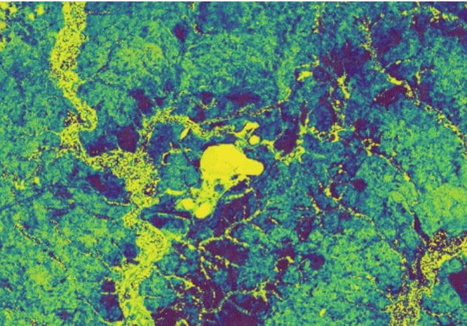
8. Spatial statistics
A. Cluster analysis: Identifying spatial patterns and hotspots
B. Point pattern analysis: Assessing the spatial distribution of points
C. Spatial interpolation techniques for estimating values at unmeasured locations
D. Geostatistics: Kriging and variogram analysis
E. Spatial join and aggregation techniques
F. Network analysis and spatial statistics
G. Space-time analysis: Examining temporal patterns and trends
H. Spatial statistics for environmental monitoring and analysis
I. Health and disease mapping using spatial statistics
J. Visualization of spatial statistical results
9. Geostatistical interpolation
A. Selection of appropriate geostatistical interpolation methods (e.g., kriging, co-kriging)
B. Variogram analysis: modeling spatial autocorrelation
C. Variogram modeling and fitting in ArcGIS Pro
D. Interpolating point data using ordinary kriging
E. Co-kriging: incorporating secondary variables for improved interpolation accuracy
F. Universal kriging: incorporating drift and trend in interpolation
10. Geoinfotech Online Test
A. Exam and Assessment
11. Award Of Certificate
A. Certificate
Share this course

Weekend Class Training
The flexible weekend class allows working professionals and students to upskill efficiently while gaining immediately applicable knowledge for careers in surveying, agriculture, real estate, construction, environmental management, and related fields. [ninja_form...

Drone Pilot for Beginners
Professional 3 Weekends ▪ Field Experience 5.0 (100% Practical) ▪ Exam & Certificate


Professional 6-7 Weekends ▪ Field Experience 5.0 (100% Practical) ▪ Exam & Certificate
The course AutoCAD for Land Surveying provides participants with practical skills for applying AutoCAD in survey analysis and plotting. Learners will gain hands-on experience in setting up and using AutoCAD software for survey data analysis, precise plotting, accurate...

Professional Drone Training Exam
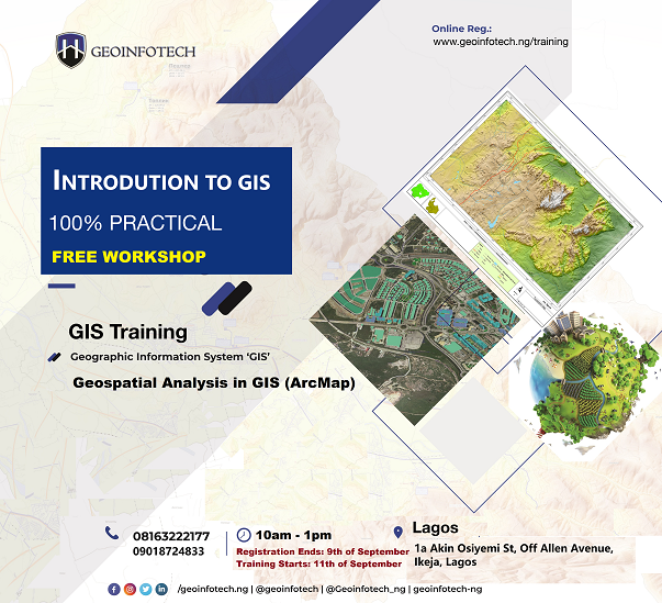
2021 Workshop: Geospatial Analysis in GIS (ArcMap) for Fire Services in Lagos
2021 Workshop on Geospatial Analysis in GIS (ArcMap) for Fire Services in Lagos This analysis helps us on why, where and how many fire services needed to be deployed in Lagos Nigeria. Multicriterial Analysis AHP | Suitability Analysis in GIS Click Here to...

UAV Drone Foundation Exam
Take the drone skills to new heights and train with the Experts at Geoinfotech. Advance your career in Drone Surveying, Photography, 3D Mapping. The next-gen digital learning solution In your own time, learn at your own pace–without taking any time off work....
![[Beginners to Advanced] Geographic Information System (ArcGIS Desktop and ArcGIS Pro)](https://geoinfotech.ng/wp-content/uploads/2020/07/GIS-Online-Training-Geoinfotech-1-1080x675.jpeg)
[Beginners to Advanced] Geographic Information System (ArcGIS Desktop and ArcGIS Pro)
Do you want to learn GIS as a professional with a proper guide online and procedures on executing GIS Projects/Tasks? This introductory course is for you. We have Introduced a step-by-step template, software installation, free data and manual to help you learn and...
![[Beginners to Advanced] AutoCAD for Land Surveying](https://geoinfotech.ng/wp-content/uploads/2025/08/WhatsApp-Image-2025-08-19-at-09.22.28_2dc55c5c-1080x675.jpg)
[Beginners to Advanced] AutoCAD for Land Surveying
The course AutoCAD for Land Surveying provides participants with practical skills for applying AutoCAD in survey analysis and plotting. Learners will gain hands-on experience in setting up and using AutoCAD software for survey data analysis, precise plotting, accurate...
Professional Drone Training Exam
2021 Workshop: Geospatial Analysis in GIS (ArcMap) for Fire Services in Lagos
2021 Workshop on Geospatial Analysis in GIS (ArcMap) for Fire Services in Lagos This analysis helps us on why, where and how many fire services needed to be deployed in Lagos Nigeria. Multicriterial Analysis AHP | Suitability Analysis in GIS Click Here to...
UAV Drone Foundation Exam
Take the drone skills to new heights and train with the Experts at Geoinfotech. Advance your career in Drone Surveying, Photography, 3D Mapping. The next-gen digital learning solution In your own time, learn at your own pace–without taking any time off work....
[Beginners to Advanced] Geographic Information System (ArcGIS Desktop and ArcGIS Pro)
Do you want to learn GIS as a professional with a proper guide online and procedures on executing GIS Projects/Tasks? This introductory course is for you. We have Introduced a step-by-step template, software installation, free data and manual to help you learn and...