
Mission Planning
Data Acquisition
Area Mapping and Inspection
Data Analysis
HIGH PRECISION DRONE IMAGES
Drone Mapping, Inspection, Creating 3D models from 2D aerial photos. Drone-based aerial photograph to smart design of competitive modeling
Drone Company Leader in Nigeria
Image Processing
We gather data with distinctive properties, so large and complex. Often deliver multi-source / multi-temporal / multi-scale information designed to take your industrial projects to the next level. Whether it’s object classification, site inspections, mapping solutions and more Drone Company Leader in Nigeria
Mapping & Aerial Surveying
Collect, measure and analyze data with accuracy across projects
Inspection - Infrastructure
Easily perform detailed inspections on complex assets and structures
Training
Train with the Experts at Geoinfotech. Advance your career in Drone Surveying, Photography, 3D Mapping
Agriculture
Get an in-depth understanding of your field to help you generate greater yields enhancing management decisions and production year-round
Construction
Collect, measure and analyze data with accuracy across projects
Our Portfolio
Check out our previous projects on GIS, Drone, Land Surveyor and Mapping Services in Nigeria


Mapping 2D & 3D Models
Real-time Mapping
Quickly generate a 2D orthomosaic of the selected area in real-time. Not only do we create detailed flight paths in remote areas but we also do time-sensitive missions that require quick decision-making on site. Drone Company Leader in Nigeria
2D Reconstruction
We Generate high resolution orthomosaics in Nigeria, enabling you to get detailed and accurate measurement results for all your critical projects. Drone Company Leader in Nigeria

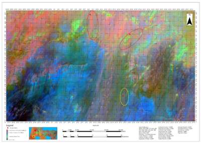
2D and 3D Multispectral Reconstruction
We Process multispectral images to generate vegetation index maps including NDVI and NDRE. Create prescription maps for variable rate application using DJI’s Agras drones to improve crop yields while driving down costs.
*Aircraft supported: P4 Multispectral
Multispectral Imaging Bands supported:
Blue (B): 450 nm ± 16 nm, green (G): 560 nm ± 16 nm, red (R): 650 nm ± 16 nm,
red edge (RE): 730 nm ± 16 nm, near-infrared (NIR): 840 nm ± 26 nm
Vegetation indices supported: NDVI, GNDVI, NDRE, LCI, OSAVI.
Data Analysis
")
2D & 3D Measurements
Acquire key dimensions across an array of terrains with analysis tools that enable you to obtain a variety of measurement data based on linear, area and volumetric measurements.
Photo Inspection
Closely inspect every photo of the model so you can pinpoint and highlight any critical elements in the real world. Drone Company Leader in Nigeria

Geoinfotech: Easement Regulatory Surveys | Protect Your Project
Geoinfotech: High-Speed 3D Laser Scanning & Point Cloud Data
Geoinfotech: Precise Ground Control for Projects
Land Survey Record Copy Plan (RCP) Plotting & Submission
Avoid Capital Cost – Rent Latest GNSS & Survey Drones
Hydrographic Survey Services At Geoinfotech
Route Surveying & Road Survey Services At Geoinfotech
Engineering and Construction Survey Services by GeoInfotech
Topographic Survey Services in Nigeria by GeoInfotech
Cadastral Survey Services in Nigeria by GeoInfotech
REQUEST A QUOTE
The Beginning of Next Generation Mapping Solutions
We are a full time mapping and Inspection solution company in Nigeria