What is GIS in agriculture, and why does it matter?
Faces of GIS in Sustainable Agriculture Imagine having a detailed map of your farm that shows you exactly where to plant, water, and fertilize for maximum yields. That’s what Geographic Information Systems (GIS) can do! Geographic Information Systems (GIS) is a powerful tool that helps farmers, researchers, and policymakers make informed decisions about agricultural practices. GIS combines spatial data (maps) with relational data (attributes) to provide insights into crop yields, soil health, water usage, and more.
How can GIS support sustainable agriculture?
By helping farmers make data-driven decisions, reduce waste, and adopt eco-friendly practices. Sustainable agriculture relies on the effective use of resources, and Geographic Information Systems (GIS) play a vital role in optimizing resource management. By leveraging GIS, farmers can monitor and manage land, water, and other resources more efficiently, track changes over time, and make data-driven decisions to adapt their practices. This approach ensures the long-term health and productivity of their farms, supporting a more sustainable future
Applications of GIS in sustainable agriculture practices:
GIS supports sustainable agriculture by:
- Crop monitoring and yield prediction: GIS helps farmers track crop health, growth, and yields, enabling data-driven decisions about irrigation, fertilization, and pest management.
- Soil mapping and nutrient management: GIS creates detailed soil maps, identifying areas with nutrient deficiencies or excesses, allowing for targeted fertilization and reduced waste.
- Irrigation management and water conservation: GIS optimizes irrigation systems, reducing water waste and ensuring crops receive adequate moisture.
- Farm planning and management: GIS helps farmers design and manage their farms, optimizing land use, crop selection, and resource allocation.
- Crop monitoring and yield prediction: Get real-time insights into your crops’ health and growth and predict yields with accuracy.
- Soil mapping and nutrient management: Create detailed soil maps to optimize fertilization and reduce waste.
- Irrigation management and water conservation: Make every drop count with precision irrigation planning.
- Farm planning and management: Design and manage your farm with precision, optimizing land use and resource allocation.
GIS Technologies for Sustainable Agriculture
- GIS software: Popular tools like ArcGIS, QGIS, and GRASS help farmers and researchers analyze and visualize agricultural data.
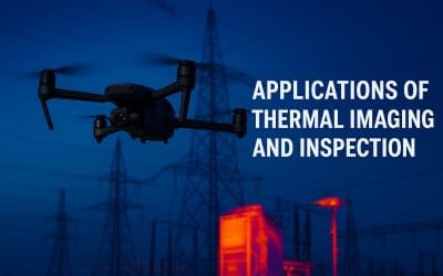
- Remote sensing technologies: Satellites and drones provide a bird’s-eye view of your farm, tracking crop health, soil moisture, and weather patterns.
- GPS and precision agriculture tools: Guide your farm equipment with precision, reducing fuel consumption and improving crop management.
Data Collecting and Analyzing for Sustainable Agriculture
GIS integrates data from satellites, soil sensors, weather stations, and farm equipment.
GIS Analysts use spatial analysis, statistical modeling, and data visualization to extract valuable insights.

Overcoming Challenges in Implementing GIS in Sustainable Agriculture
High costs, data quality issues, and limited technical expertise can slow down GIS adoption. They can be overcame through Collaboration, training programs, and cost-sharing Models.
Expert Guidance for Implementing GIS in Sustainable Agriculture
- Consulting services: Companies offer customized GIS solutions, training, and support for agricultural businesses.
- Customized GIS solutions: Experts develop tailored solutions addressing specific farm or organizational needs.
Getting Started with GIS in Sustainable Agriculture
- Educational resources: Online courses, workshops, and degree programs teach GIS skills and applications in agriculture.
- Certifications and professional development: Certifications like the Certified GIS Professional (CGP) demonstrate expertise and commitment to GIS in agriculture.
Expertise and Services in GIS for Sustainable Agriculture
- Consulting services for implementing GIS in agriculture: Companies offer customized GIS solutions, training, and support for agricultural businesses.
- Customized GIS solutions for agricultural businesses: GIS experts develop tailored solutions addressing specific farm or organizational needs.
How to Get Started with GIS in Sustainable Agriculture
- Educational resources and training programs: Online courses, workshops, and degree programs teach GIS skills and applications in agriculture.
- Certifications and professional development opportunities: Certifications like the Certified GIS Professional (CGP) demonstrate expertise and commitment to GIS in agriculture.
Geoinfotech Resources Limited: Expertise and Services
Are you looking to enhance your skills and knowledge in aerial surveying and mapping?
At GEOINFOTECH RESOURCES LIMITED, we provide
Expertise:
- Remote sensing
- GIS
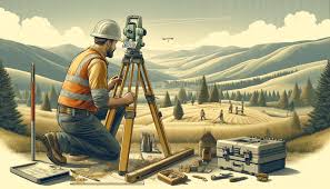
- Surveying
- Mapping
- Spatial data analysis
Geoinfotech services enhance the use of Geographic Information Systems (GIS) in agriculture by providing:
- Precise crop management through soil type and moisture analysis
- Yield prediction using satellite and drone imagery
- Detailed soil mapping for informed fertilizer application
- Optimized irrigation by identifying water-stressed areas
- Early detection of pests and diseases through satellite imaging
- Efficient farm planning through spatial analysis
- Climate change resilience through climate data analysis
- Streamlined logistics by identifying optimal transportation routes
These services help farmers and agricultural organizations increase productivity, efficiency, and sustainability, contributing to global food security.
Getting Started:
- Training programs and workshops on remote sensing designed to help you succeed in this exciting and rapidly evolving field.
- Professional certifications in remote sensing.
- Workshops, conferences, and projects.
Contact us today at https://geoinfotech.ng/contact-geoinfotech-technology-contact-us/ and take your career or business to new heights!


