DRONE TOPOGRAPHIC SURVEY: HOW GEOINFOTECH SUPPORTED LAND DEVELOPMENT PLANNING IN IGABI, KADUNA STATE
Geoinfotech conducted a high-precision Drone Topographic Survey for City International Dimensions Construction Limited (CIDCL) in Igabi Local Government Area, Kaduna State, Nigeria, to support land development planning, environmental management, and infrastructure design. The project, executed in March 2026, involved UAV aerial surveying, GNSS data acquisition, terrain analysis, and the generation of accurate geospatial datasets for sustainable development and engineering planning.
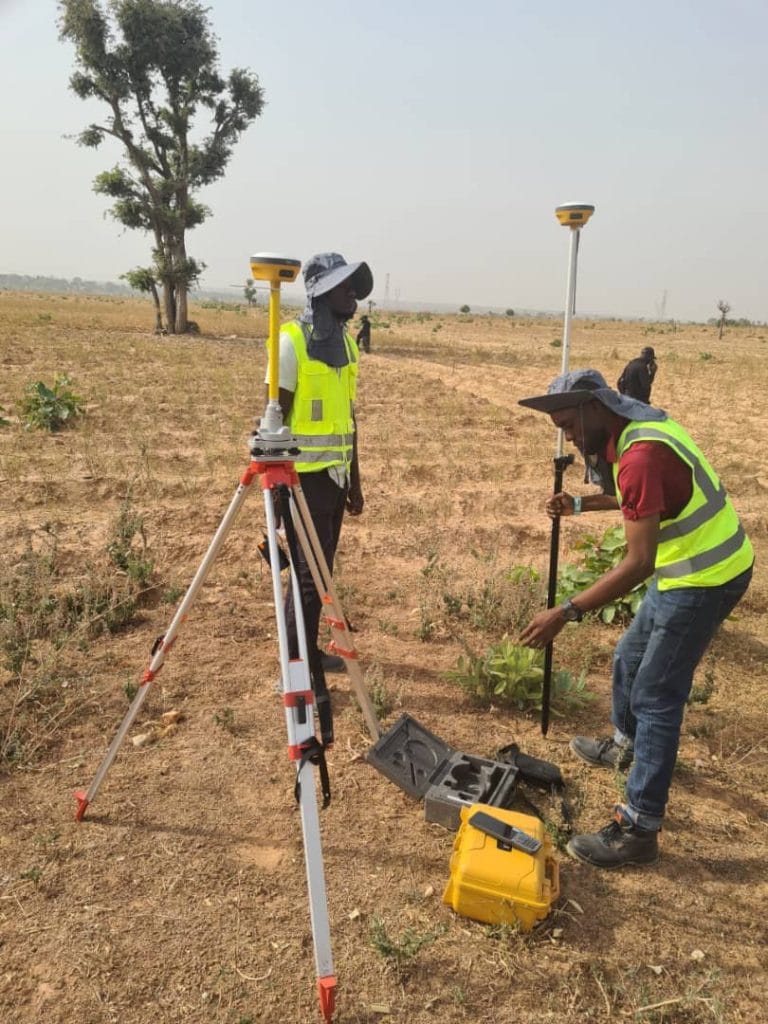
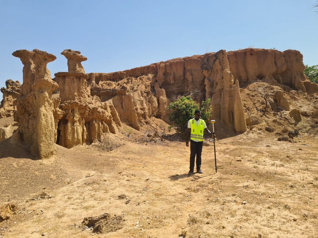
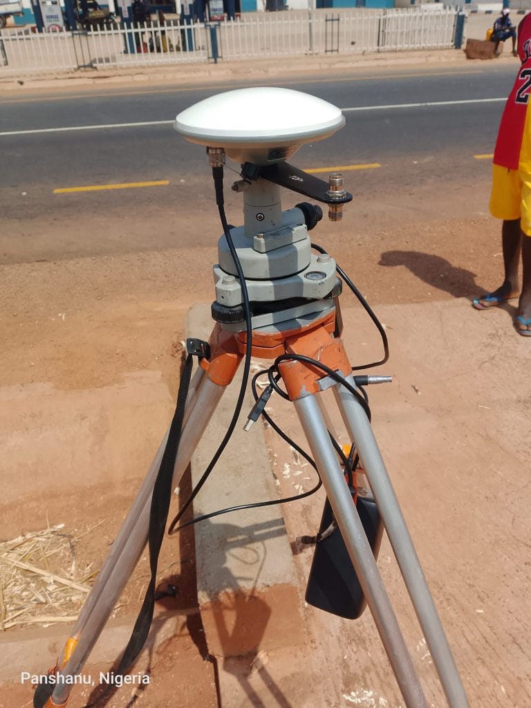
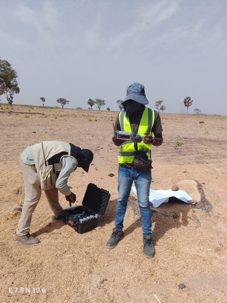
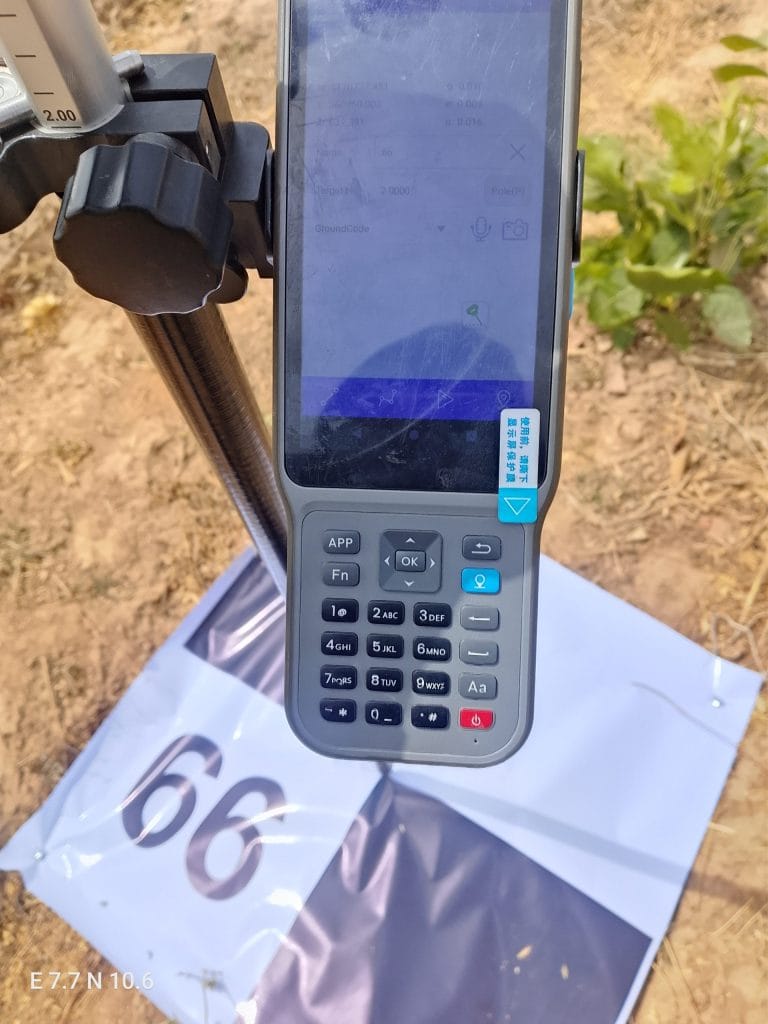
The survey commenced with a reconnaissance assessment and project planning exercise to establish survey controls and evaluate terrain conditions within the study area. Using DJI Phantom 4 Pro drone technology, Hi-Target V200 GNSS receivers, and RTK surveying methodologies, high-resolution aerial imagery and accurate coordinate datasets were acquired across the surveyed land to ensure precise terrain representation and spatial analysis.
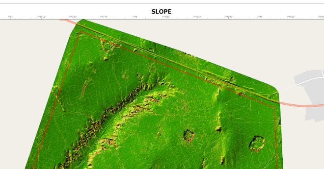
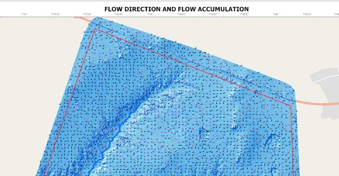
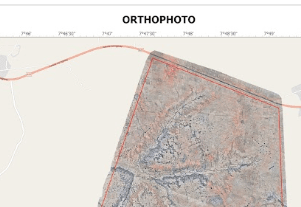
The acquired datasets were processed using advanced photogrammetric and GIS software to generate orthophotos, Digital Elevation Models (DEM), contour maps, slope analysis maps, flow direction models, flow accumulation datasets, and comprehensive topographic maps. These outputs provided detailed insights into elevation variability, drainage behaviour, hydrological characteristics, and terrain suitability necessary for land administration, engineering design, and urban development planning.
Field operations included drone deployment, GNSS control establishment, aerial data acquisition, and site validation, while office-based activities focused on terrain interpretation, hydrological analysis, cartographic production, data processing, and quality assurance. Deliverables included orthophotos, contour datasets, digital elevation models, drainage analysis maps, topographic maps, and comprehensive technical reports to support planning and infrastructure development.
By integrating drone surveying and modern geospatial methodologies, the project significantly improved the speed, precision, and reliability of terrain mapping compared to conventional survey techniques, reducing operational uncertainties and supporting informed decision-making for sustainable land management and engineering development.
This project has enabled City International Dimensions Construction Limited (CIDCL) to better understand the topographic and environmental characteristics of the surveyed land, supporting improved infrastructure planning, flood risk assessment, drainage management, and phased development implementation. Geoinfotech continues to provide innovative geospatial solutions that improve operational efficiency, environmental sustainability, and data-driven planning across major development projects.
For future development assessments, regular drone-based terrain monitoring and geospatial analysis are recommended to maintain updated spatial information, support infrastructure maintenance, improve environmental management, and ensure sustainable land development practices across the project area.
Looking Forward: Advancing Sustainable Development Through Geospatial Innovation
The successful implementation of UAV-based topographic surveying in Igabi demonstrates how advanced geospatial technologies are transforming modern land development, infrastructure planning, and environmental management. As urban expansion and development demands continue to increase, accurate spatial intelligence and terrain analysis are becoming essential tools for sustainable planning, engineering efficiency, and long-term project success.
Geoinfotech remains committed to delivering cutting-edge surveying and mapping solutions that empower developers, engineers, and organizations to make informed decisions with confidence. Through the integration of drone technology, GIS analysis, hydrological modelling, and precision surveying, businesses can improve planning accuracy, reduce operational risks, optimize resource utilization, and transform geospatial intelligence into a strategic advantage for sustainable growth and infrastructure development.