BOUNDARY SURVEY AND ENCROACHMENT ANALYSIS: HOW EGBIN POWER PLANT IMPROVED LAND MANAGEMENT THROUGH GEOSPATIAL TECHNOLOGY
Geoinfotech conducted a comprehensive Boundary Survey and Encroachment Analysis for Egbin Power Plant, Ikorodu, Lagos State, to support land administration, infrastructure protection, and environmental management. The project, executed in April 2026, involved UAV aerial surveying, GIS analysis, terrain modelling, and detailed land-use assessment for improved operational planning and boundary monitoring.
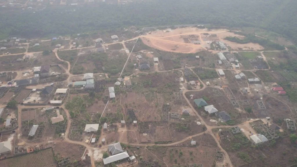
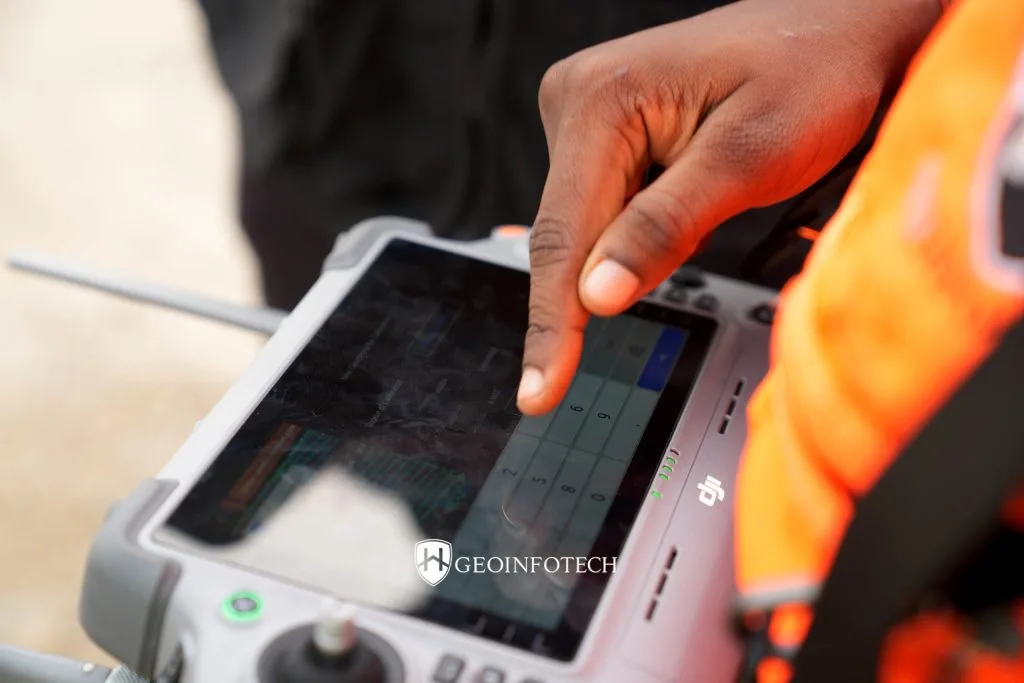
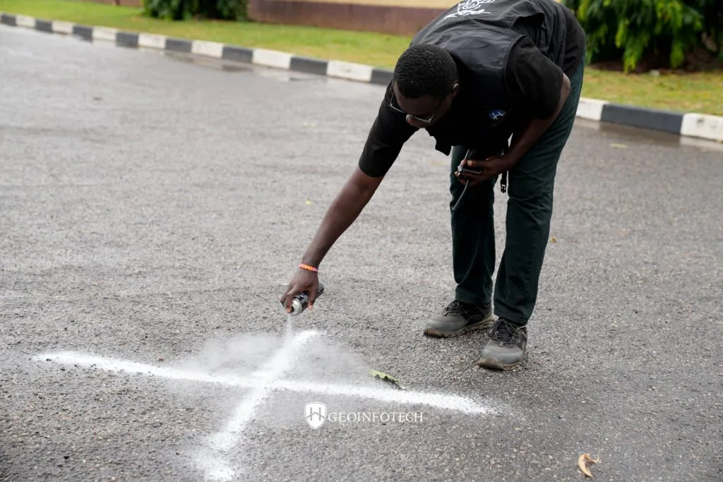
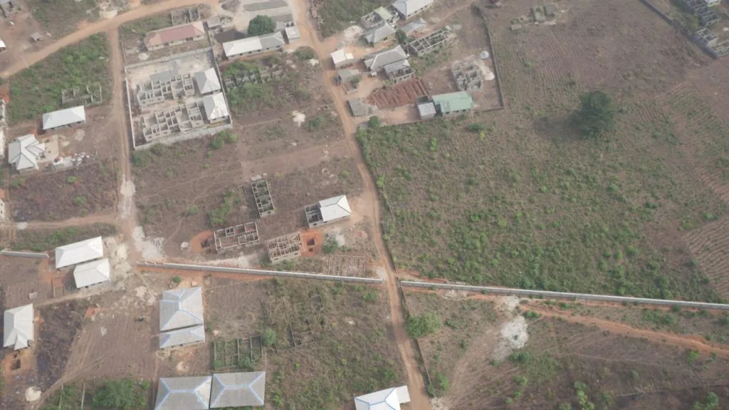
The survey began with reconnaissance activities and boundary verification to identify key control points and assess existing perimeter conditions. Using RTK-enabled drones, GNSS receivers, and GIS technology, high-resolution aerial imagery and accurate coordinate datasets were acquired across the entire power plant facility and adjoining land parcels.
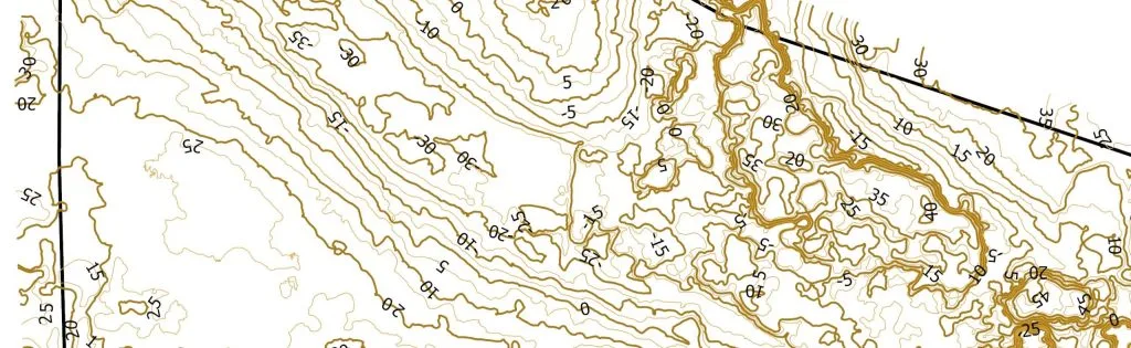
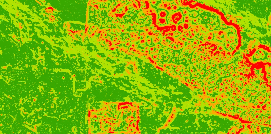
The team processed the acquired imagery using advanced photogrammetric and geospatial software to generate orthophotos, Digital Elevation Models (DEM), land-use maps, swamp delineation models, and encroachment analysis datasets. These outputs enabled accurate identification of boundary deviations, encroached structures, wetland zones, and unutilized land areas within the surveyed environment.
Field operations included drone deployment, beacon identification, perimeter verification, and site validation, while office-based activities focused on spatial analysis, terrain interpretation, hydrological assessment, GIS feature extraction, and quality assurance. Deliverables included orthophotos, encroachment maps, land-use classification datasets, elevation models, swamp analysis maps, and comprehensive technical documentation.
By integrating drone surveying and GIS technologies, the project significantly improved the speed, precision, and reliability of boundary mapping and encroachment assessment compared to conventional methods, supporting informed decision-making and reducing uncertainties associated with land management and infrastructure protection.
This project has enabled Egbin Power Plant to better understand current land-use conditions, monitor encroachment growth, evaluate environmental constraints, and improve strategic planning for facility expansion and asset protection. Geoinfotech continues to provide innovative geospatial solutions that support infrastructure sustainability, environmental monitoring, and operational efficiency.
For future land administration activities, regular drone-based boundary monitoring and GIS-driven encroachment assessments are recommended to maintain accurate spatial records, strengthen perimeter security, and support sustainable land management practices.
Looking Forward: Enhancing Infrastructure Protection Through Geospatial Intelligence
The successful implementation of drone-based boundary surveying and GIS analysis at Egbin Power Plant demonstrates the growing importance of geospatial technology in infrastructure management and environmental planning. As urban development and land pressure continue to increase, the demand for accurate spatial intelligence becomes essential for protecting critical national infrastructure and supporting long-term operational sustainability.
Geoinfotech remains committed to delivering advanced surveying and mapping solutions that empower organizations to make informed decisions with greater confidence. Through the integration of UAV technology, GIS analysis, and precision surveying methodologies, businesses and institutions can improve land administration, reduce operational risks, optimize asset management, and transform geospatial data into a strategic advantage for sustainable development.