

What is Drone Mapping and Survey & how is it used in Nigeria?
Drone mapping involves using a drone equipped with a high-resolution camera to capture hundreds of overlapping photos from the air. These images are stitched together using specialized software to produce a clear, accurate map.
Unlike simply flying a drone and taking a few snapshots, drone mapping captures every visible surface feature in a way that ensures the final map matches real-world measurements. This allows surveyors to measure distances, calculate areas, and even generate 3D models of the site.
In Nigeria, aerial surveying has become faster and safer thanks to drones. Instead of trekking across large plots of land or hiring manned aircraft, companies can now send a drone over an area to collect all the necessary surveying data in a single flight.
How One Drone Flight Can Get the Job Done
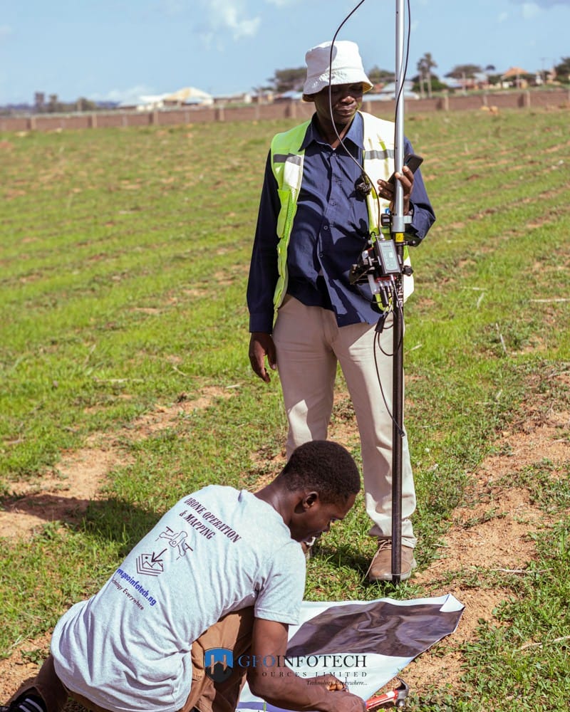
The process starts before the drone even takes off.
The pilot uses mapping software to plan the flight, setting the route, altitude, and speed, as well as when the camera should take each photo. The software also ensures that every image overlaps with the next, eliminating gaps in the final stitched map.
Once the plan is ready, the drone autonomously follows the set route, capturing hundreds of overlapping photos along with precise GPS data. This data ensures the final map is both accurate and correctly aligned to the Earth’s surface.
In many cases, one well-planned flight is enough to map an entire project site. This is why construction mapping projects can now gather in one hour the data that once required a team several days to collect.
Turning Drone Flight Data into an Orthomosaic Map
When the drone lands, the real transformation begins.
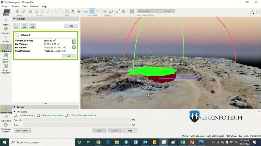
The captured images and GPS data are processed in mapping software. The software stitches the overlapping images into a seamless picture, then corrects any distortions caused by camera angles or terrain height differences, a process called orthorectification.
The result is an orthomosaic drone map: a large, high-resolution image of the site. Users can zoom in to inspect details, measure distances, and calculate surface areas—without setting foot on the site.
For project site mapping in Nigeria, this is a massive time-saver. The maps can also be shared instantly with stakeholders anywhere in the world.
Why Drone Mapping is a Game-Changer in Nigeria
Traditionally, aerial survey projects in Nigeria required teams of ground surveyors with tripods and measuring tools, or the hiring of manned aircraft to capture aerial images, both costly and time-consuming.
Now, drones can complete the same job faster, at lower cost, and with greater safety. Large sites can be mapped in hours instead of days, fewer people are needed on-site, and workers are kept out of dangerous or hard-to-reach areas.
In construction mapping, regular drone flights help project managers track progress, spot errors early, and compare the current site against design plans, reducing delays, saving money, and keeping projects on schedule.
Real-World Uses for Drone Mapping
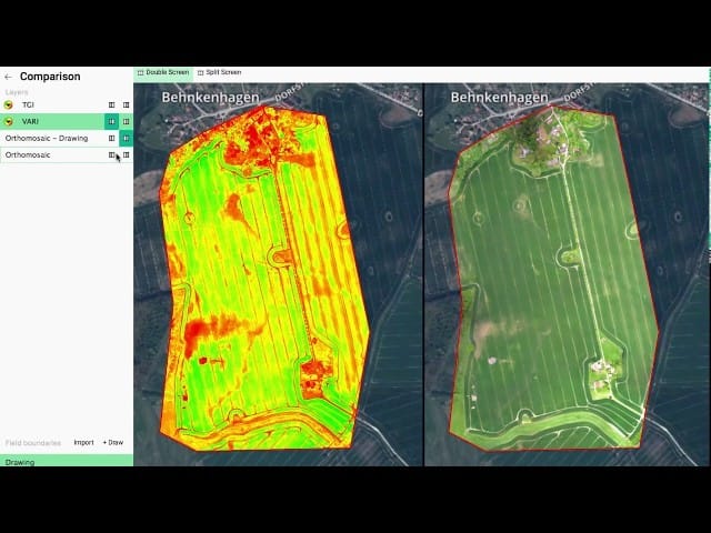
Drone mapping is now vital in multiple industries across Nigeria and worldwide. Farmers use it to monitor crop health, plan irrigation, and predict harvests. Urban planners rely on it to design road layouts, drainage systems, and housing estates. Mining companies use orthomosaic maps to measure stockpiles, track excavation progress, and improve safety.
Environmental agencies use drones to monitor erosion, flooding, and forest changes over time. Regular aerial surveys make it possible to track developments quickly and accurately.
All of these results can come from a single, well-planned drone flight.
The Future of Project Site Mapping in Nigeria
Drone technology is advancing rapidly. Newer models can fly longer, cover more ground, and capture higher-quality images. Soon, orthomosaic maps may update in real-time as drones fly.
Artificial intelligence is also being integrated into mapping software, enabling automatic detection of issues such as construction defects, crop diseases, and safety hazards. Combining drones with Geographic Information Systems (GIS) and Building Information Modelling (BIM) will make project planning and monitoring even more efficient.
For aerial surveying in Nigeria, this means faster results, higher accuracy, and smarter decision-making.
Geoinfotech Resources Limited is capable of delivering all these services. As one of Nigeria’s leading drone dealers and mapping service providers, Geoinfotech is always within your reach.


