
A Summary of the Flooding Incident at Mokwa
On May 29, 2024, a devastating flash flood struck Mokwa town in Niger State, destroying 381 buildings and displacing many residents. The flood began around 6:00 AM, sending water as high as 4 meters rushing through the community.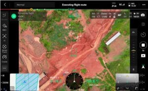
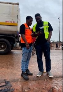
Geoinfotech utilized drones and computer mapping to investigate what caused the disaster. They discovered that heavy rains for two days had caused water to build up behind a railway track and a local irrigation dam. When these barriers couldn’t hold any more water, they burst, sending torrents flooding into the town below.
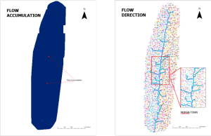
The flood was particularly bad because Mokwa is situated in a valley where water naturally collects, and the clay soil doesn’t absorb water well. Many homes had been built along old water pathways without people realizing it, and there was no proper drainage system to handle excess water.
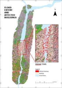
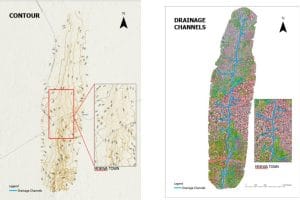
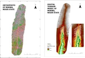
Using high-resolution orthophotos from Matrice 4T and Digital elevation model, satellite images from UNOSAT and Google Earth, the team mapped exactly how the water flowed and where it caused damage. The analysis and flood simulation performed by the team showed that the flood source elevation ranged between 170-179 meters, and the affected areas are situated at 154 – 159 meters. Making them vulnerable to the water flow from the higher terrain. The town’s clay-loamy soil further exacerbated runoff, limiting water infiltration. They also interviewed local residents to understand what happened from the community’s perspective, which was the locals reported how water accumulated at the railway base north of the town, inundating homes in minutes, which caused the loss of lives and properties. From the high-resolution orthophoto the team was able to determine the number of buildings affected, which was 381.
To prevent future disasters, experts recommend building proper drainage from the dam to the River Niger, better town planning to avoid building in flood-prone areas, and installing early warning systems to alert residents of potential floods.
This investigation shows how Nigerian technology can help solve local problems and serves as a model for other communities facing similar challenges. The Mokwa flood wasn’t just bad weather – it was a combination of heavy rains, poor infrastructure, and homes built in the wrong places. With proper planning and technology, similar disasters can be prevented.


