1.1 Introduction
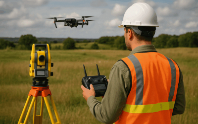
Synthetic Aperture Radar (SAR) is a type of c by simulating a large antenna (synthetic aperture) using the motion of the radar platform (e.g., aircraft or satellite). This motion allows the radar to collect data from multiple positions and combines them computationally to form a detailed image. Figure 1 illustrates the SAR imaging and its characteristics.

Figure 1: Synthetic Aperture Radar (SAR)
1.2 Components of SAR System
The SAR is composed of different system which includes:
- Radar Antenna: Emits and receives microwave signals.
- Transmitter/Receiver: Generates radar pulses and processes return signals.
- Platform: Can be airborne (drone, aircraft) or spaceborne (satellite).
- Processor: Uses algorithms to synthesize the aperture and generate radar images.
1.3 Synthetic Aperture Radar (SAR) Imaging Process
There are certain processes of SAR imaging and these involves the underlined procedures:
- Transmission of Microwave Pulses: Radar sends short bursts of radio waves to the Earth’s surface.
- Backscatter Reception: Objects reflect part of the signal back to the radar sensor.
- Data Recording: The radar records the strength (amplitude) and phase of the returned signal.
- Image Formation: Synthetic Aperture Radar processing combines echoes over time to create high-resolution 2D or 3D images.
1.4 Features of SAR Imaging
SAR has important features which include:
- All-Weather Capability: Operates effectively under cloud cover, rain, and at night.
- High Spatial Resolution: Provides detailed surface images, even from spaceborne platforms.
- Interferometric Capability (InSAR): Detects minute ground movements (e.g., due to earthquakes or subsidence).
- Polarimetric Data (PolSAR): Analyzes polarization properties of backscattered waves for material and structure identification.
1.5 Applications of SAR
The areas of applications of SARS are:
- Geology and Geomorphology: Mapping landforms, fault lines, and volcanic activities.
- Forestry and Agriculture: Estimating biomass, soil moisture, and crop monitoring.
- Hydrology: Monitoring floods, river dynamics, and water surface changes.
- Urban Mapping: Infrastructure monitoring and deformation detection.
- Disaster Management: Assessing damage after floods, earthquakes, or landslides.
- Oceanography: Observing sea ice, oil spills, and wave patterns.
- Military and Surveillance: Terrain mapping and target detection.
1.6 Advantages of SAR
The synthetic aperture radar (SAR) has advantages over
- Independent of weather and lighting conditions. Synthetic aperture radar has all-weather capability
- High-resolution imaging over wide areas. The synthetic aperture radar has high spatial resolution (independent of altitude)
- Useful for continuous monitoring and change detection.
- Sensitive to both surface roughness and moisture variations.
- Night imaging
- Terrain mapping capability
SAR platforms include Airborne SAR (mounted on aircraft) and Spaceborne SAR (mounted on satellites, e.g., Sentinel-1, RADARSAT)
1.7 Limitations
- Complex Data Processing: Requires advanced algorithms and computing power.
- Speckle Noise: Inherent grainy appearance in SAR images due to coherent radiation.
- Interpretation Challenges: Needs expert knowledge to analyze radar backscatter.
1.8 Conclusion
Radar Imaging using Synthetic Aperture Radar (SAR) is one of the most powerful tools in modern remote sensing. Its ability to capture detailed and accurate Earth surface information—regardless of environmental conditions—makes it indispensable for environmental monitoring, disaster management, resource assessment, and defense applications. With the advancement of satellite missions like Sentinel-1, RADARSAT, and TerraSAR-X, SAR continues to revolutionize Earth observation and geospatial analysis.