Document

GIS software used by professionals

GIS software are computer-based tools designed to capture, store, retrieve, manage, display and analyze all types of geographic and spatial data. This software lets users produce maps and other graphic displays of graphical information for analysis and presentation. GIS is more than just software. People and methods are combined with geospatial software and tools, to enable spatial analysis, manage large datasets and display information in maps/graphical forms.

Varieties of GIS software can be categories as commercial software, free(open) software, or open-source software. While on the other hand come in different formats such as desktop, online/cloud and mobile. Here is the top software used for geospatial mapping and analysis by GIS professionals around the globe.


  1. ESRI ArcGIS product

Environmental Systems Research Institute has been creating GIS software for over 30 years. Recognized as the leader in GIS software, it’s been estimated that about seventy percent of GIS users use Esri products. Esri overhauled its software packages into an interoperable model called ArcGIS (the desktop GIS is referred to as ArcMap).  In addition, Esri has developed plug-ins called extensions which add to the functionality of ArcGIS.

ArcGIS Pro is also an ESRI product widely used by many as it modernizes GIS with a ribbon interface, 64-bit processing and 3D integration. It’s a massive overhaul with a focus on quickness, ingenuity and cartography. Even though ArcGIS Pro is a big machine with lots of moving parts, it earns top spot.

ArcGIS Online is a complete mapping and analysis solution. It can be used on its own or expand your work using other ArcGIS products. The work you do can be shared and integrated across ArcGIS. ArcGis online composes Developer tools, field operations, and advanced workflows


  1. QGIS or Quantum

GIS is an open-source GIS software used for analysing and editing geospatial data. This open-source platform composes/exports graphical maps and depends on raster/vector layers. Users can use QGIS for supporting shapefiles, coverage, personal geodatabases and MapInfo. QGIS plugins still give you the power to analyze like the Incredible Hulk. Some of the major features in Qgis is DB Manager, Map Composer, Spatial bookmarks, Annotation tools, QGIS browser, On the fly reprojection, OpenStreet Map data


  1. Google map pro

Google Earth Pro is a 3D interactive globe that can be used to aid planning, analysis and decision making. Google Earth is the user-friendly GIS software and it allows users to quickly and easily view high-quality satellite imagery from around the world and make simple polygon or polyline layers. This platform also has the historical imagery tool which is extremely useful for geographic research.


  1. Global mapper

Global Mapper is an affordable and easy-to-use GIS application that offers access to an unparalleled variety of spatial datasets and provides just the right level of functionality to satisfy both experienced GIS professionals and beginning users


  1. GRASS

GRASS or Geographic Resources Analysis Support open source GIS software is a free open software used for geospatial data analysis and management. Graphics, image processing and maps production are other core features of the platform. It is powered by a 3D-raster. Major Features of GRASS GIS are temporal framework, erosion modeling, watershed analysis, point data analysis, solution transport, map creation.


  1. SAGA

SAGA or System for Automated Geoscientific Analyses is meant primarily for geodata analysis and processing. This open-source GIS software has a robust API, programmed within the system designed and object-oriented C++ language. It is specifically used for georeferencing and cartographic projections. Features of SAGA are intuitive data management and visualization, arid interpolation of scattered point data, image analysis, portable, scripting through the command line, modular structure, geodata handling, etc


  1. Whitebox GAT

Whitebox Geospatial Analysis Tools is an open-source and cross-platform Geographic information system and remote sensing software package that is distributed under the GNU General Public License. Whitebox GAT is intended to provide a platform for advanced geospatial data analysis with applications in both environmental research and the geomatics industry more broadly. It was envisioned from the outset as providing an ideal platform for experimenting with novel geospatial analysis methods


  1. Mapinfo professional

MapInfo Professional is its leading GIS product containing the most advanced analytical tools. MapInfo also offers plug-ins called add-ons to enhance the functionality of MapInfo Professional. For the development side, MapInfo offers Map-X. Through an Active X component, developers can embed mapping applications into other applications such as Excel. Although it can be used for a variety of analysis, the makers of MapInfo market the software more towards the business sector.


  1. Hexagon Geomedia

Hexagon Geospatial’s GeoMedia Professional is a geographic information system management solution for map generation and the analysis of geographic information with smart tools that capture and edit spatial data. GeoMedia is used for: creating geographic data; managing geospatial databases; joining business data, location intelligence and geographic data together; creating hard and soft-copy maps; conduct analysis in ‘real-time’; base platform for multiple applications, geographic data validation, publishing geospatial information and analyzing mapped information


  1. gvSIG Desktop

This is a powerful, user-friendly, interoperable GIS used by thousands of users worldwide. It is easy to work in a variety of formats with gvSIG Desktop, vector and raster files, databases and remote services. There are always available all kinds of tools to analyze and manage your geographic information. gvSIG Desktop is designed to be an easily extensible solution, allowing thus continually improving the software application and developing tailor-made solutions.


  1. AutoCAD map

AutoCAD Map 3D is a user-friendly GIS software used by businesses for GIS mapping. This intuitive system allows users to take topographical information from GIS and CAD data to create models for analysis. Map 3D is capable of taking hundreds of data points for a large geographic area and isolating the features you need automatically. Some of the top features of AutoCAD Map 3D include GIS analysis, 3D navigation, modeling tools, and the AutoCAD Ribbon.

AutoCAD Map 3D has a wide range of apps that can integrate into the software such as landscape, structural, analysis apps, and others to expand the features of the platform. AutoCAD Map 3D has a mobile app available for iOS, Android, and the web available so that you can take your work while on the go. AutoCAD Map 3D is a powerful GIS program and 3D mapping tool for managing and analyzing geospatial data.


  1. Maptitude

The Maptitude Mapping Software is a full-featured mapping package for Windows. Designed for ease-of-use, data visualization, and geographic analysis, Maptitude comes with comprehensive nationwide and worldwide maps, including complete US street maps, and Census tract and ZIP Code boundaries and demographics. Caliper also produces TransCAD for transportation and logistics. TransCAD is used for solving key analytical problems in transportation planning, management, and operations. TransCAD is used extensively for transportation database development and maintenance, demand forecasting, operations management, and vehicle routing and scheduling.


  1. RockWorks

RockWorks is a comprehensive 3D modeling program that offers visualization and modeling of spatial data and subsurface data. The app also offers GIS software capabilities designed to be workable for small and large businesses dealing with real science, and it achieves this by way of geology or topography while being intuitive and capable of more integrations. RockWorks is used in the petroleum, environmental, geotechnical, and mining industries for surface and subsurface data visualization. It employs popular tools such as maps, logs, cross-sections, fence diagrams, solid models, and volume calculations. The app offers numerous options for analyzing your surface and subsurface data and accepts many different data types, such as stratigraphy, lithology, downhole geochemistry/geophysics/geotechnical measurements, color intervals, fractures, and aquifer data.


  1. MapViewer

MapViewer is a pioneer in GIS software, bringing a lot of powerful new tools to businesses in making informed decisions, managing territories, and providing a whole new kind of CRM. Today, geospatial data is only growing with mobile phones and intelligent devices, which pretty unanimously have a global positioning system (GPS). Coordinating with advanced, interactive global map systems, GIS software is going to be the next big data type to capitalize on and evolve through integration in all industries.


RECENT ACTIVITIES AND PROJECT...

URABN HEAT ISLAND EFFECT IN CALABAR MUNICIPAL

URABN HEAT ISLAND EFFECT IN CALABAR MUNICIPAL

ANALYZING URBANIZATION TRENDS IN KANO STATE, NIGERIA USING NIGHTTIME LIGHTS REMOTE SENSING DATA

ANALYZING URBANIZATION TRENDS IN KANO STATE, NIGERIA USING NIGHTTIME LIGHTS REMOTE SENSING DATA

COMPREHENSIVE OFFSHORE SURVEILLANCE AND MARITIME INFRASTRUCTURE MONITORING

COMPREHENSIVE OFFSHORE SURVEILLANCE AND MARITIME INFRASTRUCTURE MONITORING

Comprehensive Aerial Survey and Mapping for Golf Course Asset Management at Lakowe Golf Lake

Comprehensive Aerial Survey and Mapping for Golf Course Asset Management at Lakowe Golf Lake

Professional Drone Training Program for Enhanced Corporate Security Operations at Sahara Group

Professional Drone Training Program for Enhanced Corporate Security Operations at Sahara Group

Advanced Aerial Topographic Survey and Mapping for Land Development in Ogun State

Advanced Aerial Topographic Survey and Mapping for Land Development in Ogun State

Precision RGB and Thermal Imaging Revolutionizes Solar Infrastructure Inspection In Enugu

Precision RGB and Thermal Imaging Revolutionizes Solar Infrastructure Inspection In Enugu

Advanced Drone-Based Topographic Survey for Precision Land Development Planning

Advanced Drone-Based Topographic Survey for Precision Land Development Planning

Mapping the Future: Comprehensive Area Survey Transforms Land Development in Akure

Mapping the Future: Comprehensive Area Survey Transforms Land Development in Akure

Precision Topographical Survey and Mapping for Smarter Infrastructure Planning

Precision Topographical Survey and Mapping for Smarter Infrastructure Planning

Precision Drone Volumetric Surveys: How Purechem Industries Optimized Mineral Stockpile Management

Precision Drone Volumetric Surveys: How Purechem Industries Optimized Mineral Stockpile Management

Advanced Mapping & Environmental Survey for Ilubirin Property, Lagos Island

Advanced Mapping & Environmental Survey for Ilubirin Property, Lagos Island

Unveiling the Invisible: LiDAR Technology Transforms Terrain Analysis in Abeokuta North

Unveiling the Invisible: LiDAR Technology Transforms Terrain Analysis in Abeokuta North

 DETAILED AERIAL, LAND SURVEY AND GIS ANALYSIS FOR ADVANCED REAL ESTATE DEVELOPMENT

 DETAILED AERIAL, LAND SURVEY AND GIS ANALYSIS FOR ADVANCED REAL ESTATE DEVELOPMENT

Professional Drone Mapping and GIS Training For ETA-ZUMA Mining Company

Professional Drone Mapping and GIS Training For ETA-ZUMA Mining Company

Installation of Intelligent Traffic Lights

Installation of Intelligent Traffic Lights

Geological Report on a Mining/Exploration Survey

Geological Report on a Mining/Exploration Survey

Drone Survey and Mapping of Shaishen Foods Limited

Drone Survey and Mapping of Shaishen Foods Limited

Lidar Topographic Mapping Project

Lidar Topographic Mapping Project

Geophysical/hydrogeophysical Studies for Groundwater Development

Geophysical/hydrogeophysical Studies for Groundwater Development

Togo Digital Terrain Model Project

Togo Digital Terrain Model Project

Drone Mapping of Parts of Lome Rail Line for Graceland Energy Located at Lome Togo

Drone Mapping of Parts of Lome Rail Line for Graceland Energy Located at Lome Togo

Drone/land Survey of Pure-chem Industrial Limited, Ogun State.
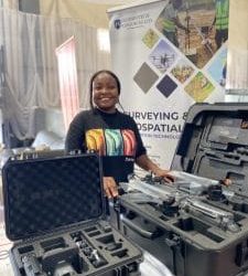
Drone/land Survey of Pure-chem Industrial Limited, Ogun State.

Drone Inspection/survey of Southern Lake Estate, Chevron, Lekki, Lagos State

Drone Inspection/survey of Southern Lake Estate, Chevron, Lekki, Lagos State

Anniversary-Workshop on the Application of Remote Sensing and Drone Technology in GIS -Abuja

Anniversary-Workshop on the Application of Remote Sensing and Drone Technology in GIS -Abuja

Topographic Mapping of Oyo State

Topographic Mapping of Oyo State

Topographic Mapping of Part of the Local Government Areas in Oyo State

Topographic Mapping of Part of the Local Government Areas in Oyo State

Topographic Mapping of Part of Kwara, Ekiti and Kogi State Local Government Area

Topographic Mapping of Part of Kwara, Ekiti and Kogi State Local Government Area

Political Map of South West, Nigeria Located in Nigeria

Political Map of South West, Nigeria Located in Nigeria

Topographic Mapping of Parts of Niger State Located at Niger State, Nigeria

Topographic Mapping of Parts of Niger State Located at Niger State, Nigeria

Topographic Mapping of Part of Kwara, Ekiti, and Kogi State Local Government Area Located in Nigeria

Topographic Mapping of Part of Kwara, Ekiti, and Kogi State Local Government Area Located in Nigeria

Topographic Mapping of Part of Kwara State Local Government Area Located at Kwara State Nigeria

Topographic Mapping of Part of Kwara State Local Government Area Located at Kwara State Nigeria

Flood Analysis of Amuwo-odofin Orthophoto.

Flood Analysis of Amuwo-odofin Orthophoto.

Site Inspection Using Drone of Water Corporation Located at Oke-aro Agege

Site Inspection Using Drone of Water Corporation Located at Oke-aro Agege

24,000 meter Lome Rail Line for Drone Mapping, Graceland Energy Located at Lome, Togo

24,000 meter Lome Rail Line for Drone Mapping, Graceland Energy Located at Lome, Togo

10 Drone Inspection Traffic Signal in Lagos

10 Drone Inspection Traffic Signal in Lagos

Lagos October 1st Free GIS Training Workshop

Lagos October 1st Free GIS Training Workshop

Osun state parcel project

Osun state parcel project

Drone Mapping & Vectorization Of Abu-allied Farm

Drone Mapping & Vectorization Of Abu-allied Farm

Proposal for aerial deployment, tracking and monitoring of threats in victoria island phase 1 and ikoyi phase 2, nigeria

Proposal for aerial deployment, tracking and monitoring of threats in victoria island phase 1 and ikoyi phase 2, nigeria

Jabi Lake Mall Solar Inspection – Abuja

Jabi Lake Mall Solar Inspection – Abuja

Ground Control and Drone Survey for Mast 3D Modeling

Ground Control and Drone Survey for Mast 3D Modeling

Telecom Drone 3D and 2D Modeling of Cellsite

Telecom Drone 3D and 2D Modeling of Cellsite

Free GIS Spatial Analysis Training (Lagos Branch)

Free GIS Spatial Analysis Training (Lagos Branch)

800 Building Plots Aerial Capture and Delineation for Database. Greenfield Estate

800 Building Plots Aerial Capture and Delineation for Database. Greenfield Estate

100 Hectares Aerial Survey with Differential GPS of High Accuracy

100 Hectares Aerial Survey with Differential GPS of High Accuracy

Protected: Nigeria Crime Report and Dashboard

Protected: Nigeria Crime Report and Dashboard

Drone Survey and Mapping – Victoria Island  Copy

Drone Survey and Mapping – Victoria Island Copy

Akwa-Ibom 500 Hectares Drone Survey and Mapping in Nigeria

Akwa-Ibom 500 Hectares Drone Survey and Mapping in Nigeria

Ground Control Establishment – Republic of the Niger – Kano, Kastina, Jigawa, Kaduna

Ground Control Establishment – Republic of the Niger – Kano, Kastina, Jigawa, Kaduna

Drone Survey and Mapping – Victoria Island

Drone Survey and Mapping – Victoria Island

Control Point Establishment – DGPS

Control Point Establishment – DGPS

Land Survey – Northern Nigeria

Land Survey – Northern Nigeria

Biodiversity Mapping – Sweden

Biodiversity Mapping – Sweden

Flood Impact Mapping – United Kingdom

Flood Impact Mapping – United Kingdom

M and E GIS Dashboard for Control Establishment Project

M and E GIS Dashboard for Control Establishment Project

Geodatabase Management System Training For National Boundary Commission

Geodatabase Management System Training For National Boundary Commission

Nigeria Topographic Map – Project

Nigeria Topographic Map – Project

Abuja Training on Introduction to GIS

Abuja Training on Introduction to GIS

200 Hectares Land and Drone Survey – Lagos Nigeria

200 Hectares Land and Drone Survey – Lagos Nigeria

Inspection of 30 hectares drainage

Inspection of 30 hectares drainage

Drainage Drone Mapping and Surveying in Lagos Nigeria

Drainage Drone Mapping and Surveying in Lagos Nigeria

GIS Cadastral Mobile Application

GIS Cadastral Mobile Application

Abuja Topographical Map – HD GIS Mapping

Abuja Topographical Map – HD GIS Mapping

Ground Topography Survey (Lagos Island)

Ground Topography Survey (Lagos Island)

2.7km2 Topography Survey in Snake Island

2.7km2 Topography Survey in Snake Island

GIS Masterclass

GIS Masterclass

Sokoto Contour Map

Sokoto Contour Map

NDVI Vegetation Assessment in Lagos State

NDVI Vegetation Assessment in Lagos State

Lagos drone training master class

Lagos drone training master class

Ifako drone topographic survey and mapping

Ifako drone topographic survey and mapping

CMD Lagos 3D mapping aerial modeling

CMD Lagos 3D mapping aerial modeling

GIS and Drone Masterclass

GIS and Drone Masterclass

Drone aerial survey and mapping – Lagos Island _ Somolu

Drone aerial survey and mapping – Lagos Island _ Somolu

Covid-19 | Nigeria Data Visualisation

Covid-19 | Nigeria Data Visualisation

Benue Flood Analysis

Benue Flood Analysis

Aerial photography Ile-Ife Osun State

Aerial photography Ile-Ife Osun State

Kenya Forest Project

Kenya Forest Project

Tunsun Consultants Ltd

Tunsun Consultants Ltd

Introduction To Gis In Maritime at the National Boundary Commission

Introduction To Gis In Maritime at the National Boundary Commission

Training on GIS and Drone Mapping (batch-4 & 5)

Training on GIS and Drone Mapping (batch-4 & 5)

Osun Flood Mapping

Osun Flood Mapping

Lahass International Limited

Lahass International Limited

Linguistic Association of Nigeria

Linguistic Association of Nigeria

West African Indexing Services

West African Indexing Services

Lagos Ikeja Road Network Map

Lagos Ikeja Road Network Map

LASU Land Regularisation Portal

LASU Land Regularisation Portal

Lingua Plus International

Lingua Plus International

Lagferry Web Route

Lagferry Web Route

YOU MAY ALSO LIKE...

COURSES

Explore Geoinfotech courses and establish a strong foundation of knowledge and skills to be productive with the latest Technology.

Spatial Analysis using ArcGIS

Learn essential concepts and a standard workflow you can apply to any spatial analysis project.
Duration: 2 Weekends (Every Friday 2pm and Saturday 10am)
Package: Field Experience, 100% Hands-on practical, jotter, Biro and Software
Others: Test, Exam and Certificate

Find out more

Managing Geospatial Data in ArcGIS

This course takes you on an in-depth exploration of the geodatabase, the native data storage format for ArcGIS software...
Duration: 2 Weekends (Every Friday 2pm and Saturday 10am)
Package: Field Experience, 100% Hands-on practical, jotter, Biro and Software
Others: Test, Exam and Certificate

Find out more

Drone Pilot for Beginners to Professional

The Drone Professional Training course is a comprehensive program designed to equip participants with the necessary skills and knowledge to operate drones effectively and safely in a professional setting.
Duration: 3 Weekends (Every Friday 2pm and Saturday 10am)
Package: Field Experience, 100% Hands-on practical, jotter, Biro and Software Others, Test, Exam and Certificate.

Find out more
Training Venue Available in,Lagos and Abuja100253Nigeria
+ Google Map

Differential GPS (DGPS) Land Surveying Training

Professional 2 weekends ▪ Field Experience 5.0 (100% Practical) ▪ Exam & CertificateFree Software and AppsHands on Practical and Field…

Find out more