
Geographic Information Systems (GIS) are powerful tools that can be used to visualize, analyze, and understand spatial data. This makes them invaluable in supporting the United Nations Sustainable Development Goals (SDGs), which aim to address global challenges like poverty, hunger, and climate change.
SDG 2: Zero Hunger
Precision Agriculture: GIS can be used to create detailed maps of agricultural land, including soil type, topography, and climate conditions. This information can help farmers optimize crop yields and reduce waste, leading to increased food security.
Real world example:
Precision Agriculture in Kenya: Kenyan farmers utilize GIS-based platforms to optimize fertilizer application, monitor crop health, and predict yields. This data-driven approach minimizes waste, increases productivity, and enhances food security.
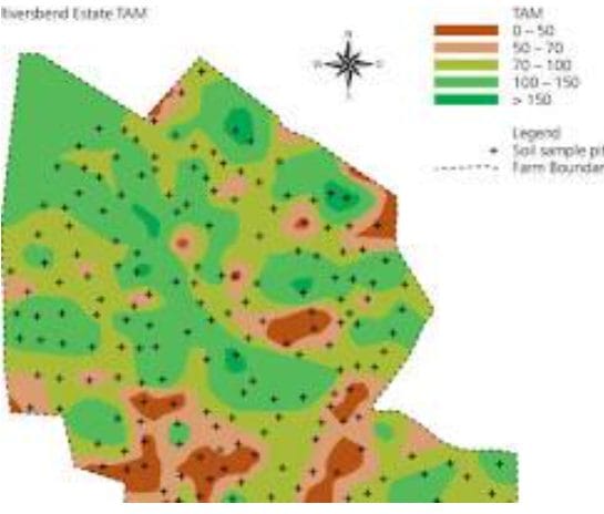
GIS map showing different soil types in a farm
SDG 3: Good Health and Well-being
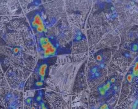
Disease Surveillance: GIS can be used to track the spread of infectious diseases, such as malaria and Ebola, by mapping reported cases and identifying areas at risk. This information can help public health officials to target interventions and prevent outbreaks.
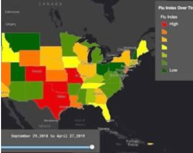
GIS map showing the spread of a disease over time
SDG 6: Clean Water and Sanitation
Water Resource Management: GIS can be used to map water resources, such as rivers, lakes, and aquifers, and to assess water quality. This information can help water managers to make informed decisions about water allocation and conservation.
Real world example:
Groundwater Management in India: GIS helps map groundwater resources, identify areas of depletion, and monitor water quality. This information is crucial for sustainable water management and ensuring equitable access to clean water.
Opens in a new windowwww.mdpi.com
GIS map showing water sources and distribution in a region
SDG 7: Affordable and Clean Energy
Renewable Energy Planning: GIS can be used to identify suitable locations for renewable energy projects, such as solar and wind farms, based on factors such as solar radiation, wind speed, and land use.
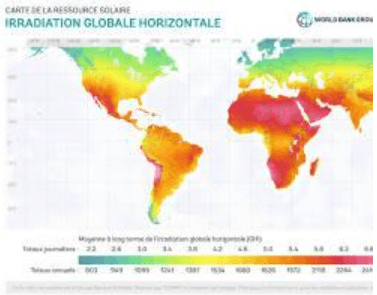
GIS map showing potential locations for a solar farm
SDG 11: Sustainable Cities and Communities
Urban Planning: GIS can be used to analyze urban areas, such as population density, transportation networks, and infrastructure, to help planners design sustainable cities.
Real world example
Urban Planning in Brazil: GIS is used to analyze urban sprawl, traffic congestion, and access to green spaces. This data informs urban planning decisions, promoting more sustainable and livable cities.
GIS map showing urban areas and transportation networks
SDG 13: Climate Action
Climate Change Mitigation: GIS can be used to map carbon emissions and identify areas at risk of climate change impacts, such as sea-level rise and extreme weather events. This information can help policymakers to develop strategies to mitigate climate change.
Real world example
Disaster Risk Reduction in the Philippines: GIS-based platforms are used to map areas vulnerable to natural disasters like typhoons and floods. This information helps communities prepare and respond effectively, minimizing loss of life and property.
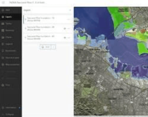
GIS map showing areas at risk of sea level rise
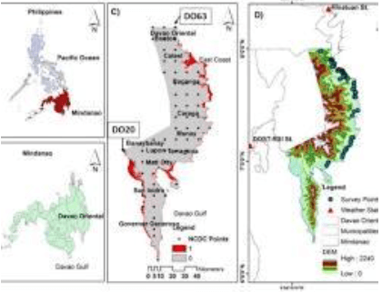
GIS map showing areas at risk of flooding in the Philippines
SDG 15: Life on Land
Biodiversity Conservation: GIS can be used to map biodiversity hotspots and identify areas that need to be protected. This information can help conservationists to develop strategies to protect endangered species and ecosystems.
Real world example
Wildlife Conservation in Tanzania: GIS is used to track wildlife movements, monitor poaching activities, and identify critical habitats. This data supports conservation efforts and helps protect endangered species.
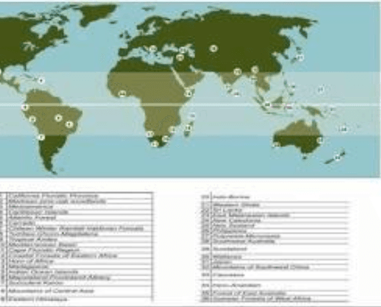
GIS map showing biodiversity hotspots
Conclusion
As GIS technology continues to advance, its role in supporting the SDGs will only grow. The integration of remote sensing, artificial intelligence, and big data analytics will enable even more sophisticated and impactful applications. By harnessing the power of GIS, we can make significant progress towards a more sustainable and equitable future for all.


