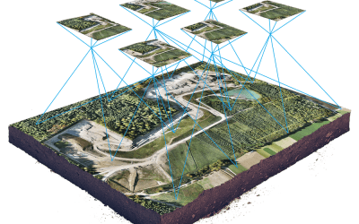
Geospatial analytical companies;
- Genesys International; Genesys International Corporation Ltd is a geospatial analytics company established in 1995. We are pioneers in advanced mapping, surveying, and geospatial services. With a team of 2000+ professionals and rich experience, we deliver expert services in Geographical Information System (GIS) and Geospatial Engineering domain.
- Orbital Insight; Orbit Insight is the first true innovation intelligence solution to provide single-source access to the latest trends, patents, startups, competitors, partners, technologies, and publications. Fully automated and continually updated.
- Cesium; Cesium for Unreal is an accurate, full-scale virtual globe for Unreal Engine. It enables developers to create global-scale interactive digitized worlds with real-world 3D location data, such as the kind captured by drones, satellites, and intelligent machines.
- Coord; Coord Technologies is a privately-owned company offering GIS, Engineering Services, Software Development, photogrammetry, Surveying, and Virtualization solutions. Our work is driven by vast expertise, advanced technology, and quality focus. It’s no surprise that Coord Tech is growing at a rapid pace, with customers spread around the globe.
- Development SEED; Development seed leverage massive earth data, cloud computing, geospatial AI, and thoughtful product development to 10x your data scientists and empower your work
- DroneDeploy; DroneDeploy, a leader in the field, is a San Francisco-based company founded in 2013 that produces photogrammetric and analytic software for drones. They offer cloud-based processing and support for DJI drones. You can use DroneDeploy to make orthomosaics, digital terrain models, gather NDVI data, and generate 3D models. Their target industries include construction, farming, and surveying.
- GeoAdaptive; GeoAdaptive is a development planning and strategy company that specializes in the use of geospatial technologies to solve complex economic, environmental, urban, and social problems in a variety of territories, scales, and industries. We deploy and integrate advanced techniques in spatial economics, risk analytics, socio-ecological modeling, and place-based design, to create robust strategies for our clients worldwide, reducing their risk and maximizing their opportunities for sustainable and inclusive growth.
- Hexagon; Hexagon’s Geospatial division is part of Hexagon, a global leader in digital solutions that create Autonomous Connected Ecosystems (ACE), where data is connected seamlessly through the convergence of the physical world with the digital, and intelligence is built into all processes. Our division creates solutions that visualize location intelligence. From the desktop to the browser to the edge, we bridge the divide between the geospatial and the operational worlds.
- Hivemapper; Hivemapper is a decentralized mapping network that enables monitoring and autonomous navigation without the need for expensive sensors, aircraft, or satellites. Anyone with a video camera can quickly and easily build a smarter and fresher map.
- L3 Harris Geospatial; L3Harris Geospatial Solutions has more than 30 years of experience developing scientifically proven solutions using cutting-edge technology. Today, organizations across industries use our in-depth knowledge of advanced geospatial analytics, machine learning, and remotely sensed data to make better decisions.
- Mapbox; Mapbox is the location data platform for mobile and web applications. They provide building blocks to add location features like maps, search, and navigation into any experience you create. When integrated with Arcadia Enterprise, you get a powerful geospatial analytics platform that enables fast, dynamic rendering of maps on data sets with billions of records that represent millions of geospatial shapes.
- Navisens; Navisens, my focus is on building a company with amazing technology and a world-class engineering team, and creating an environment where engineers work on interesting problems by applying cutting-edge research to real-world applications. At Navisens, we combine machine learning and robotics estimation techniques to build the most accurate real-time location technology available using only the sensors inside your mobile device.
- NearMap (ASX: NEA); Nearmap is a global leader in high-resolution aerial imagery. Since 2019, the company has released a number of innovations designed to help government agencies garner greater insights from aerial imagery and the use of location intelligence.
- Orbit GT; Orbit Geospatial Technologies is the world leader in solutions for exploiting 3D Mapping content in managing, viewing, extracting, publishing, sharing, and embedding in workflows, either desktop or cloud-based. Orbit GT specializes in 3D Mapping solutions for Mobile Mapping, UAS Mapping, Indoor Mapping, and Aerial Oblique Mapping, replacing the big data dilemma with ease of use.
- PlanetWatchers; PlanetWatchers was founded by ex-military intelligence officers to leverage Synthetic Aperture Radar data and extract real earth insights via AI and ML. With extensive experience in providing support for the agricultural, financial, and insurance sectors, PlanetWatchers provides fast and accurate analysis of crop classification, lifecycle, productive and damaged areas. SAR imagery can be captured day and night, without the usual visibility limitations of optical data and is well suited to monitoring extensive areas.
- PrecisionHawk; PrecisionHawk, Inc., a leading provider of drone technology for the enterprise has announced PrecisionAnalytics Energy, a complete aerial mapping, modeling, and inspection platform that uses the latest generation of artificial intelligence and machine intelligence to automate analysis of their aerial data. Whether inspecting thousands of oil well pads or hundreds of thousands of utility towers, PrecisionAnalytics’ customers can reduce costs up to 80% and dramatically improve safety in the field.
- UtiliSync; UtiliSync is a mobile app that Public Works personnel use to take photos, create geo-sketches, and complete important forms related to their utility infrastructure.
- UTTO; UTTO leverages world-class design expertise in multi-discipline technologies to deliver a real solution designed exclusively for the industry. Utilities and service providers can now have a technology plan and implement digital services that can scale and allow organizations to meet 21st Century damage prevention and operational productivity demands.
- Visual Intelligence; Visual Intelligence is a unified drone and software automation platform, uses patented dual-sensor drone technology and proprietary enterprise software, to generate billions of data points and map exponentially more measurable tower surface area than any alternative aerial or ground-based method.
- Wolf-tex; Wolf-Tek is creating, engineering, and licensing the products of tomorrow. We specialize in Geographic Information Systems, building GIS Engines and databases. We also create physical products related to our core GIS technology. Wolf-Tek is committed to effective quality engineering and product development, and rigorous testing. We hold high standards and strive to create products in which hardware and software efficiently work together to achieve a goal.
- Geoinfotech; At Geoinfotech, we always work with leading market software to deliver the best possible results to achieve your strategic goals through effective deployment of Geospatial technology.


