In the past, farming relied heavily on manual labour, observational experience, and traditional tools to monitor crops and manage fields. Today, drones, also known as unmanned aerial vehicles (UAVs), are redefining modern agriculture, bringing precision, speed, and efficiency to tasks that once took days or weeks to complete.
Agricultural drones combine aerial imaging, remote sensing, and data analytics to help farmers make informed decisions, optimise resources, and ultimately boost yields. This is the essence of precision agriculture, farming guided by accurate, data-driven insights rather than guesswork.
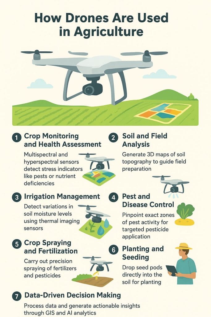
Crop Monitoring and Health Assessment
Drones equipped with multispectral and hyperspectral sensors can detect subtle changes in plant health long before they are visible to the naked eye. By capturing images in multiple wavelengths, these drones identify stress indicators caused by pests, diseases, or nutrient deficiencies.
For example, using the Normalised Difference Vegetation Index (NDVI), farmers can map areas of poor growth and take corrective action early, reducing crop loss and improving yield predictability.
Soil and Field Analysis
Before planting, drones can generate 3D maps of soil topography to guide field preparation. This allows for:
- Precise irrigation planning based on elevation and slope.
- Identification of low-lying water-logged zones.
- Tailored planting strategies for different soil conditions.
Post-harvest, the same drones can be used to assess field performance and plan for the next planting season.
Irrigation Management
By using thermal imaging sensors, drones detect variations in soil moisture levels. This data helps farmers apply water only where it’s needed, reducing waste and preventing water stress in plants. In water-scarce regions, such precision irrigation is both an economic and environmental necessity.
Pest and Disease Control
Early detection of infestations is vital. With high-resolution aerial imagery, drones can:
- Pinpoint exact zones of pest activity.
- Enable targeted pesticide application, reducing chemical usage.
- Limit environmental impact by avoiding blanket spraying.
This selective spraying method not only saves money but also aligns with sustainable farming practices.
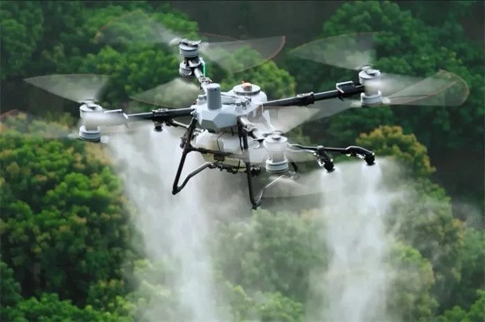
Crop Spraying and Fertilisation
Modern agricultural drones can carry payloads of liquid fertiliser or pesticides and spray them with centimetre-level accuracy. Compared to traditional ground equipment:
- Coverage is faster: drones can treat 10–20 hectares in a fraction of the time.
- Access is easier, especially in muddy or uneven fields where tractors struggle.
- Chemical exposure risk is minimised for farm workers.
Planting and Seeding
Specialised drones can drop seed pods directly into the soil, covering large areas quickly. This technique is particularly useful for reforestation projects or planting cover crops in hard-to-reach terrain.
Data-Driven Decision Making
Perhaps the most valuable contribution of drones is actionable intelligence. The data they gather is processed through GIS (Geographic Information Systems) and AI-powered analytics, giving farmers detailed reports on crop growth trends, productivity forecasts, and resource requirements. This allows for:
- Better harvest timing.
- Reduced input costs.
- Sustainable land management.
The Bigger Picture: Drones and the Future of Agriculture
The global demand for food is expected to rise sharply as the population grows. Drones offer a way to produce more with fewer resources, aligning with global sustainability goals. They are not replacing farmers but empowering them with the eyes in the sky, making agriculture smarter, more profitable, and environmentally responsible.
From rice paddies in Asia to vineyards in Europe and maize fields in Africa, drone technology is proving that the future of farming lies at the intersection of innovation and tradition.