Drone technology is reshaping how land is mapped, measured, and managed across Nigeria. In recent years, cadastral surveying has evolved from traditional ground-based methods to advanced aerial mapping solutions. Consequently, drones have become a faster, more accurate, and more affordable way to capture detailed land data.
What Is Drone-Based Cadastral Surveying?
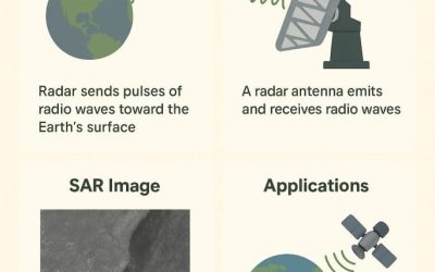
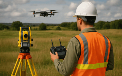
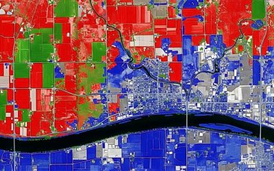
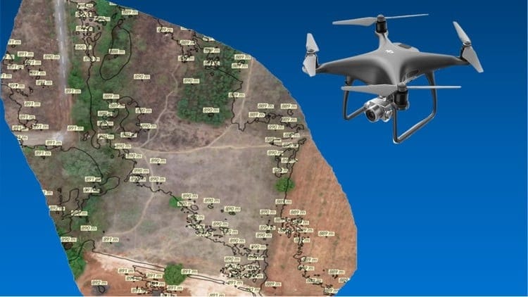
Drone-based cadastral surveying involves the use of unmanned aerial vehicles (UAVs) to capture high-resolution imagery and topographic data. Unlike traditional methods, which rely heavily on manual fieldwork, drone surveying delivers precise results in a fraction of the time. Moreover, the data collected can easily be processed into orthophotos, digital surface models (DSM), and accurate land maps.
Why Drone Technology Matters in Land Management
Land management in Nigeria faces challenges such as boundary disputes, poor record-keeping, and slow documentation. However, drones are helping to close these gaps. For instance, surveyors now use UAVs to map communities, monitor land use, and document ownership boundaries. As a result, authorities and landowners can make quicker, data-driven decisions.
Top Benefits of Drone Cadastral Surveying in Nigeria
1. Speed and Efficiency
Drone technology allows surveyors to cover large areas in record time. For example, what would take weeks with traditional surveying can now be completed within days. Furthermore, the automated nature of drone flights ensures consistent results, even in difficult terrain.
2. Improved Accuracy
Accuracy is critical in cadastral surveying. Drones equipped with RTK (Real-Time Kinematic) GPS systems capture data with centimeter-level precision. Therefore, surveyors can produce maps that meet international standards. In addition, the consistency of drone imagery reduces human error and enhances quality control.
3. Cost-Effectiveness
In comparison to manual surveying, drone operations require fewer field personnel and less time. Consequently, project costs are significantly reduced. Moreover, the digital outputs can be reused or updated easily, saving money for both government and private clients.
- Accessibility and Safety
Traditional cadastral surveys often involve navigating difficult or unsafe areas. By contrast, drones collect data from the air, keeping surveyors safe. In addition, UAVs can reach regions that are otherwise inaccessible, such as flood-prone or densely forested areas.
5. Transparency and Conflict Resolution
Disputes over land ownership are common in Nigeria. However, drone-generated maps offer visual, verifiable evidence of property boundaries. As a result, communities, government agencies, and property owners can resolve conflicts more easily. Furthermore, digital records enhance transparency in land administration and reduce fraud.
6. Environmental Monitoring
Drones not only help with land mapping but also support environmental monitoring. For instance, UAVs can track deforestation, monitor erosion, and assess flood risks. Therefore, they play a vital role in sustainable land and resource management across Nigeria.
The Future of Drone Cadastral Surveying in Nigeria
As technology advances, drone-based cadastral surveying will continue to transform Nigeria’s geospatial industry. In the coming years, we can expect deeper integration of drones with GIS software, artificial intelligence, and real-time data sharing systems. Moreover, government agencies are now adopting drone-based mapping to speed up land registration and improve urban planning.
Ultimately, drones are not just tools for mapping—they are catalysts for progress. By embracing this innovation, Nigeria is moving toward a more transparent, efficient, and data-driven land management system.
Conclusion
Drone-based cadastral surveying is a game changer for Nigeria’s land management sector. Through faster data collection, improved accuracy, and greater transparency, drones have proven to be indispensable in solving long-standing challenges in surveying and mapping. Therefore, organizations, land administrators, and surveyors should continue to adopt drone technology to build smarter and more sustainable communities in 2025 and beyond.