Document

Land Survey in Nigeria

John Abodunwa

September 11, 2025

Buying land in Nigeria is one of the most important financial decisions you’ll ever make. But it’s also one of the riskiest if you don’t do things the right way. Every year, thousands of Nigerians lose money to land scams, double sales, or government acquisition because they skipped one vital step: land survey.

A land survey in Nigeria is not just about measuring land; it is about protecting your future. Without it, you cannot truly say you “own” land.

In this guide, we’ll walk you through everything you need to know about land survey in Nigeria, from what it means, why it’s important, how much it costs, the types, the registration process, common mistakes, and how to choose the right surveyor.

By the end, you’ll understand why a land survey is the foundation of secure land ownership in Nigeria.

What is a land survey in Nigeria?

In simple terms, a land survey is the process of measuring, mapping, and defining the exact boundaries of a piece of land.

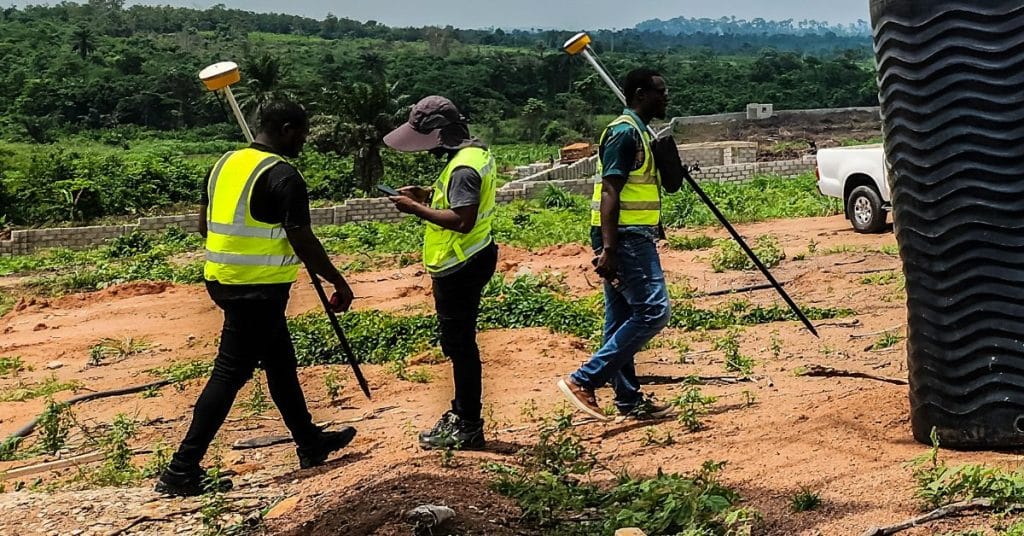
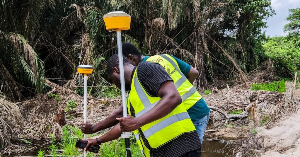
A licensed surveyor visits the land, uses professional equipment (like GPS, drones, and total stations), collects data, and produces a survey plan.

A survey plan is an official document that shows:

  • The exact location of the land (using coordinates) 
  • The size of the land in square meters or hectares 
  • The boundaries (with bearings and distances) 
  • The name of the landowner 
  • The surveyor’s details and stamp 

Once this plan is registered with the government, it becomes a legal document that protects your land.

Why is land survey important in Nigeria

If you ask 10 people who lost their land, at least 6 of them will tell you it happened because they didn’t have a registered survey plan.

Here’s why it’s so important:

  • Legal protection: Without a registered survey, your land has no official recognition. 
  • Government approval: You cannot get a Certificate of Occupancy (C of O) or Governor’s Consent without a survey. 
  • Prevents encroachment: Your neighbors won’t be able to shift your boundary or claim your land. 
  • Saves money long-term: Paying for a survey might feel expensive now, but losing millions later is worse. 
  • Essential for property development: No bank, investor, or government agency will accept land documents without a registered survey plan. 

In short: No survey, no security.

Case Study: How a man lost ₦10 million due to no survey

Mr. Chukwu bought 2 plots of land in Lagos in 2018. He trusted the seller and didn’t bother doing a proper survey. A year later, when he wanted to build, he discovered that part of his land fell under government acquisition for a road expansion project.

Because he had no registered survey plan to show when he bought the land, he couldn’t claim compensation. He lost almost ₦10 million.

If he had done a survey before purchase, the survey would have shown that the land was under government acquisition, and he could have avoided the loss.

Types of land surveys in Nigeria

Different surveys serve different purposes. Here are the most common:

  • Cadastral or Boundary Survey 
      • Defines exact land boundaries. 
      • Used for buying, selling, or registering land. 
  • Topographic Survey 
      • Shows the physical features, slopes, and elevations of the land. 
      • Useful for construction projects, estates, or road works. 
  • Subdivision Survey 
      • Splits a large piece of land into smaller plots for resale or estate development. 
  • Construction/Engineering Survey 
      • Used to “set out” buildings, roads, or other structures in their correct positions. 
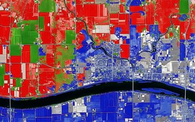
  • Drone and Aerial Survey 
    • Modern methods using drones to map large areas quickly. 
    • Common for agriculture, estates, and big infrastructure projects. 

Step-by-step process of getting a registered survey plan in Nigeria

Here’s how it usually works:

  1. Hire a licensed surveyor – confirm they are registered with SURCON. 
  2. Reconnaissance survey – the surveyor checks the land and confirms ownership details. 
  3. Fieldwork – using GPS and measuring tools, the surveyor collects coordinates of your land. 
  4. Preparation of survey plan – a draft survey plan is created. 
  5. Submission for registration – the survey plan is submitted to the State Ministry of Lands. 
  6. Verification – government checks for overlaps or acquisitions. 
  7. Payment of fees – you pay official fees to the state government. 
  8. Registered survey plan issued – you receive a red copy (the official registered survey).
Licensed surveyor in Nigeria using GNSS and drone technology for registered land survey plan

land-survey-nigeria-2025.jpg

How much does a land survey cost in Nigeria?

The cost of land survey varies depending on the:

  • Location: Lagos, Abuja, and other major cities are more expensive than rural areas. 
  • Size of the land: Bigger land = higher cost. 
  • Purpose: A simple boundary survey costs less than a topographic or drone survey. 
  • Government fees: Each state has its own fee schedule. 

Cost breakdown by example:

  • Lagos State: ₦350,000 – ₦2 million (depending on zone & plot size) 
  • Abuja (FCT): ₦500,000 – ₦3 million 
  • Ogun State: ₦250,000 – ₦800,000 
  • Rural areas: ₦150,000 – ₦400,000 

 Always ask for an official receipt and insist on government registration.

Common problems avoided by land survey

  • Buying land under government acquisition → survey reveals it early. 
  • Boundary disputes with neighbors → survey fixes your exact limits. 
  • Fraudulent land sellers → A survey can expose double allocation. 
  • Building in the wrong place → A survey helps set out structures correctly. 
  • Land size cheating → sometimes sellers exaggerate size; survey confirms real measurement. 

How to choose the right surveyor in Nigeria

Here’s a checklist before hiring a surveyor:

  • Verify their SURCON registration. 
  • Ask to see past survey plans they’ve produced. 
  • Confirm they know the local area. 
  • Make sure their plan will be registered, not just drawn. 
  • Get a written contract. 
  • Insist on clear fees (fieldwork, government fees, professional charges). 
  • Ask if they use modern tools like GPS, drones, and GIS. 

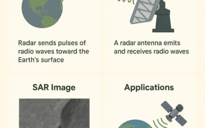
Modern tools used in Nigerian land survey

Today’s surveyors no longer rely on manual compasses alone. They use:

  • GPS/GNSS receivers – for precise coordinates. 
  • Drones/UAVs – for aerial mapping and estate layouts. 
  • Total Stations – for accurate angles and distances. 
  • GIS & CAD software – for preparing legal survey plans. 
  • LiDAR scanning – for 3D elevation mapping. 

Documents needed for land registration

When registering land or applying for a C of O, you’ll need:

  • Registered survey plan 
  • Application form (from the State Ministry of Lands) 
  • Proof of identity (passport, National ID, etc.) 
  • Purchase agreement or deed of assignment 
  • Passport photographs 
  • Payment receipts 

Extra FAQs

Q: How long does it take to get a registered survey plan?
Usually 2–6 weeks, depending on the state and how fast the Ministry processes it.

Q: Can I use the seller’s old survey plan?
Only if it’s registered. Otherwise, do your own survey plan, to be safe.

Q: Is a drone survey accepted for registration?
Yes, as long as a licensed surveyor signs off and submits it officially.

Q: Can I register my land survey myself?
No. Only a licensed surveyor can prepare and submit the plan for registration.

Q: What happens if my land falls under government acquisition?
You may not be able to get a C of O. Sometimes compensation is paid, but only if you can prove ownership with documents.

Notes

A land survey in Nigeria is more than just a drawing; it is your legal proof of land ownership. Whether you are buying, selling, or developing, you cannot afford to skip it.

At Geoinfotech, we help individuals, families, and businesses secure their land with accurate, government-recognised survey plans. Using modern technology like GPS, drones, and GIS, our licensed surveyors deliver results you can trust.

Call us today: +234 816 322 2177
Lagos Office: Oluwalogbon House, Obafemi Awolowo Way, Alausa Ikeja, Lagos
Abuja Office: 6th Floor, Nigeria Reinsurance Corporation Building, Plot 784A Herbert Macaulay Way, North, Abuja

RECENT ACTIVITIES AND PROJECT...

URABN HEAT ISLAND EFFECT IN CALABAR MUNICIPAL

URABN HEAT ISLAND EFFECT IN CALABAR MUNICIPAL

ANALYZING URBANIZATION TRENDS IN KANO STATE, NIGERIA USING NIGHTTIME LIGHTS REMOTE SENSING DATA

ANALYZING URBANIZATION TRENDS IN KANO STATE, NIGERIA USING NIGHTTIME LIGHTS REMOTE SENSING DATA

COMPREHENSIVE OFFSHORE SURVEILLANCE AND MARITIME INFRASTRUCTURE MONITORING

COMPREHENSIVE OFFSHORE SURVEILLANCE AND MARITIME INFRASTRUCTURE MONITORING

Comprehensive Aerial Survey and Mapping for Golf Course Asset Management at Lakowe Golf Lake

Comprehensive Aerial Survey and Mapping for Golf Course Asset Management at Lakowe Golf Lake

Professional Drone Training Program for Enhanced Corporate Security Operations at Sahara Group

Professional Drone Training Program for Enhanced Corporate Security Operations at Sahara Group

Advanced Aerial Topographic Survey and Mapping for Land Development in Ogun State

Advanced Aerial Topographic Survey and Mapping for Land Development in Ogun State

Precision RGB and Thermal Imaging Revolutionizes Solar Infrastructure Inspection In Enugu

Precision RGB and Thermal Imaging Revolutionizes Solar Infrastructure Inspection In Enugu

Advanced Drone-Based Topographic Survey for Precision Land Development Planning

Advanced Drone-Based Topographic Survey for Precision Land Development Planning

Mapping the Future: Comprehensive Area Survey Transforms Land Development in Akure

Mapping the Future: Comprehensive Area Survey Transforms Land Development in Akure

Precision Topographical Survey and Mapping for Smarter Infrastructure Planning

Precision Topographical Survey and Mapping for Smarter Infrastructure Planning

Precision Drone Volumetric Surveys: How Purechem Industries Optimized Mineral Stockpile Management

Precision Drone Volumetric Surveys: How Purechem Industries Optimized Mineral Stockpile Management

Advanced Mapping & Environmental Survey for Ilubirin Property, Lagos Island

Advanced Mapping & Environmental Survey for Ilubirin Property, Lagos Island

Unveiling the Invisible: LiDAR Technology Transforms Terrain Analysis in Abeokuta North

Unveiling the Invisible: LiDAR Technology Transforms Terrain Analysis in Abeokuta North

 DETAILED AERIAL, LAND SURVEY AND GIS ANALYSIS FOR ADVANCED REAL ESTATE DEVELOPMENT

 DETAILED AERIAL, LAND SURVEY AND GIS ANALYSIS FOR ADVANCED REAL ESTATE DEVELOPMENT

Professional Drone Mapping and GIS Training For ETA-ZUMA Mining Company

Professional Drone Mapping and GIS Training For ETA-ZUMA Mining Company

Installation of Intelligent Traffic Lights

Installation of Intelligent Traffic Lights

Geological Report on a Mining/Exploration Survey

Geological Report on a Mining/Exploration Survey

Drone Survey and Mapping of Shaishen Foods Limited

Drone Survey and Mapping of Shaishen Foods Limited

Lidar Topographic Mapping Project

Lidar Topographic Mapping Project

Geophysical/hydrogeophysical Studies for Groundwater Development

Geophysical/hydrogeophysical Studies for Groundwater Development

Togo Digital Terrain Model Project

Togo Digital Terrain Model Project

Drone Mapping of Parts of Lome Rail Line for Graceland Energy Located at Lome Togo

Drone Mapping of Parts of Lome Rail Line for Graceland Energy Located at Lome Togo

Drone/land Survey of Pure-chem Industrial Limited, Ogun State.

Drone/land Survey of Pure-chem Industrial Limited, Ogun State.

Drone Inspection/survey of Southern Lake Estate, Chevron, Lekki, Lagos State

Drone Inspection/survey of Southern Lake Estate, Chevron, Lekki, Lagos State

Anniversary-Workshop on the Application of Remote Sensing and Drone Technology in GIS -Abuja

Anniversary-Workshop on the Application of Remote Sensing and Drone Technology in GIS -Abuja

Topographic Mapping of Oyo State

Topographic Mapping of Oyo State

Topographic Mapping of Part of the Local Government Areas in Oyo State

Topographic Mapping of Part of the Local Government Areas in Oyo State

Topographic Mapping of Part of Kwara, Ekiti and Kogi State Local Government Area

Topographic Mapping of Part of Kwara, Ekiti and Kogi State Local Government Area

Political Map of South West, Nigeria Located in Nigeria

Political Map of South West, Nigeria Located in Nigeria

Topographic Mapping of Parts of Niger State Located at Niger State, Nigeria

Topographic Mapping of Parts of Niger State Located at Niger State, Nigeria

Topographic Mapping of Part of Kwara, Ekiti, and Kogi State Local Government Area Located in Nigeria

Topographic Mapping of Part of Kwara, Ekiti, and Kogi State Local Government Area Located in Nigeria

Topographic Mapping of Part of Kwara State Local Government Area Located at Kwara State Nigeria

Topographic Mapping of Part of Kwara State Local Government Area Located at Kwara State Nigeria

Flood Analysis of Amuwo-odofin Orthophoto.

Flood Analysis of Amuwo-odofin Orthophoto.

Site Inspection Using Drone of Water Corporation Located at Oke-aro Agege

Site Inspection Using Drone of Water Corporation Located at Oke-aro Agege

24,000 meter Lome Rail Line for Drone Mapping, Graceland Energy Located at Lome, Togo

24,000 meter Lome Rail Line for Drone Mapping, Graceland Energy Located at Lome, Togo

10 Drone Inspection Traffic Signal in Lagos

10 Drone Inspection Traffic Signal in Lagos

Lagos October 1st Free GIS Training Workshop

Lagos October 1st Free GIS Training Workshop

Osun state parcel project

Osun state parcel project

Drone Mapping & Vectorization Of Abu-allied Farm

Drone Mapping & Vectorization Of Abu-allied Farm

Proposal for aerial deployment, tracking and monitoring of threats in victoria island phase 1 and ikoyi phase 2, nigeria

Proposal for aerial deployment, tracking and monitoring of threats in victoria island phase 1 and ikoyi phase 2, nigeria

Jabi Lake Mall Solar Inspection – Abuja

Jabi Lake Mall Solar Inspection – Abuja

Ground Control and Drone Survey for Mast 3D Modeling

Ground Control and Drone Survey for Mast 3D Modeling

Telecom Drone 3D and 2D Modeling of Cellsite

Telecom Drone 3D and 2D Modeling of Cellsite

Free GIS Spatial Analysis Training (Lagos Branch)

Free GIS Spatial Analysis Training (Lagos Branch)

800 Building Plots Aerial Capture and Delineation for Database. Greenfield Estate

800 Building Plots Aerial Capture and Delineation for Database. Greenfield Estate

100 Hectares Aerial Survey with Differential GPS of High Accuracy

100 Hectares Aerial Survey with Differential GPS of High Accuracy

Protected: Nigeria Crime Report and Dashboard

Protected: Nigeria Crime Report and Dashboard

Drone Survey and Mapping – Victoria Island  Copy

Drone Survey and Mapping – Victoria Island Copy

Akwa-Ibom 500 Hectares Drone Survey and Mapping in Nigeria

Akwa-Ibom 500 Hectares Drone Survey and Mapping in Nigeria

Ground Control Establishment – Republic of the Niger – Kano, Kastina, Jigawa, Kaduna

Ground Control Establishment – Republic of the Niger – Kano, Kastina, Jigawa, Kaduna

Drone Survey and Mapping – Victoria Island

Drone Survey and Mapping – Victoria Island

Control Point Establishment – DGPS

Control Point Establishment – DGPS

Land Survey – Northern Nigeria

Land Survey – Northern Nigeria

Biodiversity Mapping – Sweden

Biodiversity Mapping – Sweden

Flood Impact Mapping – United Kingdom

Flood Impact Mapping – United Kingdom

M and E GIS Dashboard for Control Establishment Project

M and E GIS Dashboard for Control Establishment Project

Geodatabase Management System Training For National Boundary Commission

Geodatabase Management System Training For National Boundary Commission

Nigeria Topographic Map – Project

Nigeria Topographic Map – Project

Abuja Training on Introduction to GIS

Abuja Training on Introduction to GIS

200 Hectares Land and Drone Survey – Lagos Nigeria

200 Hectares Land and Drone Survey – Lagos Nigeria

Inspection of 30 hectares drainage

Inspection of 30 hectares drainage

Drainage Drone Mapping and Surveying in Lagos Nigeria

Drainage Drone Mapping and Surveying in Lagos Nigeria

GIS Cadastral Mobile Application

GIS Cadastral Mobile Application

Abuja Topographical Map – HD GIS Mapping

Abuja Topographical Map – HD GIS Mapping

Ground Topography Survey (Lagos Island)

Ground Topography Survey (Lagos Island)

2.7km2 Topography Survey in Snake Island

2.7km2 Topography Survey in Snake Island

GIS Masterclass

GIS Masterclass

Sokoto Contour Map

Sokoto Contour Map

NDVI Vegetation Assessment in Lagos State

NDVI Vegetation Assessment in Lagos State

Lagos drone training master class

Lagos drone training master class

Ifako drone topographic survey and mapping

Ifako drone topographic survey and mapping

CMD Lagos 3D mapping aerial modeling

CMD Lagos 3D mapping aerial modeling

GIS and Drone Masterclass

GIS and Drone Masterclass

Drone aerial survey and mapping – Lagos Island _ Somolu

Drone aerial survey and mapping – Lagos Island _ Somolu

Covid-19 | Nigeria Data Visualisation

Covid-19 | Nigeria Data Visualisation

Benue Flood Analysis

Benue Flood Analysis

Aerial photography Ile-Ife Osun State

Aerial photography Ile-Ife Osun State

Kenya Forest Project

Kenya Forest Project

Tunsun Consultants Ltd

Tunsun Consultants Ltd

Introduction To Gis In Maritime at the National Boundary Commission

Introduction To Gis In Maritime at the National Boundary Commission

Training on GIS and Drone Mapping (batch-4 & 5)

Training on GIS and Drone Mapping (batch-4 & 5)

Osun Flood Mapping

Osun Flood Mapping

Lahass International Limited

Lahass International Limited

Linguistic Association of Nigeria

Linguistic Association of Nigeria

West African Indexing Services

West African Indexing Services

Lagos Ikeja Road Network Map

Lagos Ikeja Road Network Map

LASU Land Regularisation Portal

LASU Land Regularisation Portal

Lingua Plus International

Lingua Plus International

Lagferry Web Route

Lagferry Web Route

YOU MAY ALSO LIKE...

COURSES

Explore Geoinfotech courses and establish a strong foundation of knowledge and skills to be productive with the latest Technology.

1000 University Student in Drone and GIS

This course is designed to equip university students with the essential knowledge and practical skills needed to become proficient in…

Find out more

Spatial Analysis using ArcGIS

Learn essential concepts and a standard workflow you can apply to any spatial analysis project.
Duration: 2 Weekends (Every Friday 2pm and Saturday 10am)
Package: Field Experience, 100% Hands-on practical, jotter, Biro and Software
Others: Test, Exam and Certificate

Find out more

Drone Pilot for Beginners to Professional

The Drone Professional Training course is a comprehensive program designed to equip participants with the necessary skills and knowledge to operate drones effectively and safely in a professional setting.
Duration: 3 Weekends (Every Friday 2pm and Saturday 10am)
Package: Field Experience, 100% Hands-on practical, jotter, Biro and Software Others, Test, Exam and Certificate.

Find out more
Training Venue Available in,Lagos and Abuja100253Nigeria
+ Google Map

Differential GPS (DGPS) Land Surveying Training

Professional 2 weekends ▪ Field Experience 5.0 (100% Practical) ▪ Exam & CertificateFree Software and AppsHands on Practical and Field…

Find out more