Technology, geography, and cartography are all combined in the exciting topic of geographic information systems (GIS). No qualification is required to learn, there are no stringent formal requirements to begin studying GIS, it is accessible to anyone who is eager to learn and has a curious nature. Nonetheless, it can be useful to have a fundamental knowledge of geography, maps, and spatial concepts.
- Competencies and Knowledge Areas: To succeed in GIS, concentrate on gaining the following competencies:
- Acquire the ability to evaluate and decipher geographic data through spatial thinking.
- Software Proficiency: Learn how to use specialist tools or GIS software like ArcGIS or QGIS.
- Study data formats, data sources, and database management in order to collect and handle data.
- Cartography: Recognize the fundamentals of map design.
- Examine spatial linkages, overlays, and geoprocessing through the lens of spatial analysis.
- Learn about satellite imaging and its uses in remote sensing.
- Programming: You can improve your skills by learning the fundamentals of Python
GIS APPLICATIONS IN URBAN PLANNING AND DEVELOPMENT
The capacity to better understand existing city demands and design to meet them is one of the reasons GIS is significant in urban planning. Users are able to obtain a comprehensive understanding of the land and infrastructure through the processing of geospatial data from satellite imagery, aerial photography, and remote sensors. The value of GIS is found in its capacity to compile the enormous amounts of data required to reconcile conflicting agendas and resolve challenging issues, like figuring out whether a waste disposal site is feasible or optimizing the location of new buildings. These tasks become more and more complex as urban populations expand.
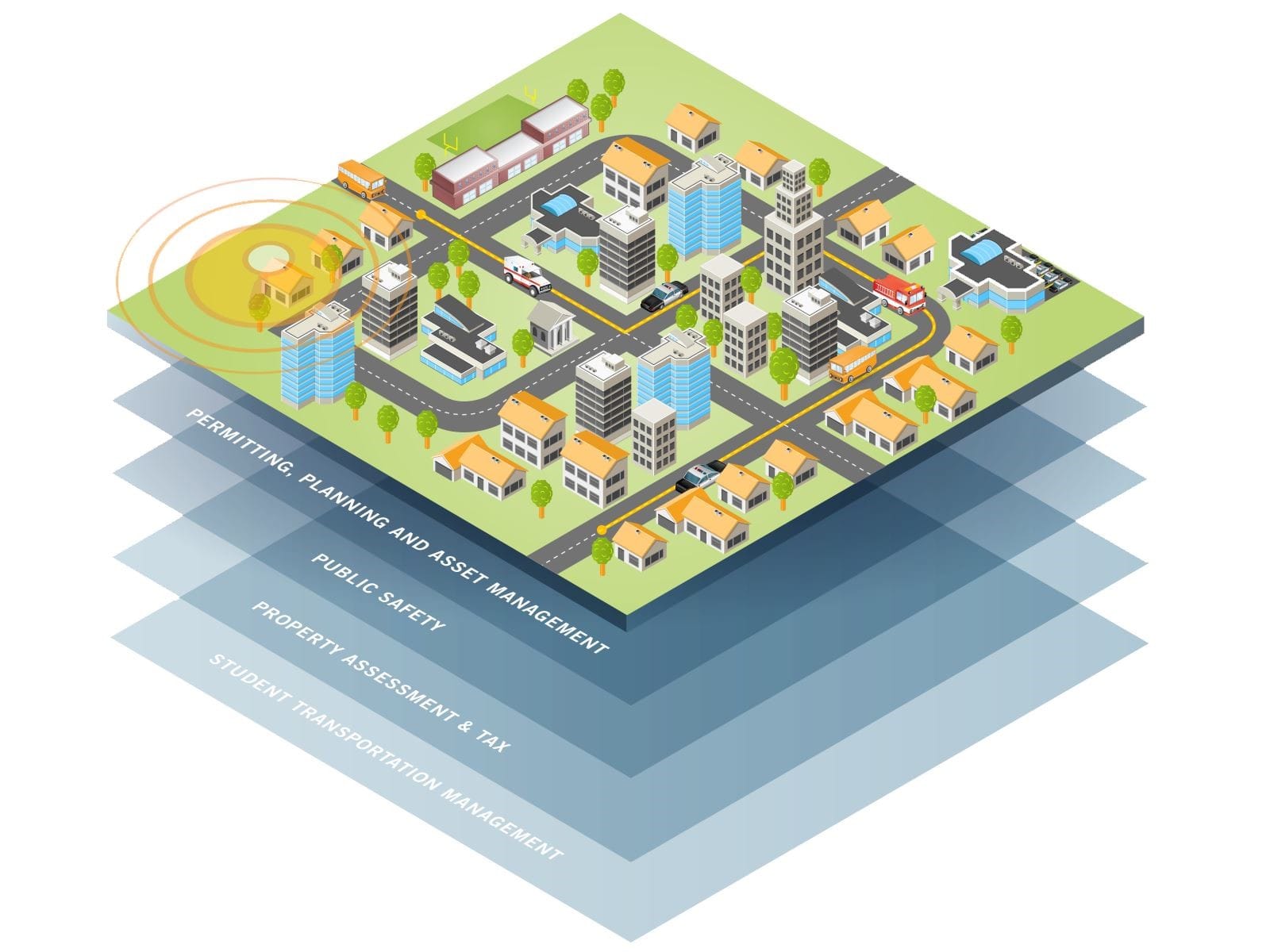
GIS is frequently used in urban planning for the following purposes:
- Land use planning analysis and review.
- Regulatory compliance checks.
- Evaluation of the effects on the environment.
- Historic site preservation.
- Planning regionally rather than just within a city or town.
- Mapping utility delivery and making backup plans in case of outages.
GIS APPLICATIONS IN NATURAL RESOURCE MANAGEMENT
To guarantee that our resources are handled efficiently and sustainably, natural resource management is essential. Managers can gather useful data and information using remote sensing and GIS technologies, which enhances decision-making for sustainable development in general.
- Geographic Information System (GIS) is a crucial instrument for tracking the expansion and contraction of environmental natural resources, as well as for obtaining both quantitative and qualitative data on environmental problems such as pollution, soil erosion, and degradation of land. GIS is used in natural resource management to help with real-time ecological condition monitoring.
- Utilizing Geographic Information Systems for Forest Management. Although most people consider forests to be renewable resources, the amount of forest cover has rapidly decreased. GIS data is used by forest managers to track a variety of factors, including human encroachment into forests and land/protected areas, forest kinds, and cover. To guarantee that our forest resources are preserved and used responsibly, GIS is essential for creating plans, choices, and policy.
- GIS data application for managing watersheds. In order to manage watersheds, GIS is essential. The continuous problem of managing water resources is aided by satellite data, which enables the monitoring of 3D-mapped and GIS-enabled water features like lakes, rivers, dams, and reservoirs.
- The optimal land use methods within a given area, soil types, nutrient availability, and their effects on the environment are all determined with the aid of GIS data. Additionally, slope information and weather desert-like conditions are encroaching on the area can be ascertained using GIS data.
- Using images from the air, the ground, and satellites, GIS data helps manage the land for plants and animals in protected areas and tracks the occurrence and spread of invasive species. Determining the amount of cover and food available is also aided by this knowledge, particularly for herbivores during particular seasons of the year.