In the high-stakes world of Nigeria’s Oil and Gas industry, precision isn’t just a requirement—it’s a safety mandate. From the swampy terrains of the Niger Delta to the deep-water frontiers of the Gulf of Guinea, the equipment a surveyor chooses can determine the success of a multi-billion Naira project.
As we move through 2025, the industry is witnessing a massive shift toward automation, LiDAR, and real-time GNSS data. If you are a project manager sourcing tools or a professional aiming to stay competitive, this is your definitive guide to the gear dominating the Nigerian landscape today.
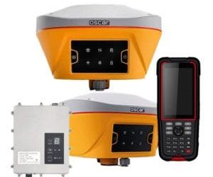
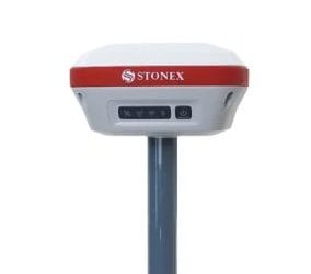
1. High-Precision GNSS/GPS Receivers: Centimeter-Level Accuracy
For pipeline routing and wellhead positioning, a standard handheld GPS simply won’t cut it. Professionals in Nigeria now rely on Differential GNSS (DGNSS) and RTK (Real-Time Kinematic) systems. These units pull data from multiple satellite constellations including GPS, GLONASS, Galileo, and BeiDou.
Top Picks: Leica GS18 T, Trimble R12i, and ComNav SinoGNSS.
The Pro Advantage: Modern units feature Inertial Measurement Unit (IMU) tilt compensation. This allows surveyors to measure points accurately even if the pole is tilted—a total game-changer when navigating the uneven mud and dense mangroves of the Delta.
2. Robotic Total Stations: Efficiency in Hazardous Zones
While GNSS is perfect for open fields, the complex infrastructure of a refinery or flow station demands a Total Station. In 2025, Robotic Total Stations are the industry standard. They allow for one-man operation and remote control, significantly reducing the number of personnel needed in high-risk “hot zones.”
Top Picks: Leica FlexLine TS07, Topcon GT Series, and GeoMax Zipp10 Pro.
Best For: High-accuracy as-built surveys, tank calibration, and structural deformation monitoring where millimeter precision is non-negotiable.
3. 3D Laser Scanners (Terrestrial LiDAR): Creating Digital Twins
For “Brownfield” projects (upgrading existing facilities), 3D Laser Scanners are no longer optional. These devices capture millions of data points per second to create a “Digital Twin” of the facility.
Top Picks: Faro Focus Premium and Leica RTC360.
Why It’s Trending: Instead of manual measurements that take weeks, these scanners map complex piping networks in hours. This provides engineering teams with a flawless “as-is” model for BIM (Building Information Modeling) workflows.
4. Hydrographic Survey Equipment: Mapping the Seabed
With Nigeria’s oil wealth heavily concentrated offshore and in riverine areas, hydrographic tools are the backbone of subsea exploration.
Essential Gear: * Multibeam Echosounders (MBES): For detailed 3D seabed mapping.
Side Scan Sonar: To detect underwater debris or identify pipeline leaks.
Leading Brands: Teledyne Marine and Kongsberg.
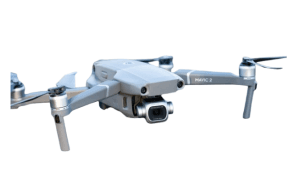
5. UAVs & Drone-LiDAR Systems: The “Eyes in the Sky”
In 2025, the trend has evolved from simple aerial photography to Drone-LiDAR. These systems can “see through” thick Nigerian vegetation to map the actual ground surface beneath, which is vital for new pipeline corridors.
Top Picks: DJI Matrice 350 RTK equipped with the Zenmuse L2 LiDAR sensor.
The Geoinfotech Advantage: We don’t just provide the hardware; we specialize in processing complex point cloud data into actionable survey reports.
Where to Buy and Get Trained in Nigeria?
Owning the best gear is only half the battle. Without a certified operator, high-end hardware produces “bad data,” which can lead to catastrophic project delays.
Professional Training at Geoinfotech
At Geoinfotech, we bridge the gap between technology and expertise. Our 2025 curriculum is specifically designed for the Nigerian energy sector, covering:
Hands-on RTK GNSS setup for swamp and land environments.
3D Laser Scanning workflows for refinery upgrades.
Drone-LiDAR data processing and volumetric analysis.
Pro Tip: Don’t let your equipment sit idle. Ensure your team is certified through our Professional Surveying & GIS modules to maximize your Return on Investment (ROI).
Conclusion: The Future is Digital
The Nigerian oil and gas sector has moved beyond “measuring lines.” It is now an era of Geospatial Data Management. By leveraging robotic sensors and 3D scanners, surveyors are providing the high-fidelity data required to keep Nigeria’s energy sector running safely and efficiently.
Ready to upgrade your firm’s capabilities? Whether you need to source the latest 2025 technology or train your team to use it, Geoinfotech is your trusted partner.
Contact Geoinfotech today for a consultation:
Call: 0816 322 2177
Visit: geoinfotech.ng
Locations: 1 oluwalogbon house, obafemi awolowo way, Ikeja, Lagos, Nigeria (Serving clients nationwide)
- Abuja: 2nd floor Puskin mall, Opposite AA Rano, Samuel Mafuyi Street, Jabi, Abuja
- PH: 21 Bekwere Wosu St, phalga, Port Harcourt 500261, Rivers