
Introduction
Geographic Information Systems (GIS) and geospatial technology continue to reshape how Nigeria collects, manages, and uses location-based information. These technologies help organizations visualize, analyze, and understand data based on where events and features occur on the Earth’s surface. As a result, GIS now drives smarter decision-making across land administration, agriculture, transportation, disaster management, urban planning, and environmental sustainability.
Across Nigeria, government agencies and private organizations increasingly rely on spatial intelligence to guide development. GIS provides the tools to map patterns, monitor change, manage assets, and support evidence-based policies. Therefore, the rapid adoption of geospatial technology is transforming Nigeria’s development landscape and enabling more informed planning for communities and infrastructure.
Applications and Use-Cases of GIS in Nigeria
- Land Administration and Registration : Several states now integrate GIS into land registration and property documentation. For example, Lagos State uses GIS in land administration, even though some processes still need full integration. GIS helps officials verify records, reduce disputes, and streamline land allocation.
- Urban Planning and Mapping : States like Ekiti use GIS for statewide mapping and infrastructure planning. These spatial datasets support zoning, road expansion, settlement planning, and environmental monitoring. Moreover, accurate maps help attract investors by reducing uncertainties in land development.
- Infrastructure and Geospatial Data Provision : Kano State (KANGIS) provides GIS datasets, satellite imagery, and thematic maps that support government ministries, private developers, and researchers. This improves access to reliable geospatial information for engineering, construction, and land-use planning.
- Open Data and Public Resources : Nigeria benefits from freely available GIS datasets, including administrative boundaries, land-use maps, and satellite imagery. Platforms like OSGoF and open-source portals provide essential baseline data for national and state planning.
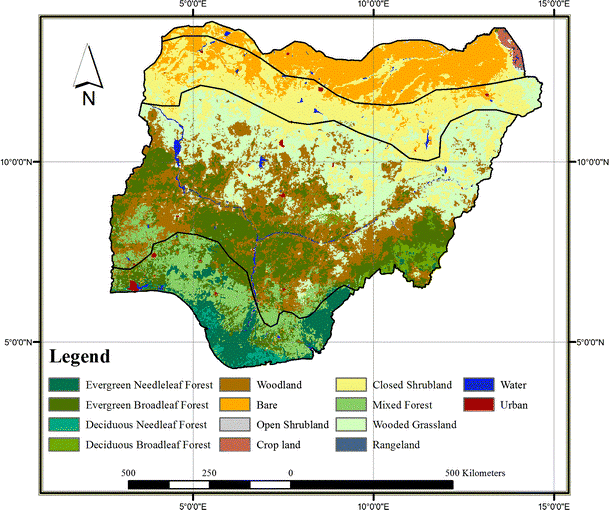
Figure 1: Land Use Dynamics in Nigeria
- Practical Government and Business Use : GIS now supports real operations—not just academic work. Government agencies, survey firms, telecoms, engineering companies, and environmental bodies depend on spatial data for daily decision-making.
Strengths and Progress Highlights
Nigeria’s geospatial ecosystem shows strong signs of growth:
More states have established GIS units and geospatial agencies.
Some states, such as Edo, are recognized for excellent GIS integration.
OSGoF continues to release national-level datasets that support planning and research.
Ekiti and others are expanding statewide spatial data infrastructure.
Consequently, Nigeria’s geospatial capacity is gradually becoming more coordinated and data-driven.
Challenges and Barriers
- Partial Adoption : Some states implement GIS only in specific departments, limiting the full benefits of spatial data. Political and administrative challenges often slow down integration.
- Data Quality Gaps: Digital Elevation Model (DEM) accuracy and satellite data quality vary across terrain and land-cover types. This inconsistency affects precision for modeling, engineering, and environmental analysis.
- Infrastructure and Capacity Issues: Many states face limited funding, outdated equipment, and a shortage of GIS professionals. Without adequate personnel and reliable infrastructure, agencies struggle to maintain geospatial systems.
- Fragmented Standards: Each state runs its geospatial operations independently, which creates interoperability and data-sharing challenges. Nigeria needs stronger national geospatial policy enforcement to ensure consistency.
- Awareness and Cultural Adoption :Decision-makers sometimes underestimate the value of GIS outputs. As a result, spatial data does not always influence policy or budget decisions as strongly as it should.
- High Cost of Implementation : Modern GIS systems require investment in hardware, software, data acquisition, training, and maintenance—costs that many state ministries struggle to sustain.
Conclusion
GIS and geospatial technology continue to evolve rapidly in Nigeria. They help agencies improve land administration, track environmental change, plan infrastructure, and strengthen governance. Although adoption remains uneven, Nigeria’s progress shows that spatial intelligence will play a major role in driving development, improving resilience, and enabling economic growth.
To fully unlock the potential of GIS, Nigeria must invest in capacity building, modern geospatial tools, reliable datasets, and stronger policy frameworks. With strategic support, the geospatial sector will continue to power smarter cities, sustainable development, and national transformation.
Geoinfotech remains committed to educating, building capacity, and empowering individuals and organizations through GIS training and geospatial innovation.


