In today’s rapidly urbanizing world, the challenges of managing solid waste and controlling urban flooding are intensifying—especially in developing regions where rapid population growth often outpaces infrastructure development. While waste management and flooding might seem like separate issues, they are deeply interconnected. And often overlooked in this conversation is the powerful, behind-the-scenes role of Geographic Information Systems (GIS) in addressing both.
The Dirty Connection Between Waste and Floods
Poorly managed solid waste is a major contributor to urban flooding. Plastics, cans, and debris thrown into drains, gutters, and waterways block the natural flow of water. During heavy rainfall, these blockages cause water to back up, leading to devastating floods that damage property, spread diseases, and cripple local economies. It’s not just about how much waste is produced—but where, when, and how it accumulates. That’s where GIS enters the story.
The Power of Location Intelligence
GIS provides the tools to map and analyze patterns in waste generation, disposal behavior, drainage infrastructure, and flood-prone zones. By layering different data sets—such as population density, rainfall patterns, elevation, land use, and waste collection routes—urban planners and environmental managers can gain a clearer picture of what’s going wrong and where. This allows for smarter decision-making:
- Identifying high-risk zones where blocked drainage is most common
- Planning better waste collection schedules
- Designing more effective drainage and retention systems
- Targeting public education in communities with poor disposal habits
Case in Point: Urban Areas in Sub-Saharan Africa
Many African cities, including Lagos, Accra, and Nairobi, face annual flood disasters often tied to clogged drainage channels filled with household waste. GIS projects in these cities have helped map out vulnerable zones, monitor water flow, and even simulate flood scenarios—all of which empower governments and NGOs to act early and more precisely.
Beyond Maps: Real-time Data and Citizen Engagement
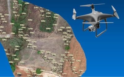
Modern GIS platforms go beyond static maps. They now include real-time monitoring using IoT sensors, drones, and satellite imagery. When integrated with mobile apps and social media, GIS can also be used to crowdsource data from residents—such as reporting blocked drains or illegal dumping. This two-way communication bridges the gap between city authorities and the public, fostering accountability and quicker responses.
A Hidden Hero in Smart City Development
Smart cities are not just about high-tech buildings and digital infrastructure—they are about using data smartly. GIS plays a hidden but inevitable role in the foundational aspects of urban resilience: clean streets, free-flowing drains, and flood-safe neighborhoods. If we are to build cities that are not only intelligent but also livable, then GIS must be embraced not just by tech-savvy experts, but by waste managers, city planners, disaster response teams, and policy makers alike.
Urban flooding and waste mismanagement are twin threats. But by using GIS to understand the “where” and the “why” behind these problems, we can design cities that don’t just react to disasters—but prevent them. The future of urban sustainability depends on the intelligent use of spatial data today.


