Integrating High-Fidelity 3D Terrain, Vector Data, and Simulation in Blender
As 3D geospatial visualization evolves, Blender GIS has moved from being a hobbyist add-on to a powerful bridge between GIS data fidelity and Blender’s 3D engine. For professionals already proficient in the Blender GIS interface, the real advantage lies not in importing DEMs or shapefiles — but in what comes after: terrain optimization, parametric modeling, simulation, and rendering workflows that enhance spatial narratives.
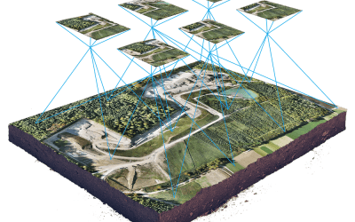
At Geoinfotech, we’re pushing the boundaries of Blender GIS integration — combining drone-derived datasets, procedural terrain manipulation, and urban design tools to deliver spatially accurate and visually compelling environments. This article explores practical enhancements and workflows for experienced users ready to elevate their geospatial 3D work.
Post-DEM Import Optimization: Decimation, Subdivision & Topology Clean-Up
After importing DEMs (SRTM, LIDAR-based DSM/DTM, or drone-derived orthophotos), terrain meshes often come in too dense for efficient manipulation.
Advanced steps:
- Use quad remeshing or the decimate modifier (with “planar” mode) to reduce poly count while preserving terrain form.
- For high-resolution output, add adaptive subdivision via the Displacement modifier using a height map texture or baked geotiff.
- Clean topological noise for smoother shading, especially if the terrain will be lit dynamically.
This allows seamless integration of buildings and assets while maintaining geodetic realism.
CRS Handling & Precision Snapping
Blender GIS auto-projects imported data into Blender’s coordinate space, but real-world projects (especially infrastructure modeling) demand precision alignment and unit coherence.
Pro tip: After import, define your scene scale explicitly — match Blender units to meters and ensure elevation Z-values are scaled accurately. Use the “Set origin based on geolocation” feature to lock vector overlays with raster base maps.
In advanced workflows, convert GIS data to local UTM zones before import, especially for engineering-scale modeling (e.g., corridors, subdivisions, pipeline paths).
Procedural Urban Modeling with OSM Data
Using the OpenStreetMap import tool, you can generate procedural geometry for roads, buildings, and networks. However, default building shapes are limited.
Advanced improvements:
- Replace basic extrusions with parametric assets from libraries like Archimesh or use Geometry Nodes for height randomization and facade variation.
- Assign semantic groups (e.g., commercial, residential) based on OSM tags and apply material overrides via attribute-based selection.
- Combine with OSM2World exports or CityGML models for complex urban scenes.
This enables photorealistic rendering for city planning or transport simulation.
Environmental Context: Lighting, Atmosphere, and Terrain Blending
Once your spatial data is placed and optimized, bring it to life with real-world context:
- Use GeoSun or Sun Position add-ons to simulate accurate solar angles for environmental shadow analysis.
- Add volumetric fog, cloud planes, or procedural skyboxes for atmosphere layers.
- Blend terrain edges using Weight Paint masks to transition between satellite textures and procedural ground shaders.
This is essential for creating simulations of environmental change, erosion, or flood impact.
Data-Driven Animation & Simulation
Blender’s animation tools, when driven by GIS-derived attributes, unlock advanced storytelling and analysis.
Use cases include:
- Animating urban expansion by sequencing OSM or shapefile layers over time.
- Simulating flood modeling or land subsidence using elevation key frames from DEM deltas.
- Driving material transitions using GIS attribute data (e.g., vegetation health, land cover change).
For time-series visualizations, bake GIS data states into shape keys or mesh cache formats and interpolate them in the timeline.
Blender GIS in a Full Workflow Pipeline
For organizations building geospatial visualization pipelines, we recommend integrating Blender GIS with:
- QGIS/Post GIS for spatial preprocessing
- Cloud Compare or Meta shape for point cloud cleaning
- Blender + Geometry Nodes for procedural 3D asset generation
- Unity/Unreal Engine for immersive or real-time outputs
Use Blender GIS as your 3D assembly and visualization hub before exporting assets into simulation engines or VR environments.
Elevating 3D GIS at Geoinfotech
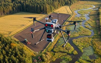
At Geoinfotech, we’re developing modular workflows that connect survey-grade data (RTK GNSS, drone photogrammetry, LiDAR scans) directly with Blender GIS for advanced modeling, simulation, and visual communication.
Whether it’s a smart city fly-through, environmental risk visualization, or terrain-aware infrastructure planning, we use Blender GIS not just for visuals, but for insight.
Your geospatial data deserves more than a flat map. Visualize it. Simulate it. Build with it.
— The Geoinfotech GIS Team


