Forests are among Earth’s most vital ecosystems, but they’re vanishing at an alarming rate. From illegal logging to agricultural expansion, deforestation is a global challenge with serious ecological, social, and climatic impacts.
Thankfully, geospatial tools like Google Earth Engine (GEE) empower analysts, researchers, and decision-makers to monitor land cover changes at scale using decades of satellite imagery. In this post, we’ll explore how Landsat data and GEE can be used to track deforestation trends over time.
Why Landsat and Google Earth Engine?
Landsat is a series of Earth-observing satellites operated by NASA and the USGS, providing continuous imagery since the 1970s at 30-meter resolution. With GEE, users can access, process, and visualize massive archives of this imagery without needing to download or store the data themselves.
The combination of spatial detail, temporal consistency, and open access makes Landsat ideal for long-term forest monitoring.
What You’ll Need
- A Google Earth Engine account (sign up: https://signup.earthengine.google.com/)
- Basic understanding of remote sensing and GEE JavaScript API
- A forested area of interest (AOI) — e.g., Amazon, DRC, or Borneo
Step-by-Step: Monitoring Deforestation in GEE
- Define Your Area of Interest (AOI)
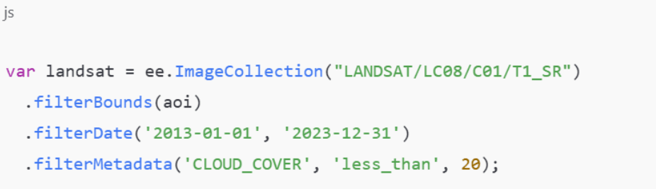
Use a shapefile or draw your AOI manually in the GEE Code Editor to limit processing to the region you’re monitoring. - Load Landsat Image Collections
Use Landsat 5, 7, and 8 for continuous multi-decade coverage. Apply filters for cloud cover, date ranges, and AOI.Example (JavaScript):
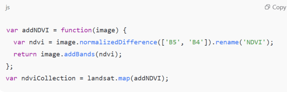
- Calculate NDVI to Monitor Vegetation
Normalized Difference Vegetation Index (NDVI) helps distinguish healthy forest from cleared land.
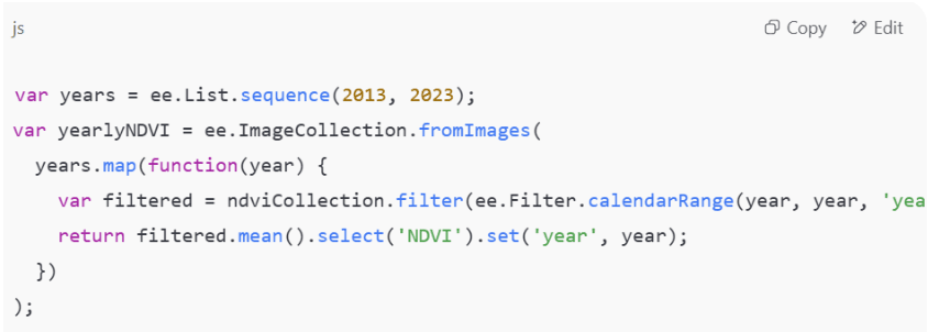
4. Create Annual NDVI Composites: Aggregate NDVI by year to create a time series of vegetation health.
5. Visualize Trends and Change Detection: Use charts to visualize NDVI decline or map areas showing significant reduction over time.
Optional: Use change detection algorithms like LandTrendr or CCDC for more detailed temporal analysis.
Real-World Applications
This workflow is used globally by:
- NGOs tracking forest loss in the Congo Basin
- Governments enforcing conservation laws in Indonesia
- Researchers analyzing post-fire regrowth in California
- Journalists exposing illegal logging in Brazil
Going Further: Classification & Alerts
Want to move beyond NDVI?
- Train a supervised classifier to label forest vs non-forest pixels
- Use thresholds to automatically flag newly deforested areas
- Build an Earth Engine App to allow public exploration of deforestation data
Conclusion
Monitoring deforestation is no longer limited to satellites and scientists with GEE, anyone can access decades of rich imagery and run advanced spatial analysis in just a few lines of code.
By combining Landsat’s legacy of Earth observation with the power of cloud computing, we can uncover the stories hidden in our forests and better protect what remains.