
Spatial data accuracy refers to how closely the data represents the real-world features it depicts. Spatial data accuracy is critical in Geographic Information Systems (GIS) projects as it directly impacts decision-making, analysis, and the integrity of the results. Inaccurate data can lead to flawed analyses, incorrect decisions, and potentially significant consequences. Accurate spatial data ensures that the information used in mapping, modeling, and analysis reflects real-world conditions, which is essential for effective planning, resource management, and environmental protection.
Types of Spatial Data Accuracy
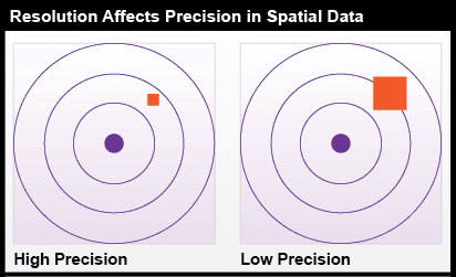
Positional Accuracy: This refers to the precision of the location of geographic features. It is crucial for applications like urban planning, transportation, and environmental monitoring. Positional accuracy is typically measured against a reference dataset or known coordinates.
Attribute Accuracy: Attribute accuracy concerns the correctness of the data associated with geographic features. For instance, the accuracy of population data in a demographic study depends on how well the attribute data corresponds to real-world values.
Temporal Accuracy: This aspect deals with the time-related aspects of spatial data. It is vital in applications such as disaster response, where timely information can significantly impact outcomes.
Why Spatial Data Accuracy Matters
- Decision Making: Accurate data is crucial for informed decision-making. For example, a city planner might use GIS to identify optimal locations for new schools or infrastructure based on population density. Inaccurate data could lead to inefficient resource allocation.
- Analysis and Modeling: GIS is often used for complex spatial analyses, such as predicting natural hazards or modeling urban growth. Inaccurate data can render these analyses unreliable and misleading.
- Legal and Regulatory Compliance: Many industries, including land use planning, environmental management, and transportation, have strict regulations regarding data accuracy. Non-compliance can result in legal issues and financial penalties.
- Public Safety: Accurate spatial data is essential for emergency response, disaster management, and public safety initiatives. Inaccurate data can hinder emergency response efforts and endanger lives.
Factors Affecting Spatial Data Accuracy
- Data Collection Methods: The method used to collect data can significantly impact its accuracy. Traditional methods like aerial photography and ground surveys can be labor-intensive and prone to errors. Modern techniques like remote sensing and GPS offer improved accuracy but may still have limitations.
- Data Processing and Analysis: Errors can be introduced during data processing, such as georeferencing, projection, and data cleaning. Careful quality control measures are essential to minimize these errors.
- Data Sources: The reliability and accuracy of the data sources used can also affect the overall accuracy of a GIS project. Government agencies and reputable commercial providers generally offer higher-quality data than less reliable sources.
At Geoinfotech Resources Limited, we specialize in providing high-quality spatial data and GIS services. we prioritize data accuracy in all their projects and employ a range of techniques to ensure the reliability of their data:
- Data Acquisition and Validation: Geoinfotech uses state-of-the-art equipment and methodologies to collect accurate spatial data. They also implement rigorous quality control procedures to validate the data and identify any errors.
- Data Processing and Analysis: The company employs experienced GIS analysts who are skilled in data processing and analysis techniques. They use advanced software tools to ensure the accuracy of their data and analyses.
- Data Standards and Metadata: Geoinfotech adheres to industry-standard data formats and metadata standards to ensure data interoperability and traceability.
- Client Collaboration: They work closely with their clients to understand their specific requirements and ensure that the data provided meets their needs.
By prioritizing data accuracy and employing best practices in GIS, Geoinfotech Resources Limited can deliver reliable and valuable spatial information to their clients, supporting informed decision-making and addressing complex challenges.


