Discovering Hidden Treasures Beneath the Surface with Spatial Intelligence
The quest for mineral resources is no longer left to chance or guesswork. The fusion of Remote Sensing and Geographic Information Systems (GIS) has revolutionized mineral exploration—bringing precision, speed, and deeper geological insights into the search for valuable Earth materials. Whether it’s detecting hidden ore bodies or modeling the spatial distribution of mineral deposits, remote sensing and GIS have become the backbone of modern exploration campaigns.
What is Remote Sensing in Mineral Exploration?
Remote Sensing refers to acquiring data about the Earth’s surface from a distance—typically using satellites, drones, or aircraft. These platforms are equipped with specialized sensors that detect electromagnetic signals reflected or emitted by the ground. In mineral exploration, remote sensing helps:
- Detect alteration zones linked to hydrothermal mineralization
- Analyze surface reflectance for mineral identification
- Track topography, vegetation anomalies, and drainage patterns
Common Remote Sensing Techniques in Mineral Prospecting
| Technique | What It Detects | Sensors Used |
|---|---|---|
| Multispectral Imaging | Vegetation stress, alteration zones | Landsat, Sentinel-2 |
| Hyperspectral Imaging | Specific mineral signatures | AVIRIS, Hyperion |
| Thermal Infrared (TIR) | Heat signatures, rock emissivity | ASTER TIR |
| LiDAR (Light Detection and Ranging) | High-res elevation models | UAV-mounted or airborne LiDAR |
What GIS Does in Mineral Exploration
While remote sensing gathers surface data, GIS is the brain that integrates, analyzes, and visualizes it alongside ground-based geological data.
GIS Can:
- Overlay geological maps, satellite images, geochemical surveys, and structural data
- Highlight spatial relationships between fault lines, ore zones, and surface features
- Create mineral prospectivity maps to pinpoint high-potential zones
- Perform 3D subsurface modeling with borehole and geophysical data
- Help in environmental monitoring, land access, and permitting
With GIS, you don’t just see where minerals might be—you understand why they’re likely there.
Instruments & Devices Used to Detect Mineral Deposits
- Magnetometers: Detect magnetic field variations caused by ore bodies like magnetite and pyrrhotite.
- Electromagnetic (EM) Sensors: Used to detect conductivity anomalies in the ground—often pointing to sulfide deposits.
- Hyperspectral Sensors: Analyze the light spectrum to identify specific mineral types based on reflectance signatures.
- Gamma Ray Spectrometers: Measure natural radioactivity from uranium, thorium, and potassium-rich rocks.
- XRF Analyzers: Portable devices used for in-field chemical analysis of rock and soil samples.
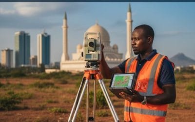
- GPS and Total Stations: Provide accurate spatial data for mapping sample locations and features.
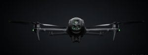
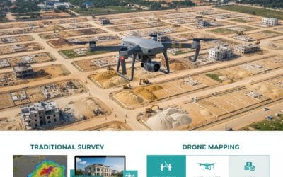
- UAVs (Drones): Equipped with LiDAR, RGB, thermal, or magnetometer payloads to collect high-resolution data from difficult terrain.
- Resistivity/IP Systems: Measure how electrical current moves through the ground—ideal for detecting buried ore zones.
Real-World Example
A mineral exploration team targets gold in a remote area of West Africa. Here’s how they proceed:
- Use Sentinel-2 imagery and NDVI in GIS to spot unusual vegetation patterns.
- Overlay fault lines and geological maps in ARCGIS to pinpoint structurally controlled targets.
- Deploy a UAV with a hyperspectral sensor to scan surface mineral alteration.
- Perform ground EM and magnetometer surveys to validate anomalies.
- Conduct XRF analysis on collected rock samples.
- Rank targets using a GIS-based weighted overlay analysis.
- Drill at top-ranked zones and model ore body geometry in Leapfrog Geo.
Other Insightful Applications of GIS in Exploration
- Risk Assessment & Terrain Analysis
Understand accessibility, slope, flood zones, and protected areas before field deployment. - Drilling Planning
Use GIS terrain models to plan drill pad locations and optimize logistics. - Community Engagement
Map settlements, cultural sites, and land ownership for responsible exploration.
Final Thoughts
Remote sensing provides the eyes in the sky, but GIS gives the intelligence to decode it all. Together, they make mineral exploration smarter, faster, and more environmentally conscious.
From high-res satellite data to UAVs skimming rugged terrain and smart 3D models in GIS—today’s explorers are leveraging tech to unveil what lies beneath with clarity and confidence.
Want to explore more tools and training in Remote Sensing & GIS for Mineral Exploration?
www.geoinfotech.ng and get started.


