GIS (Geographic Information System) and GPS (Global Positioning System) both deal with geography and location, they serve very different purposes. Let’s break down the key differences between GIS and GPS
Features of GIS:
- Data Layers: GIS organizes data into layers, where each layer represents a different kind of information (e.g., roads, land use, elevation, demographics). These layers can be overlaid to show how different factors interact.
- Data Analysis: GIS allows users to perform spatial analysis, like finding the shortest path between two locations, identifying areas at risk of flooding, or determining the best location for a new building.
- Map Creation: One of the primary outputs of GIS is the map, which can display a wide variety of data, from satellite imagery to demographic trends.
- Customization: Users can create customized maps and reports, tailor-made for specific needs, such as urban planning, environmental conservation, or disaster response.
GIS is all about understanding the “where” and “why”—it provides insights into spatial relationships and patterns.

GPS (Global Positioning System)?
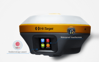
GPS, on the other hand, is a satellite-based navigation system used to determine the exact location of a device anywhere on Earth. It uses a network of satellites orbiting the Earth to provide accurate location data in the form of latitude, longitude, and altitude. GPS is widely used in applications ranging from navigation and mapping to tracking vehicles and even guiding drones.
Key Features of GPS:
- Location Tracking: GPS provides real-time location data, giving users precise information about where they are. It’s commonly used in smartphones, car navigation systems, and wearable devices.
- Global Coverage: GPS works anywhere on Earth, as long as there’s a clear line of sight to the satellites. This makes it invaluable for outdoor navigation, aviation, and even activities like hiking or sailing.
- Time Syncing: In addition to location, GPS is also used to synchronize time across systems, providing accurate timestamps for everything from financial transactions to scientific experiments.
In essence, GPS is focused on pinpointing “where” you are by providing real-time location data, usually in the form of coordinates.
Differences Between GIS and GPS
While both GIS and GPS deal with geographic data, they are fundamentally different in how they collect, use, and process that data. Here’s a comparison to help clarify their distinctions:
| Feature | GIS (Geographic Information System) | GPS (Global Positioning System) |
| Purpose | Used for analyzing, mapping, and visualizing geographic data. | Used for pinpointing the real-time location of a device. |
| Core Function | Organizes and analyzes spatial data to show relationships and patterns. | Provides exact location coordinates (latitude, longitude, altitude). |
| Data Types | Can handle various types of spatial data, including maps, images, and databases. | Focuses solely on location data from satellites. |
| Output | Maps, spatial analysis results, reports, and visualizations. | GPS coordinates (latitude, longitude, altitude). |
| Tools & Usage | Used by analysts, urban planners, environmental scientists, and businesses. | Primarily used by consumers, drivers, pilots, and outdoor enthusiasts for navigation. |
| Real-Time Data | Not necessarily real-time; typically works with stored data for analysis. | Provides real-time location data continuously. |
| Accuracy | Depends on the quality of data layers and analysis; can vary widely. | Provides high accuracy, often within a few meters. |
How GIS and GPS Work Together
While GIS and GPS serve different purposes, they are often used together to enhance mapping, navigation, and analysis:
- GPS Provides Data for GIS: GPS technology helps collect real-time location data, which can then be uploaded into a GIS system for analysis and visualization. For example, a field surveyor may use a GPS device to collect geospatial data (e.g., the location of a new building site) and then input that data into a GIS for further analysis and mapping.
- GIS Enhances GPS Data: While GPS provides precise location data, GIS adds context to that data. For example, GPS may pinpoint the location of a car, but GIS can show traffic patterns, road conditions, and alternate routes, helping drivers make better decisions.
By combining both technologies, professionals in fields like urban planning, environmental management, and transportation can make more informed decisions based on both precise location data (from GPS) and broader spatial analysis (from GIS).


