What is Topography?
 What is Topography?
Topography is the study of the forms and features of land surfaces. The topography of an area could refer to the surface forms and features themselves, or a description. It is the arrangement of the natural and artificial physical features of an area.
Topographic Map.
Topographic maps are also commonly called contour maps or topo maps. Topographic maps conventionally show topography, or land contours, by means of contour lines. Contour lines are curves that connect contiguous points of the same altitude.
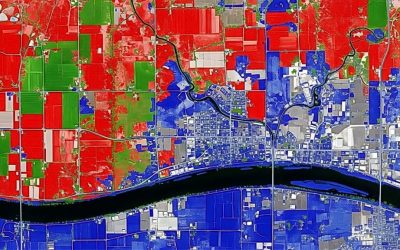
Topographical maps are large scale maps that show both natural features (such as mountains, hills, rivers, plateaus, ridges, etc.) and human-made features (such as roads, railway tracks, temples, bridges, buildings, etc.). Topography often records the various elevations of an area using a topographical map.
These maps show not only the contours, but also any significant streams or other bodies of water, forest cover, built-up areas or individual buildings (depending on scale), and other features and points of interest.
Topographic maps represent the Earth’s features accurately and to scale on a two- dimensional surface. While a road map shows where a road goes, a topographic map shows why, For example, the road bends in order to go around a hill or stops at the top of a mountain. On a contour map: Each contour line represents a specific elevation and connects all the points that are at the same elevation. Maps that show elevations are called topographic maps.
Who uses topography maps?
Hikers, campers, city and county planners, the Fish and Wildlife Service, Forest Service, miners, highway planners and construction workers, travellers, surveyors, geologists, engineers,GIS analyst and scientists are just a few of the people who use topographic maps.