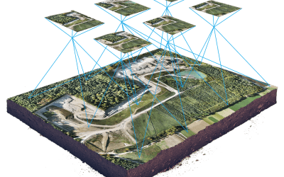
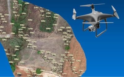
The use of Unmanned Aerial Vehicles (UAV), geospatial analytical techniques, and remote sensing tools has been on the drive for big data science analysis on climatology and precision agriculture as well mapping out the pattern of rural settlement to help improve planning of crops, farms, commercial center, etc. With the help of drone technology, spatial location and pattern of all landforms (agriculture, settlement, bare ground, rocks, road, water body. etc) also climate data can be acquired and analyzed for better decision making, prediction, tracking, and precise monitoring. Agricultural Land and Climate Data Gathering, Storage and Recovery Through the Use of Remote Sensing Drone Technology The use of drones in the agriculture industry is steadily growing as part of an effective approach to sustainable agricultural management that allows agronomists, agricultural engineers, and farmers to help streamline their operations, using robust data analytics to gain effective insights into their crops. With their bird’s eye view and advanced sensors, a drone can gather data on 500 to 1,000 acres in less than a day. UAVs are particularly useful for the careful monitoring of large areas of farmland, considering factors such as slope and elevation, for example, to identify the most suitable seeding prescriptions. The technology has also proven useful in gaining an extensive overview of plant emergence and population, as more accurate data can help with replanting decisions, as well as thinning and pruning activity and the improvement of crop models. Crucially, the high-resolution nature of drone data can be used to: Count and size plants Measure plant health, quantitatively Generate prescription maps Optimize the zonal efficiency of fields Detect early indicators of plant stressors Assess livestock health and weight gain Identify damaged fencing Assess storm damage Calculate grove maturity Determine optimal foraging areas Agricultural producers must embrace revolutionary strategies for producing food, increasing productivity, and making sustainability a priority. Drones are part of the solution, along with closer collaboration between governments, technology leaders, and industry.
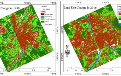
Satellite Image Processing for Long-Term Planning in Nigeria: A Key to Past and Present Information for Transformation
Satellite image processing plays a crucial role in supporting sustainable development and...


