
What is Geospatial Survey?
A geospatial survey is a methodical process of collecting, analyzing, and interpreting spatial data related to the Earth’s surface and its features. It involves the use of various technologies and tools to capture, store, manipulate, analyze, and visualize geographic information. Geospatial surveys are integral in mapping and understanding the physical and cultural characteristics of different locations. Geospatial surveys find applications in diverse fields, including urban planning, environmental monitoring, natural resource management, disaster response, agriculture, and various scientific research endeavors. The collected data aids decision-makers in making informed choices based on a comprehensive understanding of the spatial aspects of the areas under study.
The most common methods of data collection for geospatial survey include;
Satellite and Aerial Imagery: Eyes in the Sky Revealing Earth’s Secrets
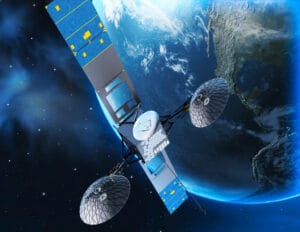 Geospatial surveys often kick off with the grandeur of satellite and aerial imagery. Satellite imagery refers to images of the Earth or other planets collected by imaging satellites orbiting the planet in space. Aerial imagery refers to photographs or digital images captured from an elevated, these images are usually taken from an airborne vehicle such as a manned or unmanned aircraft (drone). Satellites orbiting high above and drones soaring through the skies capture breathtaking visuals of our Earth. These images become the canvas upon which the geospatial story unfolds, showcasing landscapes in stunning detail.
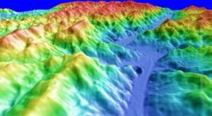
LiDAR Technology: Laser Precision Mapping
 Imagine a laser beam painting an intricate portrait of the Earth’s surface. LiDAR (Light Detection and Ranging) achieves just that. This advanced technology uses laser pulses to measure distances, creating highly accurate three-dimensional representations of terrain. It’s the meticulous cartographer, capturing the subtle nuances of elevation and structure. It is carried on a low-altitude aircraft that also has an inertial navigation system and a differential GPS to provide location.
Global Positioning System (GPS): Pinpointing Every Detail
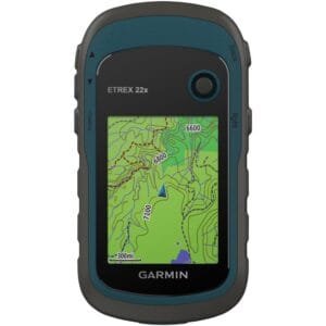 The trusty GPS, is one of the global navigation satellite systems (GNSS) that provide geolocation and time information to a GPS receiver anywhere on or near the Earth where there is an unobstructed line of sight to four or more GPS satellites. Whether navigating vast landscapes or marking specific points of interest, GPS provides accurate coordinates that weave together the spatial tapestry of a survey. Every location becomes a precise dot on the map, contributing to the comprehensive understanding of geographical features. The GPS has evolved over time, leading to various types tailored for specific needs. Though they share a common fundamental principle, each type specializes in addressing particular requirements. Some of the GPS systems include Assisted-GPS, Simultaneous GPS, Differential GPS, and Non-differential GPS.
Remote Sensing: Capturing Earth’s Essence from Afar
 Remote sensing, a pillar in geospatial surveys, involves obtaining information about the Earth’s surface from a distance. Satellites and sensors capture data beyond the visible spectrum, revealing insights about vegetation, land cover, and environmental changes. Resolution is a key physical characteristic of remote sensing systems for example, spatial resolution refers to the size of object that can be resolved and the most usual measure is the pixel size, spectral resolution refers to the parts of the electromagnetic spectrum that are measured and temporal resolution, or repeat cycle, describes the frequency with which images are collected for the same area. Remote sensing adds a layer of depth to our understanding, providing a comprehensive view from above.
Ground Surveys and Field Validation: Where Technology Meets Terra Firma
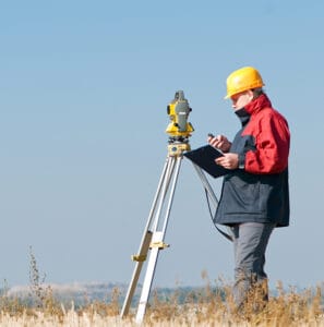 Ground surveying is based on the principle that the 3-D location of any point can be determined by measuring angles and distances from other known points. Traditional equipment like transits and theodolites have been replaced by total stations that can measure both angles and distances to an accuracy of 1 mm. Ground survey is a very time-consuming and expensive activity, but it is still the best way to obtain highly accurate point locations, it is typically used for capturing buildings, land and property boundaries, manholes, and other objects that need to be located accurately and also employed to obtain reference marks for use in other data capture projects
Geographic Information System (GIS): The Mastermind of Spatial Intelligence
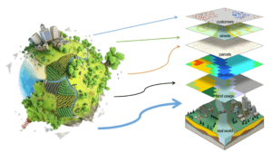 GIS is the orchestrator, seamlessly integrating diverse data layers into a coherent narrative. It’s the storyteller’s toolkit, allowing researchers to overlay maps, analyze patterns, and extract meaningful insights. GIS transforms raw data into actionable information, offering a holistic view of the surveyed area.
Begin an adventurous journey through the heart of Earth’s narrative with Geoinfotech, where technology and hands-on expertise converge to create a masterpiece of geospatial survey data collection. From the boundless skies of satellite imagery to the grounded insights of meticulous researchers, each method paints a vivid piece of the picture.
In this vast puzzle of our world, every data point seamlessly fits into place, revealing the intricate details that shape our understanding of the environment. Yet, the challenge lies in obtaining and processing this wealth of information – a task made seamless by companies specializing in geospatial services. Enter Geoinfotech, a beacon of excellence in deciphering Earth’s story through cutting-edge methods and unwavering precision.
Within the realm of geospatial surveys at Geoinfotech, data collection methods intertwine, weaving a detailed tapestry that illuminates our environment. From the technological marvel of satellites to the laser-sharp accuracy of LiDAR and the boots-on-the-ground validation of geodetic surveys, each method contributes to the creation of accurate and reliable geospatial information.
As technology relentlessly evolves, Geoinfotech stands at the forefront of geospatial data collection, offering a glimpse into the future of mapping and analysis. Join us on this extraordinary expedition where every data point is a revelation, and the landscape of our understanding is continually reshaped by innovation. Trust Geoinfotech to navigate the intricate journey of geospatial surveys, paving the way to a future where the story of our world is told with unprecedented clarity and depth.


