In today’s interconnected world, Geographic Information Systems (GIS) have emerged as powerful tools for understanding and analyzing spatial data. Whether it’s planning infrastructure projects, managing natural resources, or responding to emergencies, GIS plays a pivotal role in decision-making across various industries. But how valuable is a GIS certificate, and what skills are needed to excel in this field? Let’s explore.
The Importance of GIS Certification:
Obtaining a GIS certificate can be highly beneficial for individuals seeking to establish or advance their careers in geospatial technology. A GIS certificate demonstrates proficiency in essential GIS concepts, tools, and techniques, providing employers with confidence in your abilities. Moreover, many employers require or prefer candidates with formal GIS training, making a certificate a valuable asset in the job market.

Computer Skills in GIS:
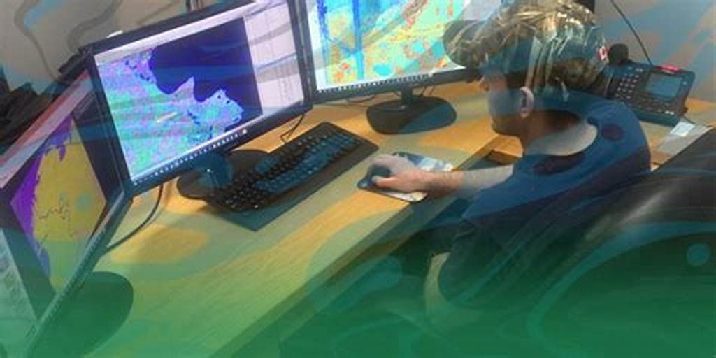
While GIS does require some level of computer proficiency, it’s not necessarily limited to individuals with advanced technical skills. Most GIS software comes with user-friendly interfaces and intuitive tools, allowing users to perform basic tasks with minimal training. However, as with any technology-driven field, proficiency in computer skills such as data management, analysis, and visualization can greatly enhance your effectiveness in GIS.
The Future of GIS:
In an evolving world shaped by technological advancements and global challenges, the relevance of GIS is only expected to grow.
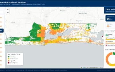
- Data Integration: With the proliferation of data from various sources such as satellites, sensors, and social media, GIS enables the integration and analysis of diverse datasets to derive meaningful insights. This capability is crucial for addressing complex issues like climate change, urbanization, and public health.
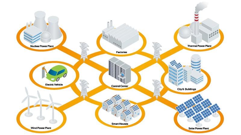
- Smart Cities and IoT: As cities become smarter and more interconnected, GIS plays a central role in managing urban infrastructure, optimizing transportation networks, and enhancing public services. Integrating GIS with Internet of Things (IoT) devices enables real-time monitoring and decision-making, leading to more efficient and sustainable cities.
- Environmental Conservation: GIS is indispensable for conservation efforts, enabling scientists to monitor biodiversity, track habitat loss, and plan protected areas. With environmental challenges becoming increasingly urgent, GIS provides valuable tools for mitigating the impact of human activities on ecosystems and biodiversity.
- Disaster Management: From natural disasters to humanitarian crises, GIS is instrumental in disaster preparedness, response, and recovery efforts. By mapping vulnerable areas, coordinating emergency response teams, and assessing damage, GIS helps save lives and minimize the impact of disasters on communities.
- Business Intelligence: In the business world, GIS is used for market analysis, site selection, and supply chain optimization. By leveraging spatial data to understand customer behavior, identify growth opportunities, and mitigate risks, businesses can gain a competitive edge in the marketplace.
In conclusion, a GIS certificate can be a valuable asset for individuals aspiring to pursue careers in geospatial technology. While GIS does require some level of computer skills, its user-friendly interfaces and intuitive tools make it accessible to individuals with varying technical backgrounds. As we navigate an increasingly complex and interconnected world, GIS will continue to play a vital role in addressing global challenges and driving innovation across industries. Embracing GIS skills today opens doors to a world of opportunities tomorrow.