Over the past few decades, the growing use of Geographic Information Systems (GIS) technology has changed health and human services (HHS) and opened the eyes of researchers, public health experts, staff members of hospitals and health systems, and the general people they serve. Although the fields of health and human services have long used maps and geographical analysis, health professionals and the general public now have access to a wide range of potent spatial analytic tools.
We highlight important applications like immunization management, disease tracking, outbreak analysis, disease surveillance, syndromic surveillance, emergency preparedness and response, community health assessment, environmental health, chronic disease prevention, animal and veterinary health in fields where high GIS adoption rates occurred, like public health.
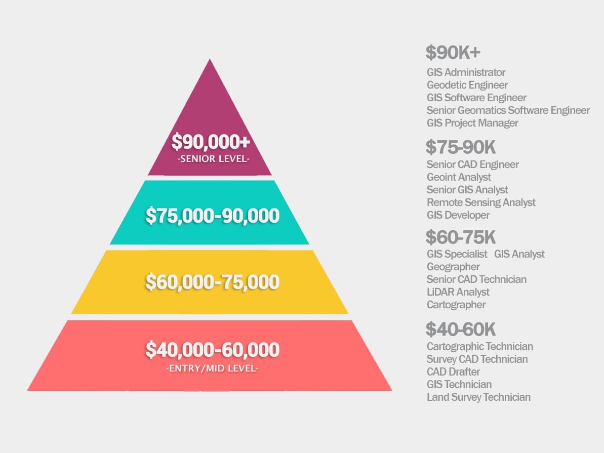
GIS SALARY PAY SCALE
The field of GIS is broad. The typical GIS compensation ranges from $40,000 to over $100,000+, demonstrating the diversity of the pay scale. Don’t be duped by the compensation scale, though. When it comes to project workloads, GIS technicians, draftsmen, and analysts perform all the hard lifting. There wouldn’t be a strong basis for data without them.
- Cartographic Technician ($42,000)
- Survey CAD Technician ($44,000)
- CAD Drafter ($45,000)
- GIS Technician ($48,000)
- Land Survey Technician ($53,000)
- Geographer ($61,000)
- GIS Specialist ($64,000)
- GIS Analyst ($65,000)
- Senior CAD Technician ($70,000)
- LiDAR Analyst ($71,000)
- Cartographer ($75,000)
- Senior CAD Engineer ($75,000)
- Senior GIS Analyst ($76,000)
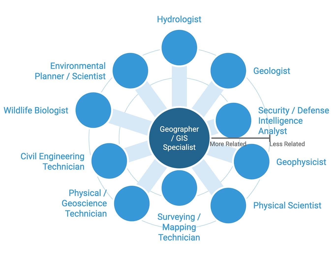
OPPORTUNITIES IN GIS
The field of geographic information systems (GIS) continually evolves and presents professionals with new potential job opportunities. GIS refers to personnel, technologies and strategies related to collecting, analyzing, interpreting and generating maps or other digitalization based on geospatial or topographical data. Earning a degree in GIS can give you the ability to pursue a range of careers and industries which includes;
- Geographer
- Surveying/Mapping technician
- Cartographer
- Urban/regional planner
- Geologist
- Geospatial engineer
- Crime analyst
- GIS analyst
- Environmental scientist
- Technical security threat intelligence officer
- Remote sensing analyst
- Lidar analyst
- CAD engineer