We’ve all been there: relying on our smartphones to navigate to a new restaurant, find the quickest route home, or even pinpoint a lost car in a sprawling parking lot. “Just use GPS,” we say, almost instinctively. But what if we told you that the technology powering this convenience is far more vast, complex, and impactful than you might imagine?
Meet GNSS: Global Navigation Satellite Systems. While GPS (the Global Positioning System) is undoubtedly the most famous player, it’s actually just one part of a much larger, global family of satellite-based positioning systems that silently underpin vast swathes of our modern world.
Beyond GPS: Understanding the GNSS Family Tree
Think of GPS as a brand name, like “Kleenex” for facial tissues. While “Kleenex” is widely used, it’s just one manufacturer among many. Similarly, GPS is the United States’ satellite navigation system, but it’s not the only one. GNSS is the umbrella term for all the independent satellite positioning systems that provide autonomous geo-spatial positioning with global coverage.
The main constellations that make up GNSS include:
- GPS (Global Positioning System): Operated by the United States. This is the one everyone knows!
- GLONASS (Globalnaya Navigatsionnaya Sputnikovaya Sistema): Operated by Russia.
- Galileo: Operated by the European Union.
- BeiDou (BDS): Operated by China.
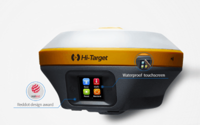
When your “GPS” device (be it your phone or a professional receiver) is active, it’s often not just talking to GPS satellites. Modern receivers can simultaneously pick up signals from multiple constellations within the GNSS family, leading to greater accuracy, availability, and reliability, especially in challenging environments like urban canyons or dense forests.
Why Does “Beyond Your Phone GPS” Matter? The Quest for Precision
For everyday navigation, your phone’s GPS is usually accurate to within a few meters. That’s perfectly fine for finding a coffee shop. But what if you’re:
- Mapping precise property boundaries?
- Guiding an autonomous farm vehicle to plant seeds with centimeter accuracy?
- Inspecting critical infrastructure with a drone that needs to return to the exact same spot repeatedly?
- Creating highly detailed 3D models of construction sites?
In these scenarios, a few meters of error simply won’t cut it. This is where advanced GNSS capabilities come into play, offering centimeter-level accuracy that revolutionizes industries. Technologies like RTK (Real-Time Kinematic) and PPK (Post-Processed Kinematic) leverage additional data from ground-based reference stations or precise post-processing to correct satellite signal errors, transforming typical meter-level accuracy into stunning precision.
The Unseen Power: Where GNSS Truly Shines
The true magic of GNSS often happens behind the scenes, powering critical operations you might not even realize rely on it:
- Drone Services: The Eyes of Precision
- High-Accuracy Mapping & Surveying: Drones equipped with RTK/PPK GNSS receivers can create highly accurate orthomosaics, 3D models, and digital elevation models with minimal or no ground control points, revolutionizing land surveying, construction progress monitoring, and volumetric analysis.
- Automated Flight & Inspection: For tasks like inspecting power lines or wind turbines, precise GNSS guidance allows drones to follow exact flight paths, ensuring comprehensive coverage and repeatable data collection over time.
- GIS Data Collection: Building Smarter Maps
- Accurate Field Asset Mapping: From marking the exact location of utility poles and pipelines to documenting environmental samples, GNSS receivers are integral for collecting spatially accurate data that feeds into Geographic Information Systems (GIS). This precision ensures that maps reflect reality with utmost fidelity, critical for infrastructure management, resource allocation, and urban planning.
- Environmental Monitoring: Tracking invasive species, monitoring land degradation, or mapping forest cover all benefit from high-precision GNSS to ensure data points are accurately recorded for long-term analysis within GIS.
- Agriculture: The Green Revolution from Above
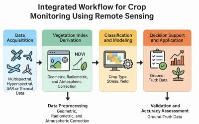
- Precision Farming: Auto-steer tractors use GNSS to plant seeds, apply fertilizers, and harvest crops with unparalleled accuracy, minimizing waste, optimizing yield, and reducing environmental impact.
- Construction & Engineering: Building with Certainty
- Machine Control: Bulldozers and graders use GNSS for automated, precise grading and excavation, ensuring projects are built to exact specifications.
- Site Layout & Monitoring: Surveyors use GNSS receivers to lay out construction sites and monitor ground movement with extreme precision.
- Autonomous Vehicles: The Road to the Future
- Self-driving cars and delivery robots rely on highly accurate GNSS in conjunction with other sensors (LiDAR, radar, cameras) to pinpoint their exact location on the road, navigate complex environments, and ensure safety.
- Disaster Response & Emergency Services:
- During floods, wildfires, or earthquakes, precise GNSS helps emergency responders navigate to affected areas, map damage in real-time, and coordinate relief efforts effectively.
The Foundation of Our Connected World
GNSS is more than just a technology; it’s a fundamental utility that underpins much of our modern infrastructure and countless daily activities. From enabling precision agriculture that feeds the world, to guiding the drones that inspect vital assets, and informing the GIS systems that help us understand our planet, GNSS is the invisible network providing the crucial “where” that drives innovation.
So, the next time you glance at your phone’s map, remember the vast, global network of satellites working tirelessly above us. It’s a reminder that even the most commonplace technologies have deep roots in advanced science, continually evolving to bring us greater accuracy, efficiency, and a truly connected world.


