
Geographic Information Systems (GIS) have come a long way from their early days of paper maps and basic digital representations of the world. Today, GIS is evolving rapidly, driven by new technologies that are pushing the boundaries of what we can map, analyze, and understand about our world. Among the most exciting trends shaping the future of GIS are 3D mapping, real-time analytics, and the integration of artificial intelligence (AI). These innovations are transforming how GIS is used in industries ranging from urban planning and healthcare to environmental conservation and disaster management.
The Rise of 3D Mapping
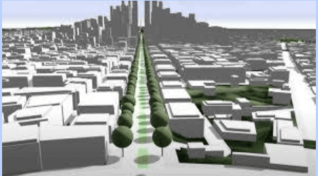
While traditional GIS maps typically focus on flat, two-dimensional representations, 3D mapping is taking things to a new level. With 3D maps, users can visualize geographic data in a more realistic and intuitive way. This is especially helpful in areas where terrain, elevation, and building structures play a crucial role in decision-making.
Key Benefits:
- Urban Planning and Design: Cities are using 3D GIS models to simulate urban growth, assess environmental impacts, and plan infrastructure developments more effectively. For example, 3D models can help visualize how new buildings will affect traffic patterns or the local climate.
- Environmental Monitoring: 3D mapping is invaluable for tracking changes in landscapes, such as deforestation, erosion, or the growth of urban areas. It’s also used in disaster management to model flooding, earthquakes, and landslides in a more accurate, dynamic way.
- Tourism and Entertainment: Virtual tours, video games, and augmented reality (AR) applications are incorporating 3D maps to create more immersive experiences for users, whether that’s navigating through a city or exploring distant natural wonders.
With advancements in LiDAR (Light Detection and Ranging) and drone technology, the ability to create highly detailed and accurate 3D maps has become more accessible and affordable.
Real-Time Analytics: Making Decisions in the Moment
Real-time data is an essential feature of many modern applications, and real-time analytics in GIS is no different. With real-time capabilities, GIS can collect, analyze, and visualize data as it’s being generated, enabling decision-makers to act quickly and accurately in dynamic situations.
Key Benefits:
- Disaster Response and Management: In emergencies like wildfires, hurricanes, or floods, real-time GIS analytics can provide on-the-ground information to responders. They can track the movement of disaster events, monitor resources, and deploy emergency services more efficiently.
- Traffic and Transportation Systems: Real-time GIS analytics are increasingly used in transportation management. Traffic flow data, public transit schedules, and real-time vehicle locations can all be integrated into GIS systems to optimize routes, reduce congestion, and improve safety.
- Environmental Monitoring: GIS can be used to track environmental factors in real time, such as air quality, water levels, or pollutant concentrations. This allows for rapid responses to changing conditions and potential threats to public health.
The ability to process data in real time is becoming more possible with the rise of Internet of Things (IoT) devices, connected sensors, and satellite technology. By integrating these data streams into GIS platforms, real-time decision-making is now a reality for a wide range of industries.
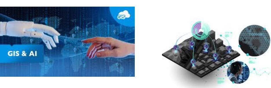
Artificial Intelligence (AI) Integration: Smarter Maps and Insights
Artificial Intelligence is bringing a new level of sophistication to GIS by enabling systems to analyze and interpret vast amounts of geospatial data in ways that would be difficult or impossible for humans to do manually. AI and machine learning (ML) algorithms are being integrated into GIS software to provide smarter mapping solutions, predictive analytics, and automated decision-making.
Key Benefits:
- Pattern Recognition: AI can help GIS systems identify patterns and trends in geospatial data that might not be immediately obvious. For example, it can recognize land use changes over time, detect environmental changes, or even predict areas prone to natural disasters.
- Automated Data Processing: AI-powered GIS can automate the process of classifying and analyzing spatial data. This is particularly useful for satellite imagery, where AI can quickly analyze and label large amounts of visual data, reducing the need for human intervention.
- Predictive Analytics: Machine learning models can be trained to predict future trends based on historical data. For instance, AI can predict future population growth patterns, traffic congestion, or even potential disease outbreaks based on past data, helping city planners, health officials, and emergency responders to make proactive decisions.
As AI continues to advance, the integration of machine learning into GIS will make the technology even more powerful, enabling systems to make complex decisions, optimize processes, and offer more accurate insights.
Conclusion: A New Era of GIS
The future of GIS is incredibly promising, thanks to the exciting developments in 3D mapping, real-time analytics, and AI. These technologies are opening up new possibilities for how we understand and interact with the world around us. Whether it’s visualizing a city in 3D, responding to a disaster in real time, or using AI to uncover hidden patterns in data, GIS is becoming smarter, faster, and more accessible.
As these technologies continue to evolve, the applications for GIS will only grow, helping solve some of the world’s most pressing challenges, from climate change and urbanization to health crises and natural disasters. The integration of 3D mapping, real-time analytics, and AI represents a significant leap forward, and we can expect to see even more breakthroughs in the years to come.


