To “extract topographic pictures from a DEM” means to visually represent the elevation data contained within a Digital Elevation Model (DEM) by generating images that highlight the terrain features like hills, valleys, and slopes, typically done through specialized software within a GIS platform by manipulating the DEM data to create various visualizations like shaded relief maps, contour lines, hillshade maps, or 3D terrain models.
- Open the project in ArcGIS Pro.
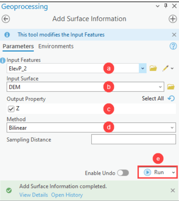
- In the Geoprocessing pane, search for and open Add Surface Information (3D Analyst Tools).
- In the Add Surface Information pane, specify the parameters.
- For Input Features, select the point feature layer from the drop-down list.
- For Input Surface, select the DEM layer from the drop-down list.
- For Output Property, check the Z check box.
- For Method, select the preferred method to determine the information from the surface layer.
- Click Run.
Use the Summarize Elevation tool
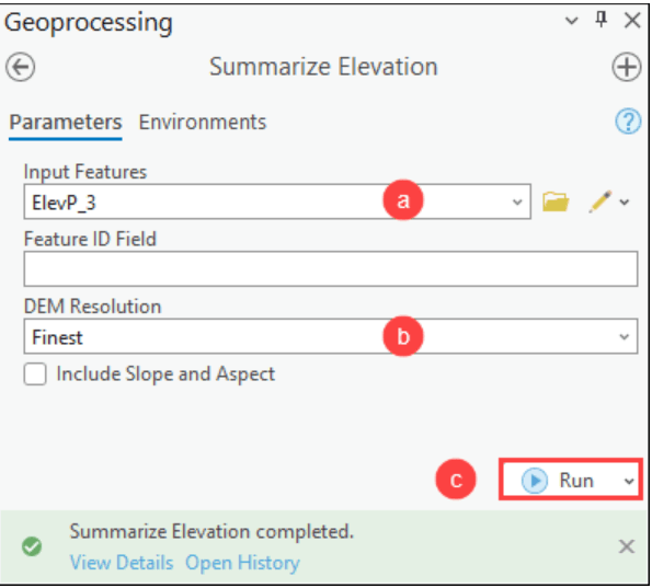
The Summarize Elevation calculates the statistical summary of elevation for each input feature.
- Open the project in ArcGIS Pro.
- In the Geoprocessing pane, search for and open Summarize Elevation (Ready To Use Tools).
- In the Summarize Elevation pane, specify the parameters.
- For Input Features, select the point feature layer from the drop-down list.
- For DEM Resolution, select the preferred approximate spatial resolution of the source elevation data used for the calculation.
- Click Run.
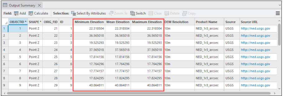
Note that the tool summarizes the elevation, slope, and aspect information for the input features. The returned elevation values are measured in meters.
The image below shows the elevation information of point feature classes derived from the DEM using the Summarize Elevation tool.